Phase 1: Land-use analysis of flash flood risk factors
Phase 1: Land-use analysis of flash flood risk factors (click for full-sized maps)


| Close-up views by area: NLCD | Close-up views by area: NLCD and LSRs | |||||||
 Chicago |
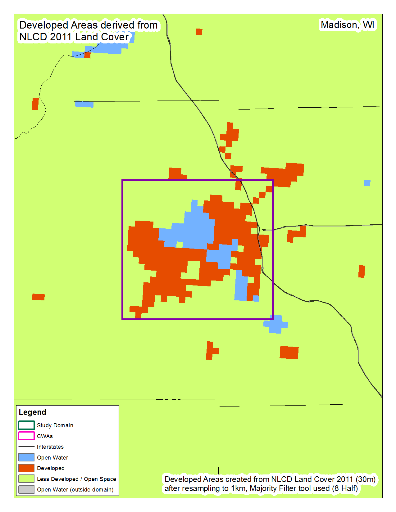 Madison |
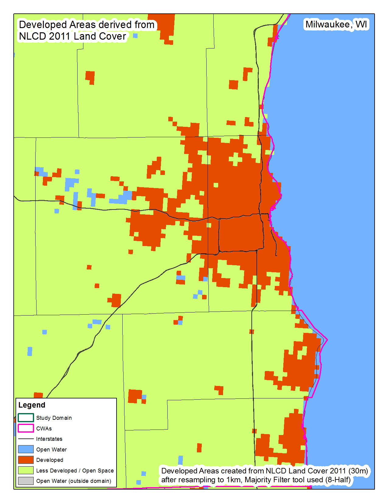 Milwaukee |
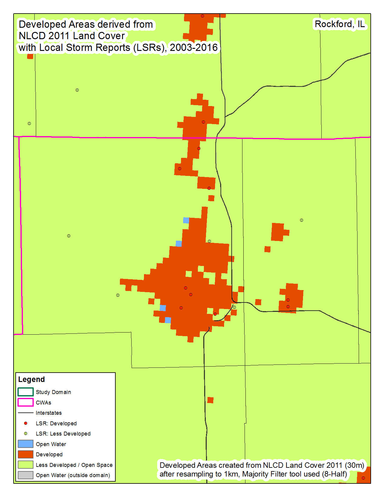
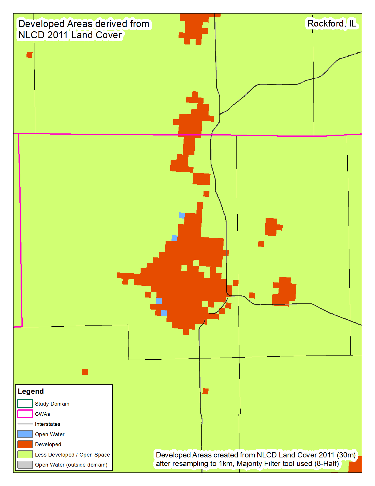 Rockford |
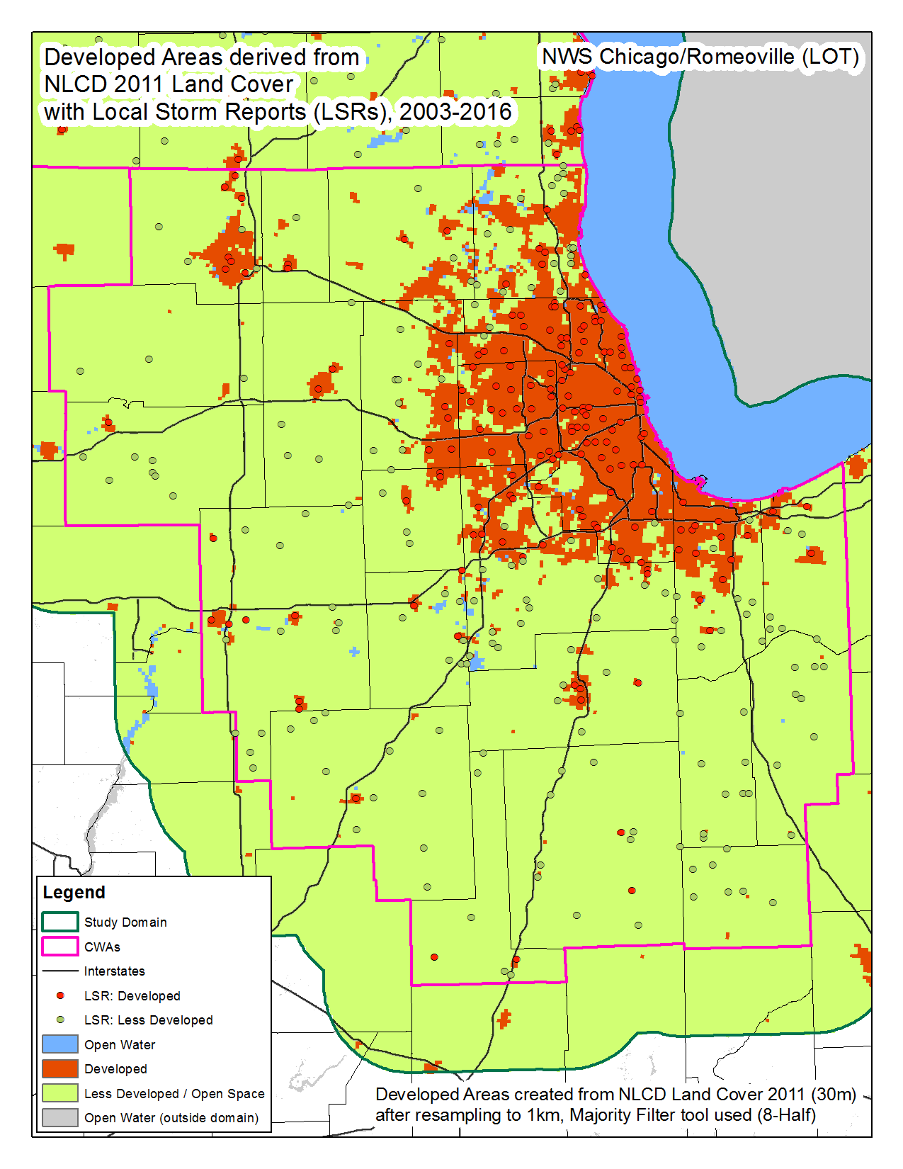
 Chicago |
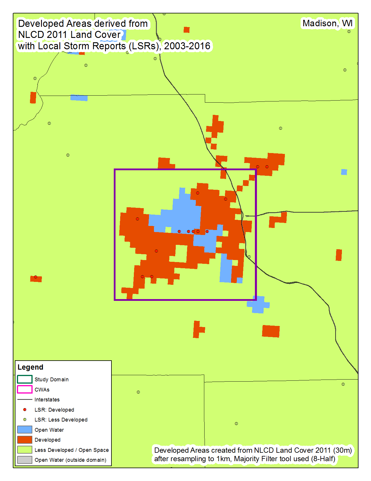 Madison |
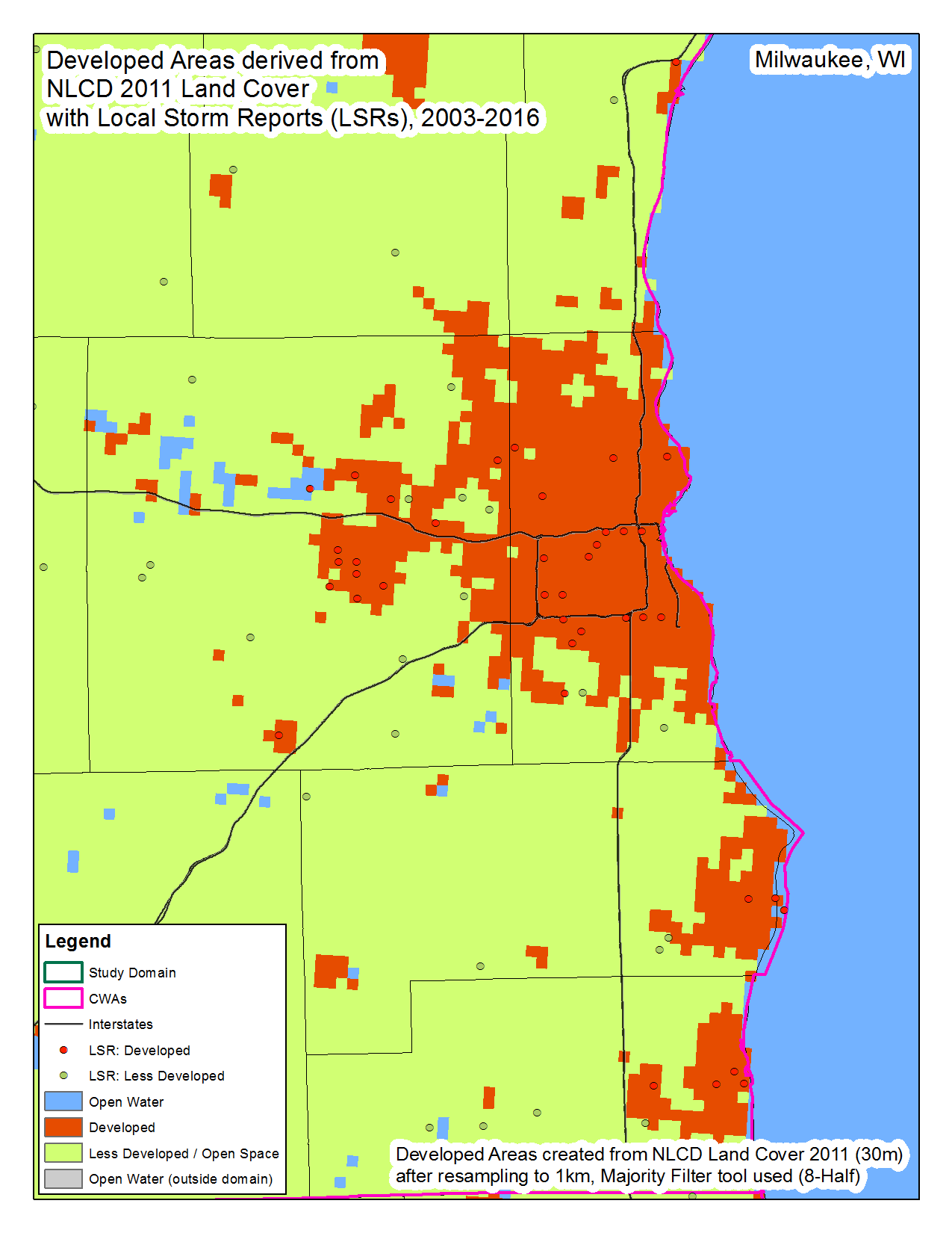 Milwaukee |
 Rockford |
|
 CWA LOT |
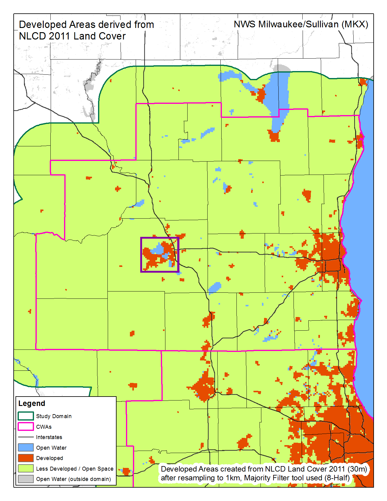 CWA MKX |
 CWA LOT |
 CWA MKX |
|||||
About the data
The source data for the AFFPI developed areas dataset is the National Land Cover Database 2011 (NLCD 2011), which is provided at a 30-meter resolution. After extracting the data within our study extent, it was reclassified to three categories: open water, developed (low, medium or high density developed), and less developed/open space (all other values). Next, the reclassified dataset was resampled to match the project’s 1-kilometer resolution. Last, a majority filter was run in order to smooth the final dataset.