February 9-15, 2020
Midwest Weekly Highlights - February 9-15, 2020
Winter Chill
Temperatures were below normal across the western two-thirds of the Midwest during the period
(Figure 1). Most of Missouri, Iowa, Wisconsin and Minnesota were 3-6°F below normal, with some areas western Wisconsin, northeastern Iowa and southeastern Minnesota were 7-9°F below normal. These areas had minimum temperatures as much as 13°F below normal (Figure 2). More than 400 daily low maximum and low minimum temperature records were broken or tied
(Figure 3), mainly in the western half of the region. Meanwhile, most of Lower Michigan, Indiana central Kentucky and most of Ohio were within a degree of normal, with some areas of southeastern Ohio and eastern Kentucky were 2-4°F above normal.
Heavy Rain and Snow
Precipitation amounts were moderate to heavy across a large portion of the Midwest during the week (Figure 4). Heavy rains in the Ohio River Valley dumped upwards of an inch, with areas in southern Kentucky receiving more than three inches. In most cases, this was more than twice the normal amount
(Figure 5), with some areas having thrice the normal amount. Amounts over a half inch in southern Minnesota and central Wisconsin were also more than twice the normal amount. Precipitation in the Upper Midwest was mostly due to snowfall (Figure 6), with 4-6 inches falling from southern Minnesota through northern Lower Michigan. More than 80 daily precipitation records were broken
(Figure 7), along with more than 100 daily snowfall records (Figure 8).
February 8-10 Winter Storm
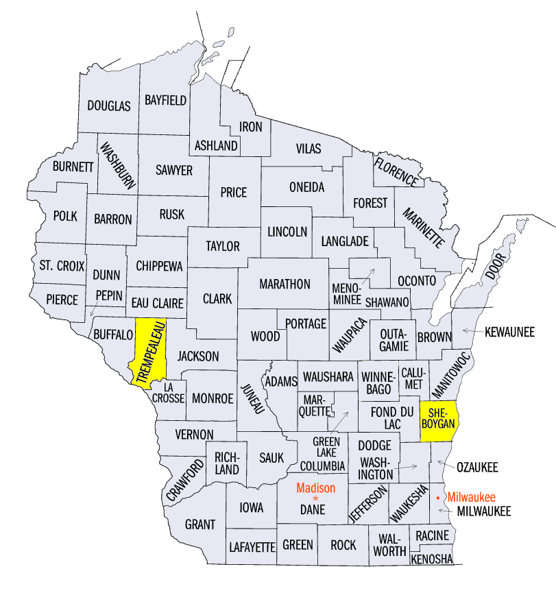
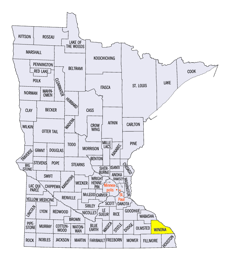
A major winter storm brought heavy snow to the Upper Midwest from February 8-10. Heavy snow impacted southern Minnesota on February 8 through the morning of February 9
(Figure 9). Amounts of 6-8 inches were common, with isolated amounts up to a foot. The storm moved east on February 9 through the morning of February 10 (Figure 10), as 4-6 inches of snow fell across Wisconsin and northern Lower Michigan. Some of the heaviest totals from the storm included 14.0 inches near Trempealeau, WI (Trempealeau County), 14.0 inches in Hingham, WI (Sheboygan County) and 13.0 inches near Minnesota City, MN (Winona County). Heavy rains were also recorded across the Ohio River Valley through the mornings of February 10
(Figure 11) and February 11 (Figure 12) on the southern edge of the storm.
-BJP-