February 22-28, 2021
Midwest Weekly Highlights - February 22-28, 2021
Much Warmer
Temperatures warmed considerably in the last week of February. The entire region was above normal, with some northern areas averaging more than 10°F above normal for the week (Figure 1). These temperatures were a very large change from the very cold temperatures recorded in the third week of the month (Figure 2). Many areas were 25 to 30°F warmer than the previous week. Locations in northeastern Minnesota and northwestern Wisconsin saw minimum temperatures in the -30s and -40s in the third week of February, followed by maximum temperatures in the upper 40s in the last week of the month.
Wet in the Southeast
Precipitation was heaviest in the southeastern Midwest in the last week of February. Totals greater than an inch for the week were spread across all of Kentucky, much of southern Illinois and southern Indiana, southeastern Missouri, and the extreme southern reaches of Ohio (Figure 3). Totals over 2 inches were located in southeastern Illinois, southern Indiana, and much of southern and eastern Kentucky. Eastern Kentucky had totals ranging to over 4 inches for the week. Much of the remaining Midwest had below normal precipitation amounts, with some areas in Missouri were more than a half inch below normal (Figure 4). Totals in eastern Kentucky were as much as four times the normal precipitation for the week. Some areas in Northern Minnesota and a swath including western and northern Missouri, southeastern Iowa, and northwestern Illinois had less than 25 percent of normal precipitation (Figure 5).
Snow in the North
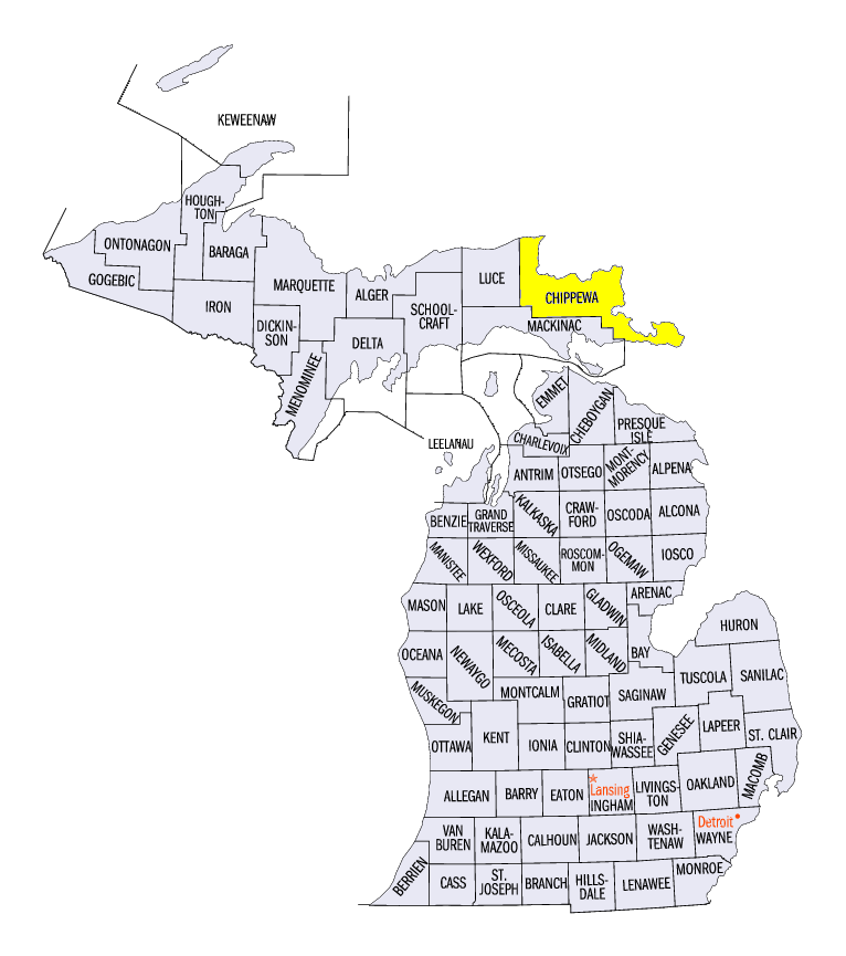
Most of the snow that fell during the week fell in just the four states of Iowa, Minnesota, Wisconsin, and Michigan (Figure 6). Totals ranged up to 4 to 6 inches with some totals of about a foot in northern Michigan. Detour Village (Chippewa County) reported 16.5 inches and Sault Ste. Marie (Chippewa County) reporting 12.6 inches. Where the snow fell, some locations were above normal including parts of Iowa where the totals were more than three times normal for the week (Figure 7).
Drought Holds Steady
According to the US Drought Monitor, drought conditions were relatively steady in the Midwest in late February (Figure 8). Minnesota, Wisconsin, Illinois, Indiana, Ohio, and Missouri had the same coverage of drought and abnormally dry areas in each of the last two week of February. Drought areas in western Iowa shrunk slightly from February 16th to February 23rd. Overall, drought dropped from about 30% of the state to about 27%, while severe drought fell from 12.4% to 10.1%, and extreme drought shrunk from 3.5% to 2.9% of the state.
Flooding in Kentucky
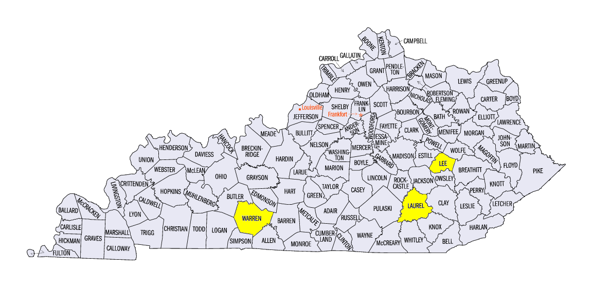
Seven stations in Kentucky reported over 4 inches of rain, including two with more than 6 inches. London Corbin Airport (Laurel County) reported 6.78 inches and Bowling Green Airport (Warren County) reported 6.16 inches. Numerous highways were closed due to flooding and some water rescues were needed. Thirteen counties, mostly in eastern Kentucky, declared emergencies. Beattyville (Lee County), along the Kentucky River, had flood levels unseen since 1957.
-MST-