October 25-31, 2006
Midwest Weekly Highlights - October 25-31, 2006
Rain Soaks Ohio Valley
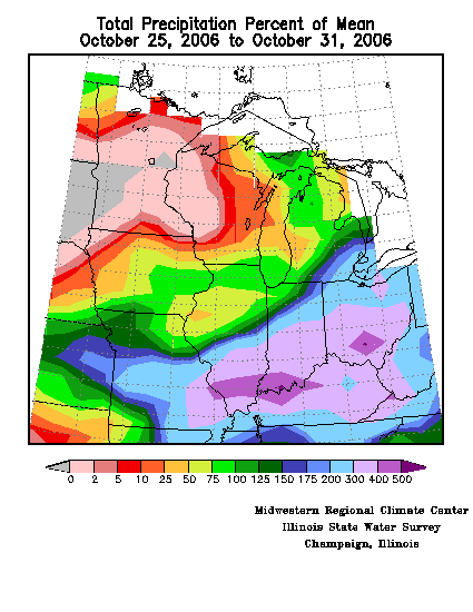
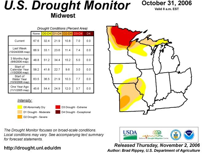
A major storm system produced copious amounts of rain to the Ohio Valley region the first part of this week. Rainfall for the week was more than three times normal from southeastern Missorui through southern Indiana, southern Ohio, and most of Kentucky (Figure 1). In contrast, much of Minnesota and western Wisconsin, still dealing with a persistent Moderate to Extreme Drought (Figure 2), received little precipitation. The pattern the last week of the month reflected the precipitation pattern for the month of October as a whole.
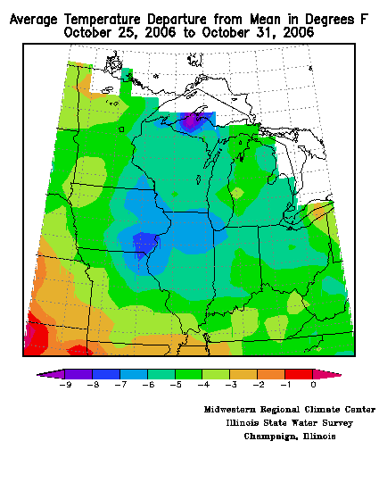
Temperatures this week ranged from 2°F below normal in southwestern Missouri to 7°F to 8°F below normal in the central Midwest from eastern Iowa, through northern Illinois, and into northeastern Missouri (Figure 3). This was the third consecutive week with below normal temperatures across most of the region.
Intense Storm Brings Rain, High Winds
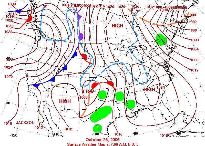
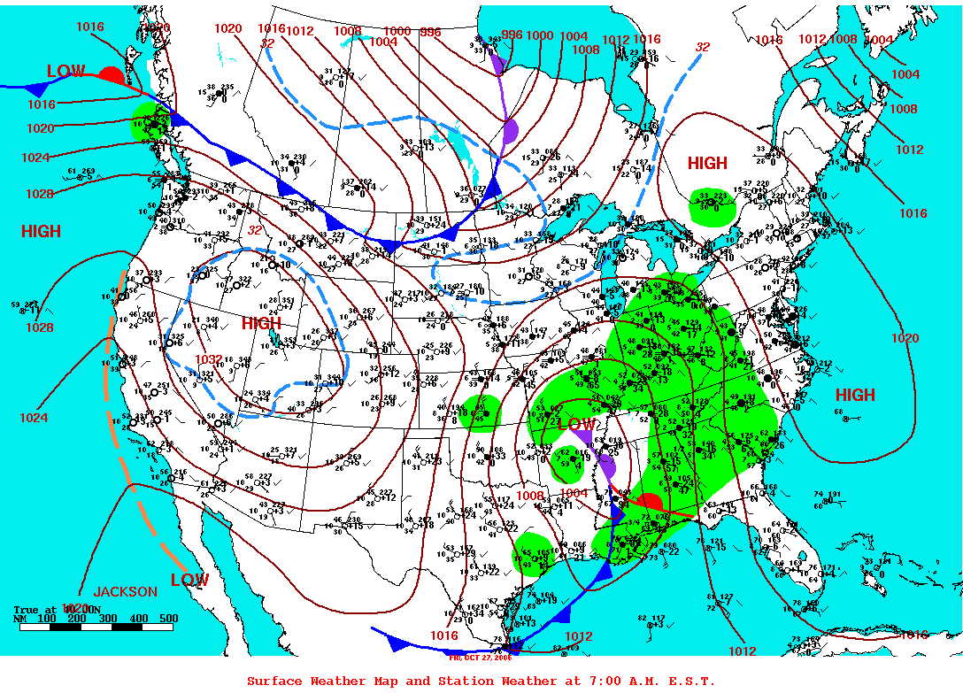
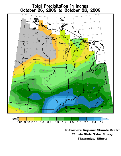
As the final week of October began an elongated ridge of high pressure stretched from Hudson Bay in Canada to the Gulf of Mexico (Figure 4), producing fair but chilly fall weather across the eastern half of the country. At the same time, the next big weather maker was already taking shape over the Texas Panhandle. A shield of clouds spread across the southern half of the Midwest as the high retreated and the low advanced, and rain was close behind. By the morning of October 27 the intensifying low pressure system was located over northern Arkansas and heading northeast (Figure 5). Between late on October 25 to the morning of October 28, more than 2.50 inches of rain fell in a band extending from the Ozarks of Missouri across the Ohio Valley (Figure 6). A number of locations set new daily rainfall records during the storm. Among the records for October 27 were: West Plains, MO, 1.80 inches, old record 1.73 inches in 1973; Indianapolis, IN, 1.71 inches, old record 1.63 inches in 1919; London, KY, 1.29 inches, old record 0.78 inches in 1995; and Columbus, OH, 1.21 inches, breaking the old record of 0.74 inches in 1939.
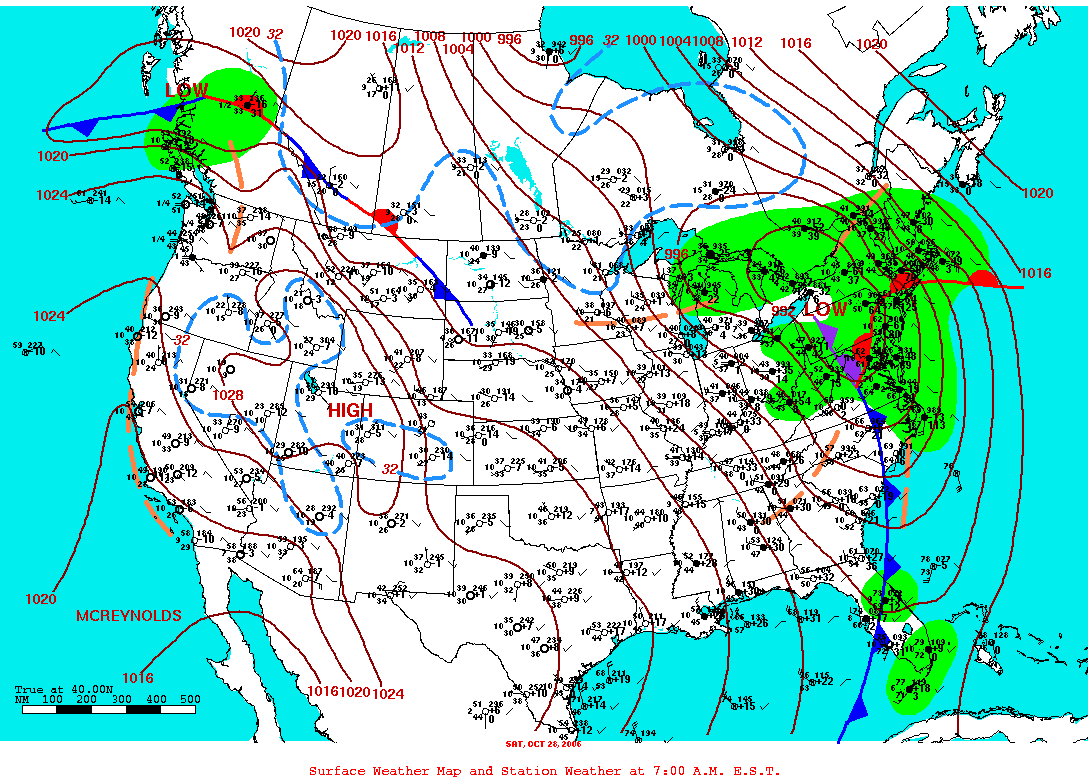
The low continued to deepen as it moved northeast into western New York by the morning of October 28, producing very strong, gusty winds (Figure 7). While the significant damage from this system occurred in the Northeast U.S., there were some reports of damage from the winds in a few locations the Midwest, mostly in eastern Ohio. Winds regularly gusted 45 to 50 mph in lower Michigan on October 28, and a gust to 68 mph was recorded at Presque Isle, MI (Presque Isle County).
A "Chilling" Halloween
Temperatures rapidly moderated across the Midwest October 29-30, with highs reaching the 70s as far north as southern lower Michigan and in the mid 60s into central Minnesota and northern Wisconsin on Ocotber 30. The mild weather was brief, however, as a strong Arctic cold front raced through the Midwest beginning late on October 30, producing much colder and blustery weather for Trick or Treaters on October 31. High temperaratures on October 31 ranged from only the mid 20s in northern Minnesota to mid 40s in central Missouri across to central Indiana. St. Joseph, MO tied its record low of 23°F on October 31, first set in 1930. Eastern and far southern portions of the region saw early morning high temperatures in the low to mid 60s, but temperatures tumbled during the day as the cold air spilled in. The front moved through most of the region dry, but showers dampened Halloween in southern Indiana, Ohio, and Kentucky as the cold air collided with moisture over the Ohio Valley.