September 2015
Midwest Overview - September 2015
Warm Across the Region
Following a cool summer, temperatures were warmer in September, averaging up to 7°F above normal in the northern states and just slightly above normal in parts of Kentucky (Figure 1). Minimum (Figure 2) and maximum
(Figure 3) temperatures had similar patterns with the minimum temperatures a slight bit warmer. September temperatures for the Midwest as a whole ranked among the warmest on record (1895-2015). The preliminary temperature ranked as the second warmest September, only 1931 was warmer. Minnesota (64.6°F), Wisconsin (65.5°F), and Michigan (65.1°F) all set preliminary records for September statewide values, averaging 6°F to 7°F above normal for the month. Iowa (3rd), Ohio (6th), and Illinois (7th) also ranked among the 10 warmest Septembers on record. The first week of the month was particularly warm with many locations recording or matching their warmest day of the year. After a cooler second week, the warmth returned for the latter half of the month.
Drier than Normal
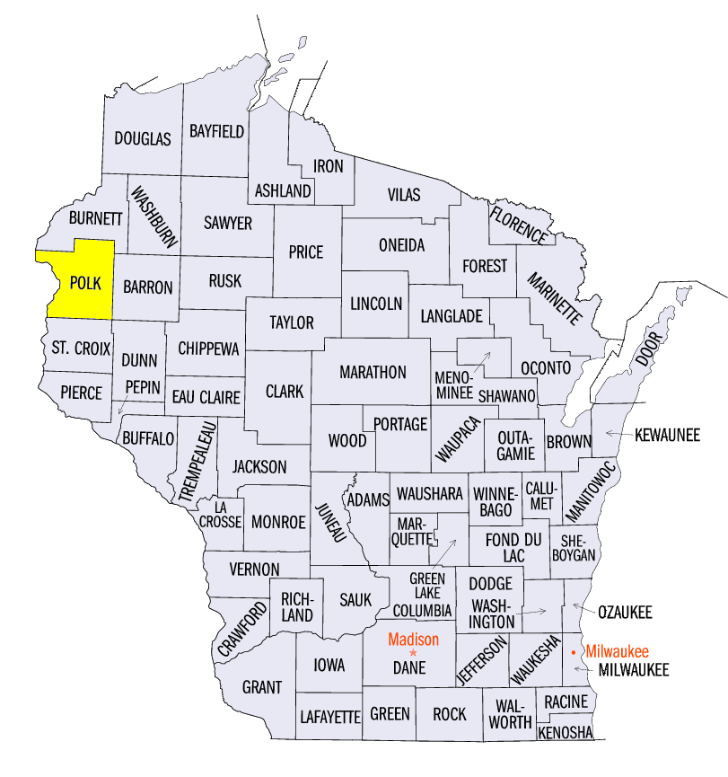
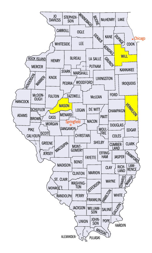
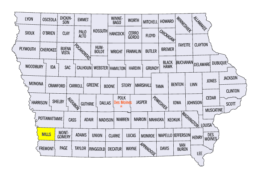
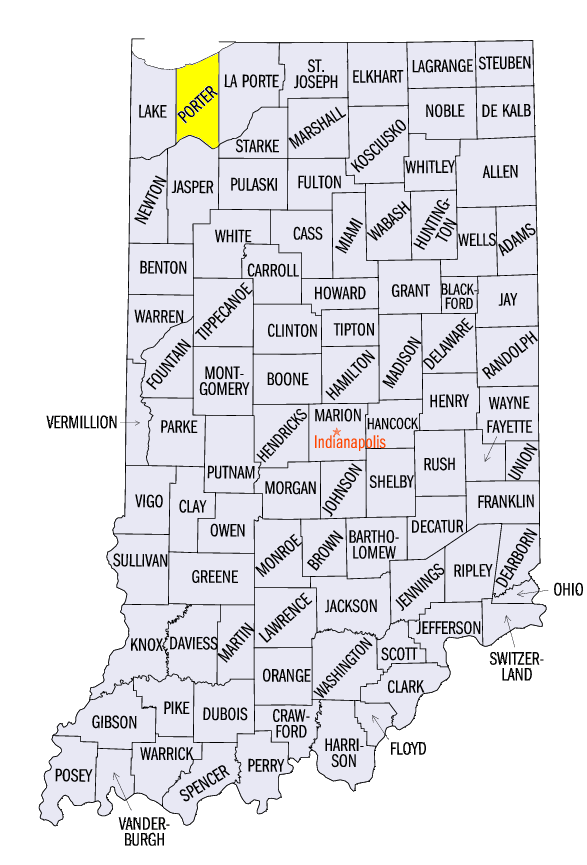
Conditions were drier than normal in September for the Midwest as a whole. The local conditions varied however with totals ranging from less than 25% of normal to nearly 200% of normal (Figure 4). Statewide values ranged from near normal in Iowa and Wisconsin to well below normal in Kentucky and Missouri where statewide totals were just over half of normal. Despite the overall dry pattern, there were locations that were quite wet with monthly accumulations over 10 inches. The locations topping 10 inches were scattered among four states and included Amery, Wisconsin
(Polk County) with 12.19", Hoopston, Illinois
(Vermillion County) with 11.74", Glenwood, Iowa
(Mills County) with 11.63", and Portage, Indiana
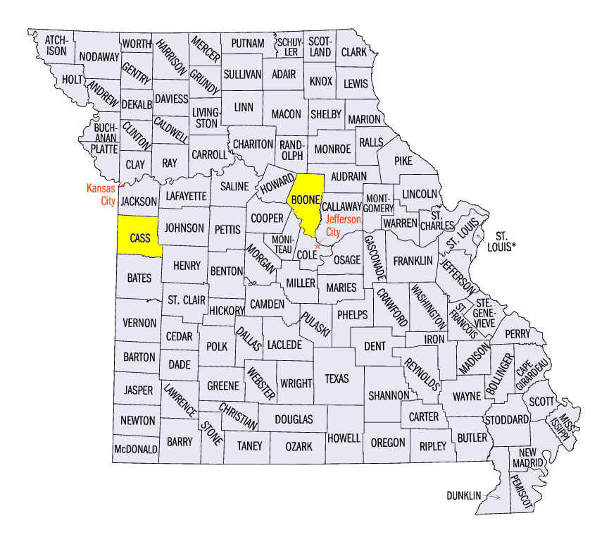
(Porter County) with 10.64". Drought continued throughout the month in a few counties in southwest Wisconsin and new areas developed in Kentucky and southeast Indiana in the latter half of the month (Figure 5). Just 1% of the region was classified as drought. Abnormally dry conditions were more widespread, over 20% of the region including areas in all nine states, and included Columbia, Missouri
(Boone County) where the local station had the driest August-September since 1999.
Fall Field Work
With generally favorable warm and dry conditions in many locations, harvest progress during September ramped up. Soybean harvest was running ahead of the 5-year average except in Iowa and Wisconsin where it was 5-10% behind. Corn harvest was running about 5-10% behind 5-year averages in all nine states. Wheat planting was near normal in the Midwest. Crop conditions changed very little since the beginning of the month for both soybeans (Figure 6) and corn
(Figure 7).
Severe Weather
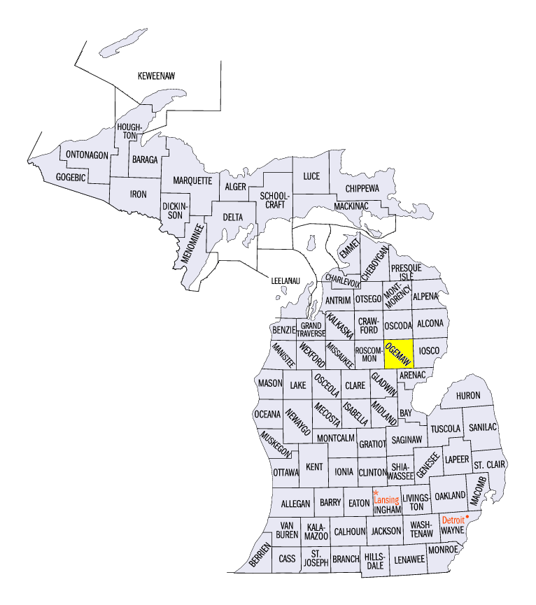
Severe weather was reported in all nine states in the region (Figure 8) spread across 15 days in September, most falling early in the month. Reports of severe weather came in on the first 11 days of the month, the 16th-18th, and on the 22nd with most occurring on just six days, the 3rd & 4th, 8th, 10th, and the 17th & 18th. Tornadoes touched down in Ogemaw County, Michigan on the 8th, Mason County, Illinois on the 10th, and both Will County, Illinois and Cass County, Missouri on the 18th. The tornados caused minor damage and no reported injuries. Hail reports in the region ranged from 1.00" to 1.75".
-MST-
The Iowa Climatology Bureau also contributed to this report.
The Minnesota State Climatology Office also contributed to this report.
The Missouri Climate Center also contributed to this report.