August 8-14, 2015
Midwest Weekly Highlights - August 8-14, 2015
Mixed Bag of Precipitation
Summertime storms tracked through the region this week, leaving some areas with plentiful rain and others with little to no precipitation
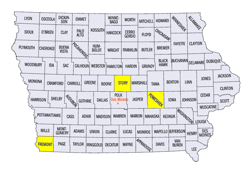
(Figure 1). Storms in central Wisconsin dropped over an inch of rain through the morning of August 8 (Figure 2), while storms in Iowa through the morning of August 9 brought up to 4 inches of rain in Story, Poweshiek and Fremont counties (Figure 3) (Table 1). Southern Missouri was hit hard the next day where 2-3 inches of precipitation fell in some areas
(Figure 4). Drier areas were found along the Mississippi River north of the Illinois border and in the western Ohio River Valley, where less than quarter the normal amount of precipitation fell for the period
(Figure 5). Precipitation departures in these areas were around an inch below normal
(Figure 6).
Warm in Minnesota, Cool in Kentucky
While a majority of the region was within 2°F of normal for the period, two states spent the period at opposite ends of the spectrum (Figure 7). Most of Minnesota was above normal, with temperatures 2-5 degrees above normal. Warm conditions were also seen in the U.P. of Michigan and Wisconsin, where temperatures were 2-4°F above normal. On the opposite end, most of Kentucky spent the period 1-3 degrees below normal. Cooler conditions also spilled into southeastern Missouri and parts of the northern Ohio River Valley. Near normal conditions were common across most of Illinois, Wisconsin, Iowa, Lower Michigan and Missouri as average temperatures were in the upper 60’s to 70’s
(Figure 8).
Severe Weather Roundup
A few isolated severe weather events occurred over the period (Figure 9). Strong storms brought wind damage to Missouri and Iowa on August 8 and 9, while an EF-0 tornado touched down near Germantown in Washington County, WI. A strong hail storm in Roseau County, MN brought 3.0-4.5 inch hail on August 12. More 1-2 inch hail fell as the storm moved into central Minnesota as the storm died out during the overnight hours.
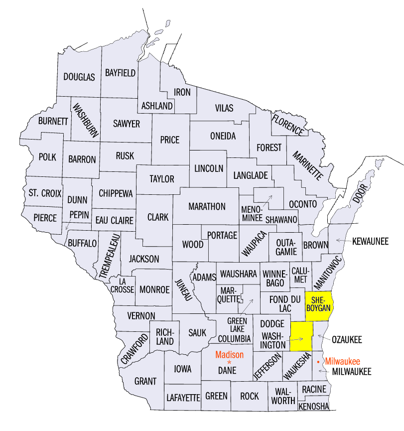
A widespread wind and hail event occurred in the afternoon of August 14 across eastern Wisconsin and Michigan as storms fired. In Michigan, trees and power lines were toppled as well while 1.00-1.75 inch hail fell in spots as storms moved through the state. A line of storms went through Sheboygan County, WI where the PGA Championship was being held at the Whistling Straights Golf Course. Trees on the course were damaged and multiple tents were blown over, as well as the leaderboard. Play was suspended for the day after the storms moved through to tend to damage on the course.
Moderate Drought in Southwest Wisconsin
After very dry conditions continued for parts of Wisconsin, the National Drought Mitigation Center added moderate drought into southwest portions of the state (Figure 10). Parts of the tri-state area have only had half the normal amount of precipitation since July 1, with some areas having less than a quarter the amount of normal (Figure 11).
-BJP-