March 22-31, 2015
Midwest Weekly Highlights - March 22-31, 2015
Cold End To March
After many hoped that winter was finally over, below normal temperatures persisted through much of the region to end the month of March
(Figure 1). The most below normal areas were seen around the Great Lakes, as there is still a substantial amount of ice on many of the lakes. A tongue of below normal temperatures were also seen from southern Minnesota through northern Illinois. This was due in part to snow cover reflecting more solar radiation across these areas (Figure 2). Near to slightly below normal temepratures were seen along the Ohio River, while near to slightly above normal temperatures were seen in western portions of Missouri, Iowa and Minnesota.
Rain, Hail & Snow
The Midwest got its fair share of precipitation types to end March as snow fell to the north, rain to the south, and hail fell in severe thunderstorms. Almost all of the region saw at least some precipitation
(Figure 3). The areas seeing the least amounts of precipitation were in the Lower Ohio Valley and western Minnesota. While most of the region saw near to below normal precipitation for the period, above normal precipitation was seen in southern Missouri through the Upper Ohio Valley, as well as along the Mississippi in southern Minnesota and western Wisconsin (Figure 4). Severe weather events in southern Missouri dropped over 1.5 inches of rainfall for the period, while hail reports flooded in on March 24-25
(Figure 5). An abnormally strong winter storm on March 22-24 dropped heavy snow on southeastern Minnesota and western Wisconsin (Figure 6), bringing well above normal snowfall for this time of year
(Figure 7). This ultimately helped these areas to have above normal precipitation for the period.
March 22-24 Snowstorm
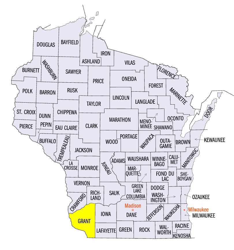
After many put away the snow shovels for the winter, a strong early spring snowstorm moved through parts of Minnesota, Iowa, Wisconsin, Illinois, Michigan, Indiana and Ohio on March 22-24, dumping a heavy band of snow (Figure 8, Note: some reports came in on March 25 for snowfall on March 24). A narrow band of heavy snow first formed in the afternoon on March 22 ahead of the main system. Later that evening, the system began to form a more widespread path of snowfall from western Minnesota through southwest Wisconsin. The system continued to dump snow over southeast Minnesota and southwest Wisconsin throughout the morning hours on March 23 before moving eastward through the afternoon hours. Snow continued through the afternoon in Illinois and Indiana before moving into Ohio overnight. A large swath of 4-8 inches of snow was seen from western Minnesota through southern Lake Michigan. A narrow band of 8-12 inches of snow was also seen in extreme southeast Minnesota through southwest Wisconsin. The heaviest snowfall was reported in Grant County, WI where 15.0 inches of snow was measured at Fennimore and Woodman.
This storm also brought much-needed precipitation for areas in the Abnormally Dry and Moderate drought categories in southern Minnesota and Wisconsin. Until this snowstorm, these areas had accumulated less than a quarter inch of precipitation for the month of March
(Figure 9). Over a half an inch of liquid equivalent precipitation fell during this storm in many of these areas. Unfortunately, most of Wisconsin and Minnesota are still 1-3 inches below normal for precipitation since December 1, 2014 (Figure 10).
Severe Weather March 24-25
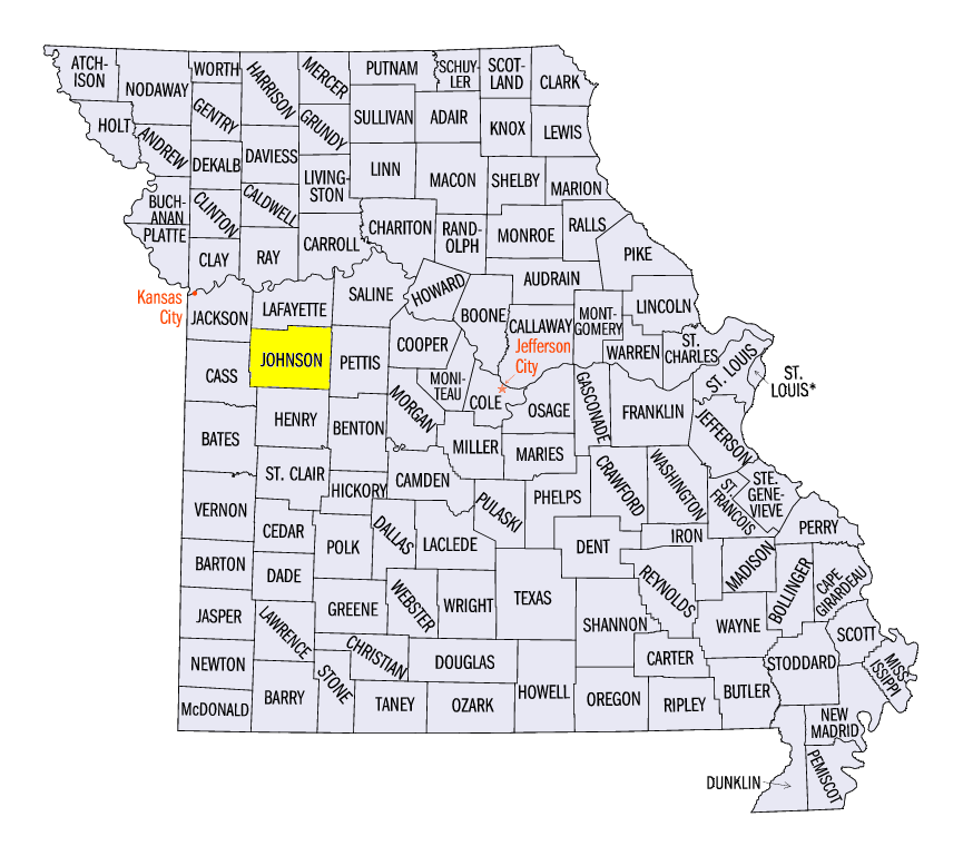
The first severe weather day of 2015 in the Midwest came on March 24th as supercell thunderstorms dropped hail throghout western Missouri. Most reports were for 1-inch diameter hail, with up to 2-inch diameter hail reported in Johnson County, MO. No tornadoes were reported. The next day, March 25th, yet another day of hail and severe weather was in order in Missouri. Hail was reported throughout the southern part of the state with the southwest corner seeing the most reports. Two-inch diameter hail was reported in both Ozark and Shannon County. Multiple trees and power lines were also blown down from strong winds. No tornadoes were reported in Missouri, but multiple tornadoes were reported in Oklahoma and Arkansas, with Moore, OK falling victim to yet another tornado.
Drought Expands in Wisconsin
Despite snowfall and below normal temperatures, drought conditions were expanded into more of northern Wisconsin with the National Drought Mitigation Center’s Drought Monitor valid for March 31, 2015 (Figure 11). Despite heavy snowfall in southeastern Minnesota and southwestern Wisconsin, abnormally dry conditions remain. Unfortunately, these conditions are expected to persist and worsen in the upcoming months.
-BJP-