September 22-30, 2016
Midwest Weekly Highlights - September 22-30, 2016
Wet Weather in Minnesota, Iowa and Wisconsin
Well-above-normal precipitation fell across southern Minnesota, Wisconsin and Iowa in the last week of September
(Figure 1). Over three inches of precipitation fell in these areas, with locally higher amounts approaching 10 inches (Figure 2). In many cases, this was three to five times the normal amount
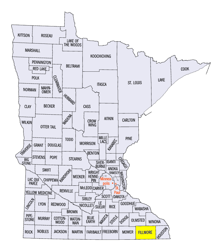
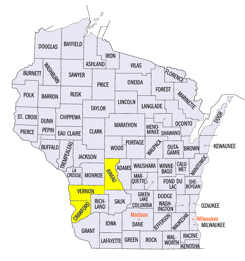
(Figure 3). Some of the locally heavier amounts in the three states included 9.76 inches near Nashua, IA (Floyd County), 5.48 inches near Lanesboro, MN (Fillmore County) and 5.95 inches near Hillsboro, WI (Vernon County). Parts of Ohio also received well above normal precipitation, helping to alleviate drought in the state. Moderate drought across Ohio was reduced to less than 10% of the state in the September 27 Drought Monitor (Figure 4). Further south, drier conditions were common across Missouri, Illinois and Kentucky. Most of Missouri had less than half the normal amount of precipitation, with the Iowa, Illinois and Missouri tri-state area receiving no precipitation.
Well-Above-Normal Temperatures
A warm airmass across the central U.S. led to above-normal temperatures across the Midwest in the last week of September
(Figure 5). The entire region was above normal, with the warmest areas in Iowa, Illinois and Missouri. Temperatures in those areas were 5-7°F above normal. Closer-to-normal temperatures were found across Minnesota and Michigan, where temperatures were only 1-4°F above normal. A large portion of the warmth came from overnight minimum temperatures that were up to 10°F above normal (Figure 6). Over 150 daily high minimum temperature records were broken across the region. High temperatures were also quite warm, with mid- to upper-80’s across the southern half of the region on multiple days, including September 22, where many stations were around 90°F
(Figure 7).
Iowa, Wisconsin Flooding
An anomalous weather pattern on September 20-24, coupled with antecedent conditions from a wet August and early September, led to flooding and flash flooding across southern Minnesota, Iowa and southwestern Wisconsin. Read more about the flash flooding on September 21 in the previous week’s Midwest Climate Watch.
Iowa
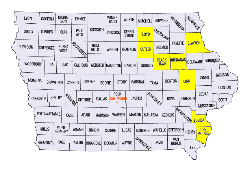
Moderate and major flooding occurred along many of eastern Iowa’s major rivers during the last week of September (Figure 8). Multiple gauges crested among their top five highest crests on record. Preliminary crests along the Cedar River included 98.90 feet in Cedar Falls (Figure 9, Black Hawk County), 22.95 feet in Waterloo (Figure 10, Black Hawk County), and 21.91 feet in Cedar Rapids (Figure 11, Linn County). The Shell Rock River at Shell Rock (Butler County) had its highest crest on record at 21.51 feet (Figure 12). Major flooding also occurred on the Iowa River at Columbus Junction (Figure 13,Louisa County) and Wapello (Figure 14, Louisa County) as well as along the Wapsipinicon River at Independence (Figure 15, Buchanan County). Twenty-one counties were put under a disaster proclamation by Governor Terry Branstad (Figure 16). Read the full summary of the Iowa flooding from NWS-Des Moines.
Wisconsin
Flooding and flash flooding in southwestern Wisconsin continued through the period (Figure 17). Major flooding occurring along the Kickapoo River at Steuben (Figure 18, Crawford County) and the Yellow River at Necedah (Figure 19), Juneau County). Moderate flooding also occurred along the Baraboo River. A State of Emergency was declared by Governor Scott Walker in 14 counties (Figure 20). Surveys by Wisconsin Emergency Management as of September 30 assessed over $7 Million in damage to homes and businesses and over $14 Million in damage to roads, bridges and trails. More than half of the damage estimates came from Crawford and Vernon counties along the Mississippi River.
Mississippi River
Flood waters from Iowa and Wisconsin flowed into the Mississippi River during the week, elevating river levels
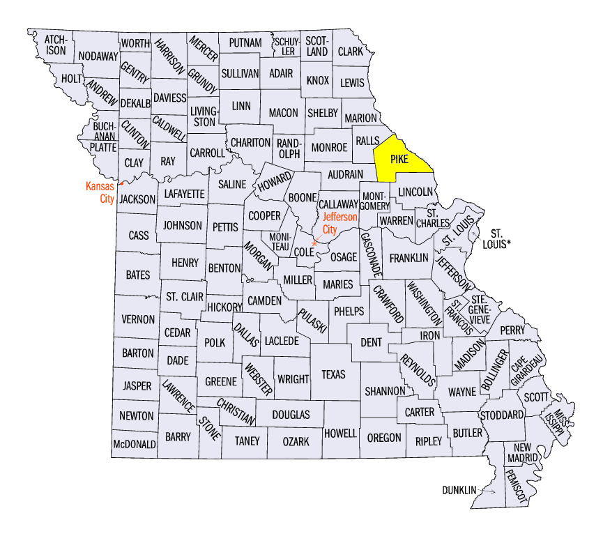
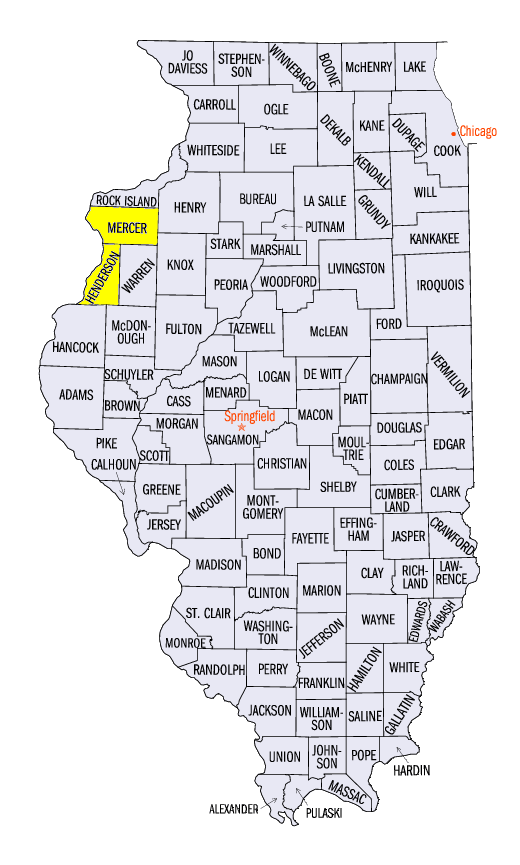
(Figure 21). Minor flooding was common late in the period from McGregor, IA (Clayton County) through Clarksville, MO (Pike County). Moderate and major flooding was also common near the mouth of the Iowa River at the end of the period. Gauges at New Boston, IL (Figure 22, Mercer County), Keithsburg, IL (Figure 23, Mercer County), Gladstone, IL (Figure 24, Henderson County), and Burlington, IA (Figure 25, Des Moines County) were either near or at major flood stage on September 30.
-BJP-
The National Weather Service-Des Moines also contributed to this report.