July 2016
Monthly Overview - July 2016
Very Wet July for Most of the Midwest
Heavy rains fell in the Midwest on several days during July bringing above-normal totals to much of the region
(Figure 1). Rainfall totals topped 5 inches for much of the region, 10 inches in many locations and 15 inches in parts of western Kentucky ((Figure 2). Below-normal rainfall fell in northeast Indiana and much of Ohio as well as other scattered areas across the region. Totals ranged from less than 50 percent of normal in northwest Ohio and northeast Indiana to two to three times normal in areas across the western and southern parts of the region
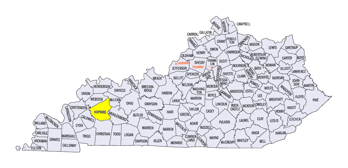
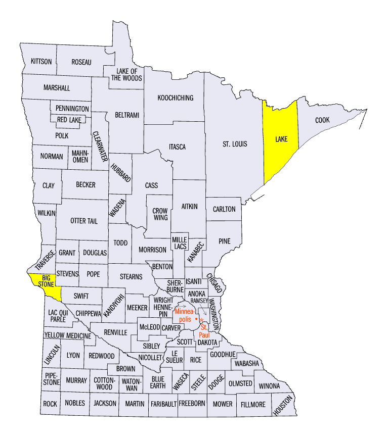
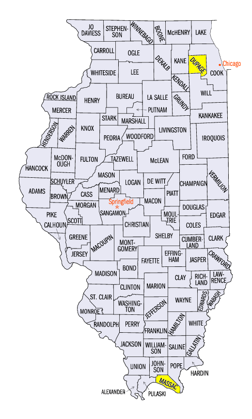
(Figure 3). Statewide ranks for the 1895-2016 period were among the top 10 wettest in Kentucky (2nd wettest), Illinois (3rd), Minnesota (4th), and Missouri (8th) while Ohio, the only drier-than-normal state, ranked as the 29th driest in those 122 years. Total precipitation for the month topped 10 inches at dozens of stations spread across seven states and topped 16 inches in four of those states (Figure 4). The highest monthly total in Kentucky was 18.67" at Madisonville
(Hopkins County), in Missouri was 17.04" in Brumley
(Camden County), in Minnesota was 16.58" in Ortonville
(Big Stone County), and in Illinois was 16.13" in Downers Grove
(DuPage County).
Cool Start Turns Hot and Humid
July got off to a cool start with temperatures well below normal for the first few days of the month
(Figure 5). Temperatures dropped into the 30s in Minnesota, Michigan, and Ohio and into the 40s in Wisconsin, Iowa, Illinois, and Indiana. Just a couple weeks later, temperatures were above normal (Figure 6) as a hot and humid air mass spread across the Midwest. Heat Index values topped 100°F, and even 110°F, in many locations
(Figure 7). Temperatures averaged over the month were mostly within a couple degrees of normal except along the southern and eastern edges of the region (Figure 8). Minimum temperatures were above normal for most of the Midwest (Figure 9), mostly due to high dew points which kept nighttime temperatures high
in the latter half of the month.
Lots of Severe Weather
There were numerous severe weather reports throughout the month with only the 1st and 2nd failing to record severe weather in July. The reports covered the region spatially as well (Figure 10). There were more than 500 reports of severe weather on the 13th
(Figure 11) and more than 100 on six additional days (5th-8th, 20th-21st). Tornadoes were reported on 12 days in eight states. Large hail (1" or more) fell in all nine states with very large hail (2.50" to 3.00") reported on four days in Minnesota and one day in Michigan. On the 20th, two fatalities occurred in Lake County, Minnesota when trees were blown down onto tents at a scout camp. A tornado near Metropolis, Illinois
(Massac County) on the 6th was responsible for two injuries. Flash flooding was also reported in several locations and dates with three confirmed deaths in northwest Wisconsin due to flooding on the 11th and 12th.
Ohio Dries Out
At the onset of July (Figure 12), drought was located in west central Minnesota and southeast Iowa with abnormally dry areas scattered across the region. July rains eliminated much of that drought by the end of the month, but the introduction and expansion of drought in Ohio and parts of Michigan. As of the end of July
(Figure 13), drought covered more than 33 percent of Ohio, more than 16 percent of Michigan, and a few percent of Iowa and Missouri.
Crop Development
Corn and soybeans were rated in about the same condition in the Midwest as of July 31 according to NASS Crop Progress. Conditions were rated good or excellent for more than 70 percent of the crop in every state except Ohio and Michigan for both crops. In Ohio and Michigan where drought emerged in July, the crops were only rated good or excellent in 54 to 58 percent of the fields.
-MST-
The Iowa Climatology Bureau also contributed to this report.
The Minnesota State Climatology Office also contributed to this report.
The Missouri Climate Center also contributed to this report..