June 22-30, 2016
Midwest Weekly Highlights - June 22-30, 2016
Hot to the South
Temperatures were warmer than normal across the southern half of the region
(Figure 1). Missouri, southern Illinois, southern Indiana and Kentucky were 2-5°F above normal. Closer to normal temperatures were found across the northern half of the region. Spotty areas of slightly below-normal temperatures were found in Minnesota, Wisconsin and Michigan. Minimum temperatures were cooler that normal in some of these areas, especially in northern Lower Michigan (Figure 2). Maximum temperatures were near to slightly above normal in Lower Michigan
(Figure 3).
Varying Amounts of Precipitation
Varied amounts of precipitation fell across the region to end June (Figure 4). Storms on multiple days took different tracks, leading to more than two inches of precipitation in northern Wisconsin, eastern Iowa, northern Illinois, central Ohio and eastern Kentucky. Drier conditions were found across Lower Michigan, the mid-Mississippi River Valley, western Iowa and western Minnesota, where less than a quarter of the normal precipitation fell
(Figure 5).
Drought Added to Southeast Iowa
Drought conditions filled in across southeast Iowa and extreme northeast Missouri according to the June 28 Drought Monitor from the National Drought Mitigation Center (Figure 6). A small area of west-central Minnesota was also classified as in moderate drought. Abnormally dry conditions were added to southern Lower Michigan where there was decreased topsoil moisture. Above normal rainfall in parts of Indiana and Ohio led to the removal of some abnormal dryness. More than a quarter of the Midwest was considered to be abnormally dry or in moderate drought.
June 22-23 Northern Illinois Tornadoes/Severe Weather
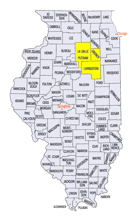
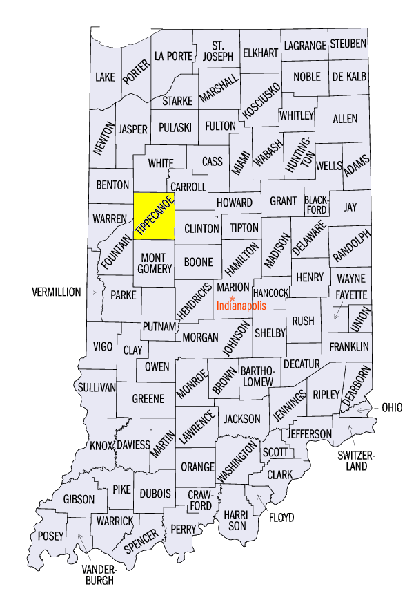
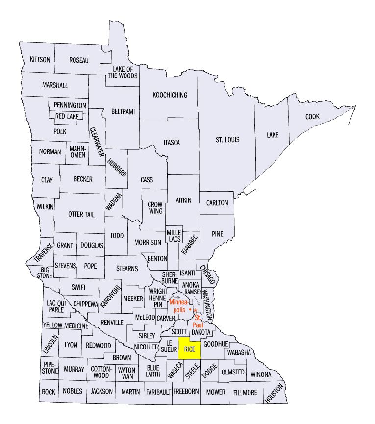
On June 22, 18 tornadoes were reported across northern Illinois (Figure 7). A majority of these tornadoes were from three major supercells, which dropped and lifted multiple times. Sixteen of the 18 tornadoes were classified as either EF-0 or EF-1. Two tornadoes were classified as EF-2, one south of Pontiac, IL (Livingston County) and one north of Seneca, IL (LaSalle and Grundy Counties). Four injuries were reported from the Pontiac tornado. Fortunately, no fatalities were reported from any of the 18 tornadoes.
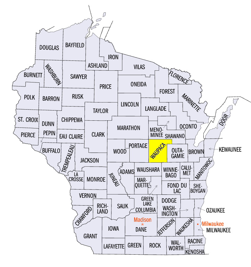
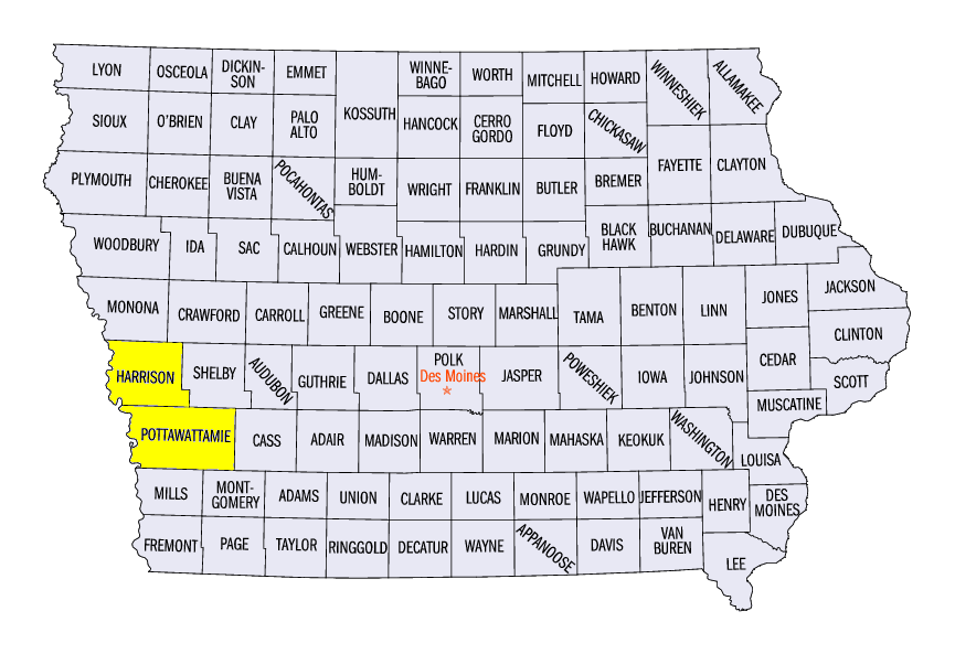
Further east, storms caused wind damage in Indiana and Ohio, including a 100 mph gust near Battle Ground, IN (Tippecanoe County). Several weak tornadoes were also reported in Indiana and Ohio. While large hail was not common from storms in Indiana and Ohio, a report of 3 inch hail occurred in an unrelated storm in Rice County, MN. Energy from the main system remained on June 23, leading to wind damage across most of Kentucky. The remainder of the week was relatively quiet. However, a cluster of wind reports in northeast Minnesota and northwest Wisconsin occurred on June 25, including a weak tornado in Waupaca County, WI. Two other tornado reports were found on June 29 in Harrison and Pottawattamie Counties in Iowa.
-BJP-