June 8-14, 2016
Midwest Weekly Highlights - June 8-14, 2016
Warm Weather to the West
Temperatures were well above normal across the western half of the Midwest during the period (Figure 1). Illinois, Missouri, Iowa and southern Minnesota were 3°F or more above normal. Parts of southwest Minnesota and western Iowa were as much as 12°F above normal. Maximum temperatures reached 90°F or higher in these areas on three or four occasions during the week, and averaged up to 14°F above normal (Figure 2). More than a dozen maximum temperature records were broken through the morning of June 11 in Iowa alone. More than 50 record high minimum temperatures were also recorded in Iowa from June 10-13.
Elsewhere, average temperatures were much cooler near the Great Lakes. Most of Michigan and eastern Ohio were 2-4°F below normal, while eastern Wisconsin was near-normal. The Ohio River Valley was within 3°F of normal, but maximum temperatures reached the 90’s on multiple occasions.
Dry, Except in the in the Driftless Area
Dry weather was common across most of the Midwest
(Figure 3). Less than half an inch of precipitation fell across Michigan, Ohio, Indiana, Kentucky, Missouri and southern Illinois. Departures of more than an inch below normal were common across Ohio, Kentucky, eastern Indiana, southern Illinois and northern Missouri (Figure 4). However, wet conditions were common in the Driftless Area along the Mississippi River in Minnesota, Iowa and Wisconsin. More than two inches of precipitation fell during the period, which was more than double the normal amount
(Figure 5).
June 14 Flooding/Flash Flooding
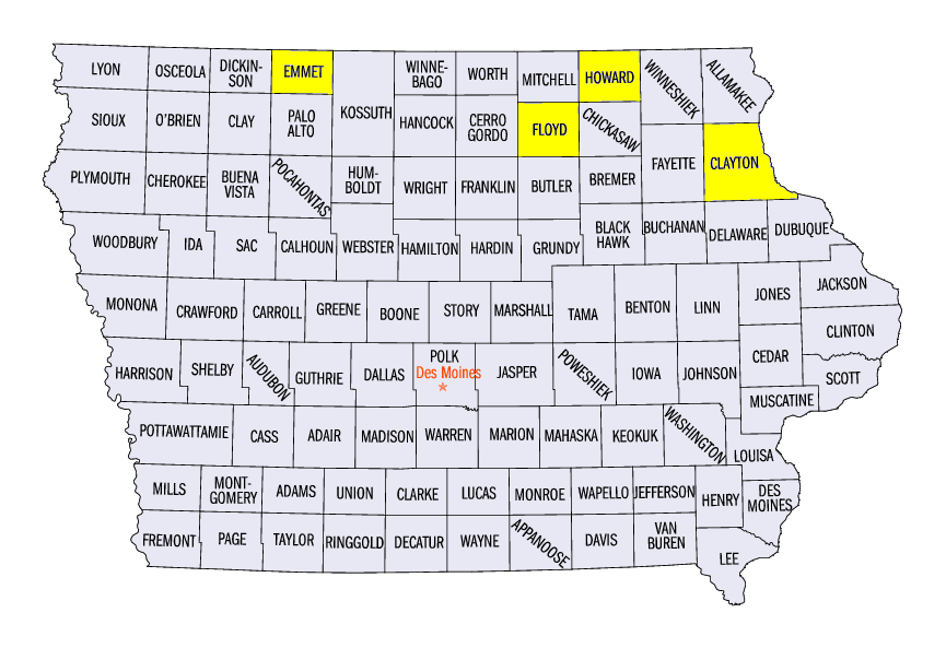
A strong line of thunderstorms moved through the Driftless Area of Minnesota, Iowa and Wisconsin on June 14, leading to minor flooding along multiple rivers and tributaries. Precipitation values of over 2 inches were common during the evening hours and through the morning of June 15 (Figure 6). Some of the wettest locations included Riceville (5.54 inches) in Howard County, IA, Nora Springs (4.25 inches) in Floyd County, IA and the Prairie Du Chien Airport in Crawford County, WI (3.49 inches). The heavy rainfall caused the Turkey River stage at Garber, IA (Clayton County) to rise more than nine feet overnight, which led to minor flooding
(Figure 7).
Severe Weather in the Upper Midwest
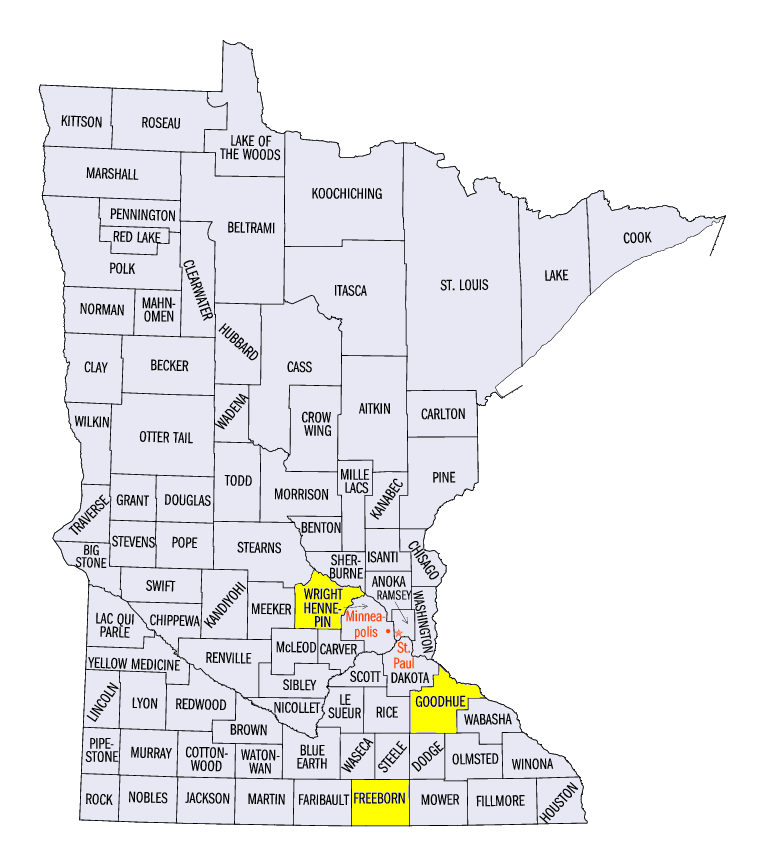
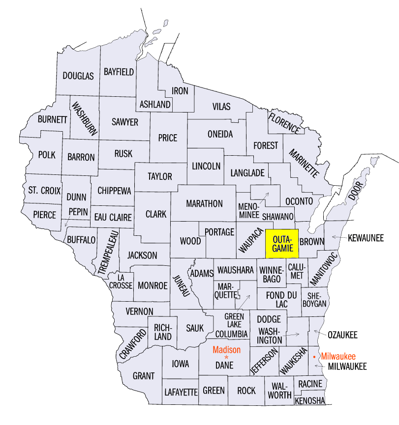
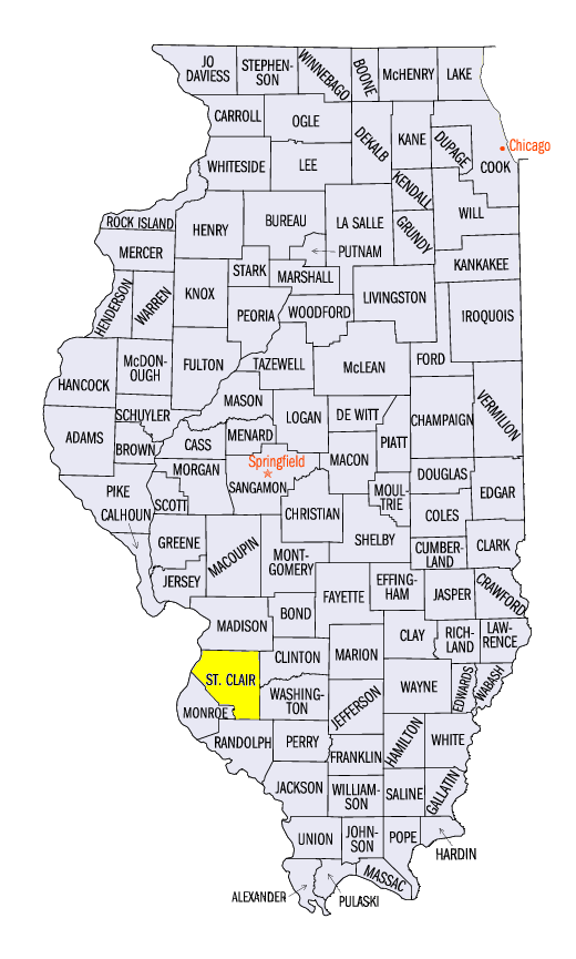
Multiple days of severe weather were focused in the Upper Midwest this week (Figure 8). A lone cell in Wright County, MN began the week with tennis ball-size hail on June 8. Strong winds and hail were common on June 10 across southern Minnesota, northern Iowa and Wisconsin. Wind gusts of 75 mph were reported in Freeborn and Goodhue counties in Minnesota, and 76 mph gust was reported in Emmet County, IA. A weak tornado was also reported in Outagamie County, WI. After a cluster of storms brought strong winds and hail to west-central Minnesota on June 12 and a lone, short-lived tornado touched down in St. Clair County, IL on June 13, multiple tornadoes and many wind reports were found in Iowa and southern Minnesota. Nearly a dozen tornadoes were reported, with most occurring in Minnesota.
Good Crop Weather
Crops conditions across the Midwest are in good shape as the region continues to have favorable weather for plant development. Less than 15% of the region is considered abnormally dry, and only a small sliver of west-central Minnesota is considered in drought according to the latest Drought Monitor (Figure 9). Adequate precipitation has also fallen since April 1, which has charged soil moisture. According to USDA’s National Agricultural Statistics Service, corn crop condition was at 65% good to excellent or more across the entire region for the week ending on June 12 (Figure 10). Soybeans were doing similarly well, with only Missouri and Ohio under 70% good to excellent (Figure 11).
-BJP-