May 22-31, 2016
Midwest Weekly Highlights - May 22-31, 2016
Hot End to May
Above-normal temperatures were common across the Midwest during the final week of May
(Figure 1). Some of the most above-normal areas were in Michigan and Wisconsin, where temperatures were 8-12°F above normal. Only a few areas in southern Missouri and Kentucky were near normal. Maximum temperatures routinely reached the upper 70s to low 80s (Figure 2). This led to maximum temperature departures of up to 15°F above normal across Wisconsin and Michigan
(Figure 3).
Wet to the West, Dry to the East
Wet weather was common across the western half of the region, where 1-3 inches of precipitation fell across Missouri, Iowa, Wisconsin and Minnesota (Figure 4). Lesser amounts under a quarter of an inch were common across Indiana, Ohio and Michigan. Precipitation departures of an inch below normal were common across Indiana and Ohio
(Figure 5). Meanwhile, portions of Missouri, Iowa, Minnesota, Wisconsin and the U.P. of Michigan received one-and-a-half to two times the normal amount (Figure 6).
Severe Weather
After a quiet week of severe weather, wind, hail and tornado reports returned to the region to end May
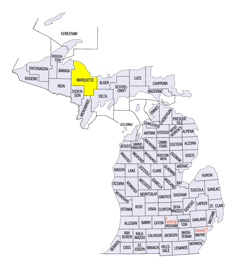
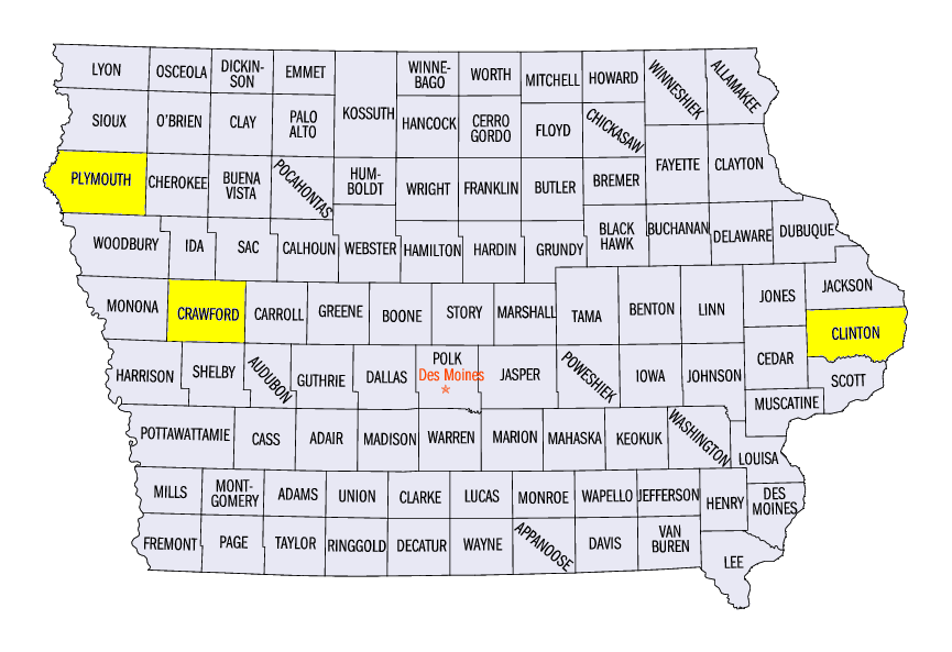
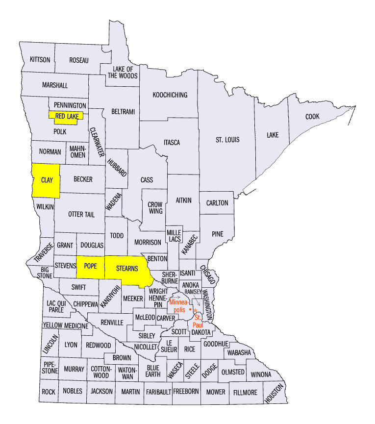
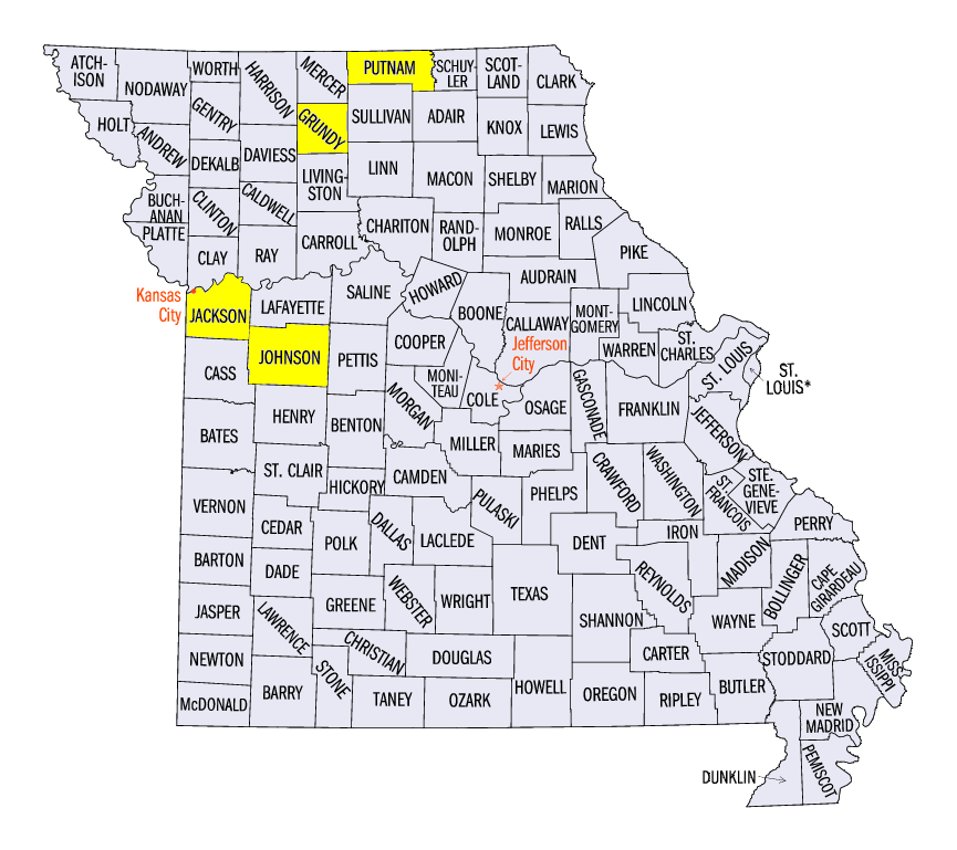
(Figure 7). A few storms caused wind and hail damage on May 23 and 24, including a tornado in Marquette County, MI. On May 25, widespread strong thunderstorms moved across Iowa, Minnesota and Wisconsin, with some of the strongest winds observed in central Iowa. Wind gusts of 60-75 mph were reported, with a wind gust of 87 mph at the Denison Airport in Crawford County, IA. Two brief tornadoes were also spotted in Pope and Stearns counties in Minnesota. On May 26, storms were further south in western Missouri. Hail up to baseball-size was reported in Jackson County, MO, while tennis ball-size hail was reported near a brief tornado touchdown in Johnson County, MO. May 27 was relatively quiet, but brief tornadoes touched down in Red Lake County, MN, Clay County, MN and Grundy County, MO. An EF-1 tornado also was reported in Fond Du Lac County, WI. A few wind and hail reports were observed on each day from May 28-31 and brief tornadoes were observed in Plymouth County, IA on May 28 and in Putnam County, MO and Clinton County, IA on May 31.
Dry Weather Aiding in Planting
Wet weather in the eastern Midwest had led to corn and soybean planting delays in Indiana, Ohio and Michigan as of the May 22 USDA National Agricultural Statistics Service Crop Progress and Condition update. Corn planting was 15% below the five-year average in both Indiana and Ohio (Figure 8). Ohio was even farther behind with soybeans at 24% behind the five-year average (Figure 9).
However, dry weather during the period helped farmers get into their fields. Indiana, Ohio and Michigan all had more than 5.5 days available for fieldwork for the week ending on May 29 (Figure 10). Michigan and Indiana were near the five-year planting average for corn in the May 29 update, with Ohio not far behind at 7% below average (Figure 11). Soybean planting was also back on schedule throughout the Midwest, except in Kentucky (Figure 12). Emergence of both corn (Figure 13) and soybeans (Figure 14) in Michigan, Indiana and Ohio remained behind the five-year average.
-BJP-