September 1-9, 2017
Midwest Weekly Highlights - September 1-9, 2017
Dry, Except for Kentucky
Dry weather was prevalent across the Midwest during the first week of September
(Figure 1). Little to no precipitation fell across Missouri, Iowa and northern Illinois. Southern Minnesota and southern Illinois also had less than a quarter-inch of rainfall. Most of Indiana and Michigan had below-normal precipitation as well (Figure 2). Wet weather was widespread across Kentucky, however. Most of the state had more than twice the normal amount
(Figure 3). Parts of Central Kentucky had more than five times the normal rainfall. Most of this rainfall came as the remnants of Hurricane Harvey passed through Kentucky on September 1 (Figure 4) and September 2
(Figure 5). More than 30 daily precipitation records were broken in Kentucky during the period (Figure 6).
Record Cold
Temperatures were well below normal for most of the region
(Figure 7). Kentucky, Ohio, Indiana, Michigan, eastern Illinois and eastern Wisconsin were 6-10°F below normal. Missouri, Iowa and most of Minnesota were 2-5°F below normal. Several stations in the U.P. of Michigan and northern Minnesota had their first fall freeze during the period (Figure 8). Hundreds of daily low maximum and low minimum temperature records fell in the region, with records in every Midwest state
(Figure 9). Illinois recorded a combined 94 low maximum and minimum records, while Ohio recorded 65 low maximum records. In Urbana, OH, the maximum temperature of 57°F through the morning of September 3 broke the previous record of 62°F in 1909 (Figure 10).
Labor Day Severe Weather
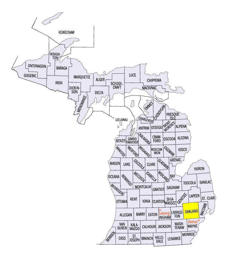
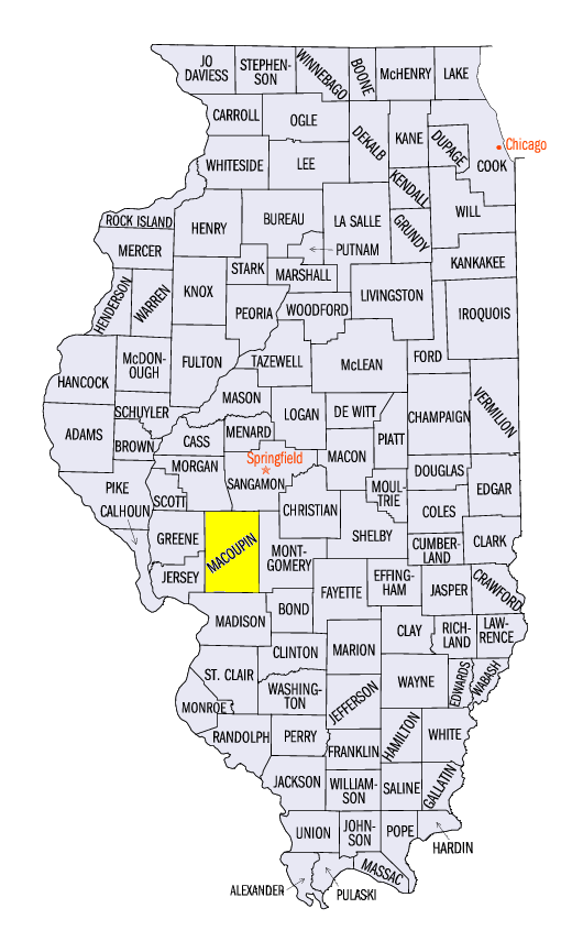
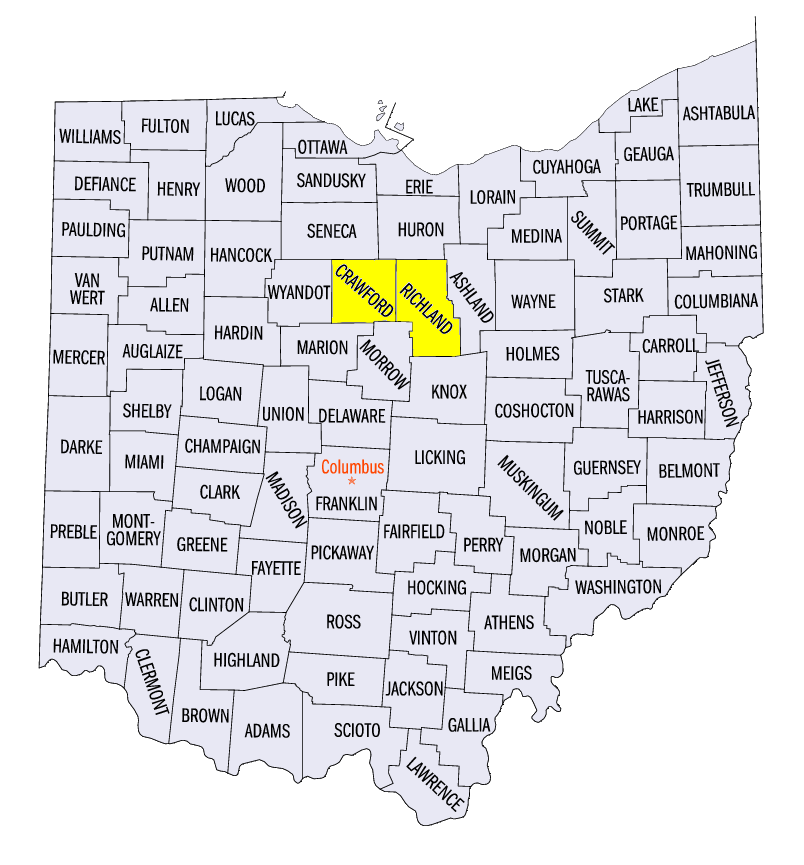
Severe weather during the period was largely limited to Labor Day on September 4
(Figure 11). Strong winds and large hail were reported across Ohio, eastern Lower Michigan, southern Illinois and Minnesota. Two-inch diameter hail was reported near South Lyon, MI (Oakland County) and near Pruett, IL (Macoupin County). A strong and long-lived EF-2 tornado also tracked across Crawford and Richland counties, OH. The tornado was on the ground for nearly 17 miles and packed estimated winds of 130 mph. Two injuries were reported, but thankfully no fatalities.
Tough Growing Season
A cold month of August and cold start to September has added to what has been a tough growing season for crops across the Corn Belt. Extremes that included heavy rainfall during germination, drought in Iowa, Minnesota and Illinois, heat and cold have stressed crops this summer. The colder temperatures in August and early September have led to departures of more than 100 modified growing degree days below normal in the northern Corn Belt since April 1 (Figure 12). As of September 3, Iowa, Missouri, Illinois, Indiana, Michigan and Ohio all had less than 60 percent of the corn crop rated good or excellent
(Figure 13). On top of the issues crops have dealt with during the growing season, the threat of freezing temperatures during the period nearly cut the growing season short across the northern Midwest. A few locations in northern Minnesota and the U.P. of Michigan received their first freeze in late August or early September (Figure 14). However, warmer weather was forecast to delay worries of a near-record early first fall freeze in other areas.
-BJP-