August 15-21, 2017
Midwest Weekly Highlights - August 15-21, 2017
Wet to the West
Much needed precipitation fell across western portions of the Midwest, including drought-affected areas in western Iowa
(Figure 1). More than an inch of precipitation fell across most of Minnesota, northern Wisconsin, the U.P. of Michigan, western Iowa and Missouri, with areas in southwestern Minnesota and western Iowa receiving more than three inches. In many cases, this was more than twice the normal amount (Figure 2). More than 100 daily precipitation records were broken during the period (Figure 3). Many of these records occurred through the morning of August 17 in Minnesota and Missouri (Figure 4). Relatively dry conditions were common across central Illinois and Indiana, however. Less than a quarter inch of rain fell in most of these areas.
Warm to the East, Cool in Minnesota
Temperatures were warmer than normal across the eastern half of the Midwest during the period (Figure 5). Most of Lower Michigan and Kentucky were 1-3°F above normal while Indiana and Ohio were 2-4°F above normal. Eastern and southern Illinois were also 1-2°F above normal. Two dozen daily high minimum temperature records were broken, with many occurring in Kentucky and Ohio (Figure 6). Meanwhile, most of southern and western Minnesota were cooler than normal during the period. Areas in southwestern Minnesota were 2-3°F below normal.
August 21 Total Solar Eclipse
The first total solar eclipse viewable in the United States since 1979 traversed across several Midwest states during the early afternoon of August 21 (Figure 7). This was also the first time since 1925 that a total solar eclipse was visible in the nine-state Midwest region (Figure 8). The path of the eclipse totality in the Midwest stretched from Kansas City, MO through Paducah, KY. Nearly all areas of the Midwest experienced at least an 80 percent eclipse, with the entire Continental U.S. seeing at least a 50 percent eclipse.
Viewing in the path of totality was largely unobscured during the event (Figure 9, preliminary, non-operational GOES-16 data). While fair weather cumulus clouds began to form in southern Illinois and Missouri an hour before the maximum eclipse, less solar radiation from the transit of the eclipse decreased instability in the atmosphere and kept sky conditions clear. However, storms associated with a frontal boundary obscured the view of the partial eclipse in northern Missouri, Iowa, northern Illinois, and Minnesota (Figure 10). Storms also began to fire at the moment of maximum eclipse along an outflow boundary in southern Illinois and western Indiana from leftover morning thunderstorms in western Illinois.
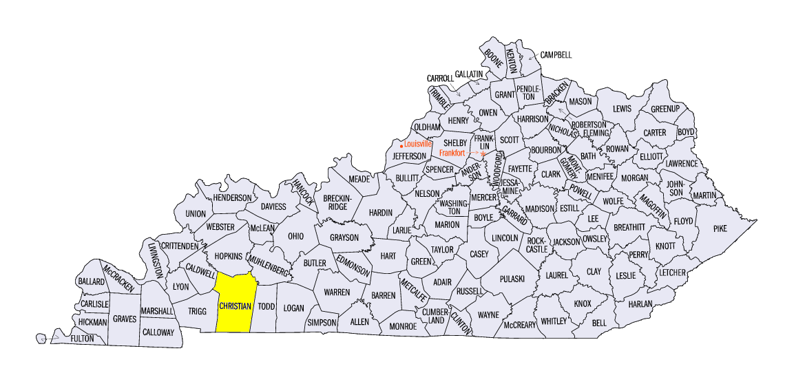
Temperature drops of 2-6°F were observed in the path of totality and in surrounding areas during the eclipse. Several mesonet stations in the Midwest were also in the path of totality and recorded the precipitous decline of solar radiation during the event. One of these stations was the Kentucky Mesonet station near Hopkinsville, KY (Figure 11, Christian County). The Illinois Climate Network also had several stations in the path of totality that measured temperature and solar radiation frequently during the eclipse (Figure 12).
While this spectacle was considered by many as a once in a lifetime event, another total solar eclipse will traverse parts of the Midwest in 2024 (Figure 13). The path of totality will stretch from southern Missouri, through southern Illinois, Indiana and northern Ohio during the afternoon of April 8, 2024.
August 16-18 Tornadoes
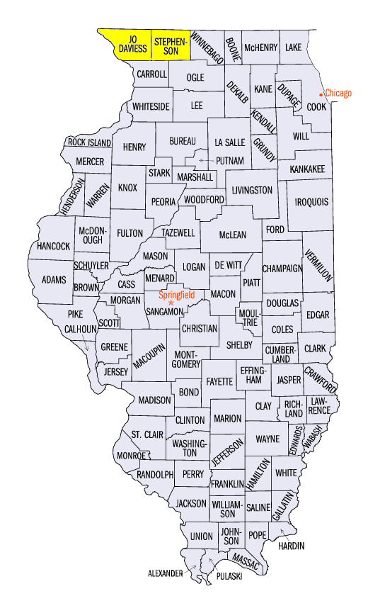
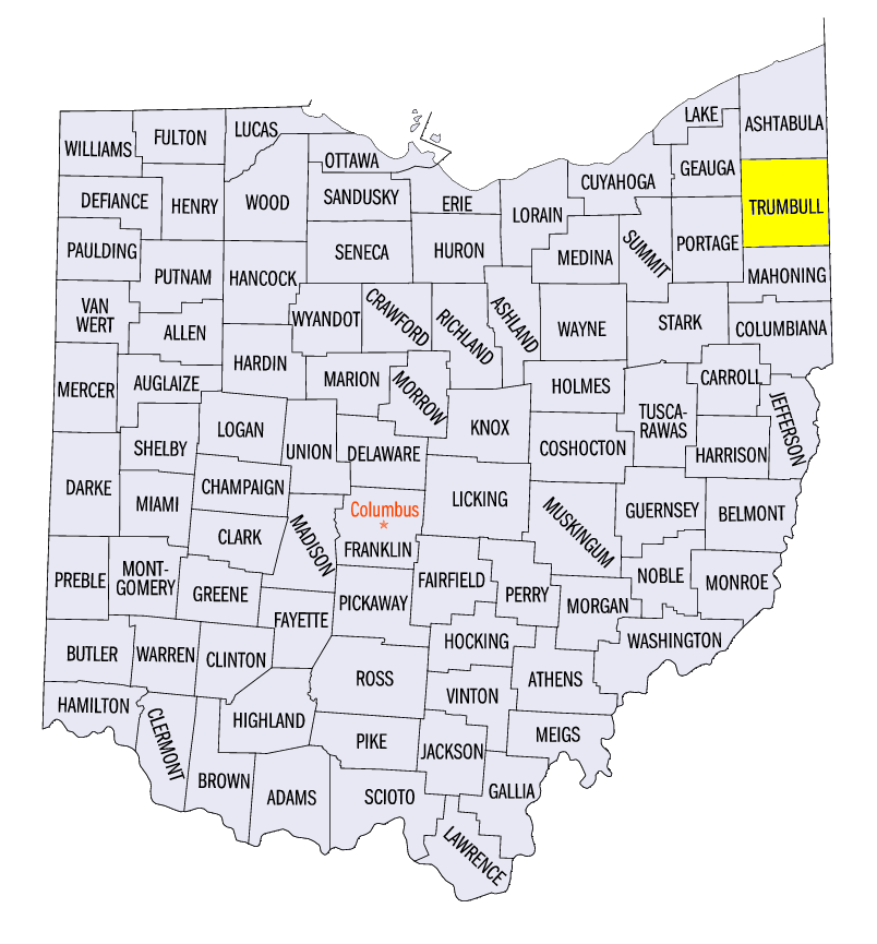
More than a dozen weak tornadoes were observed in parts of the Midwest on August 16-18 (Figure 14). Ten separate tornadoes touched down in south-central Minnesota on August 16. Only one of these tornadoes was rated EF-1, while the remaining nine were rated EF-0. Seven of these were on the ground for less than a mile. No injuries were reported. Several weak EF-0 and EF-1 tornadoes were also reported on August 16 in Stephenson and Jo Daviess counties, IL. On August 17, tornadoes were reported in northeastern Lower Michigan, as well as an EF-1 tornado in Trumbull County, OH.
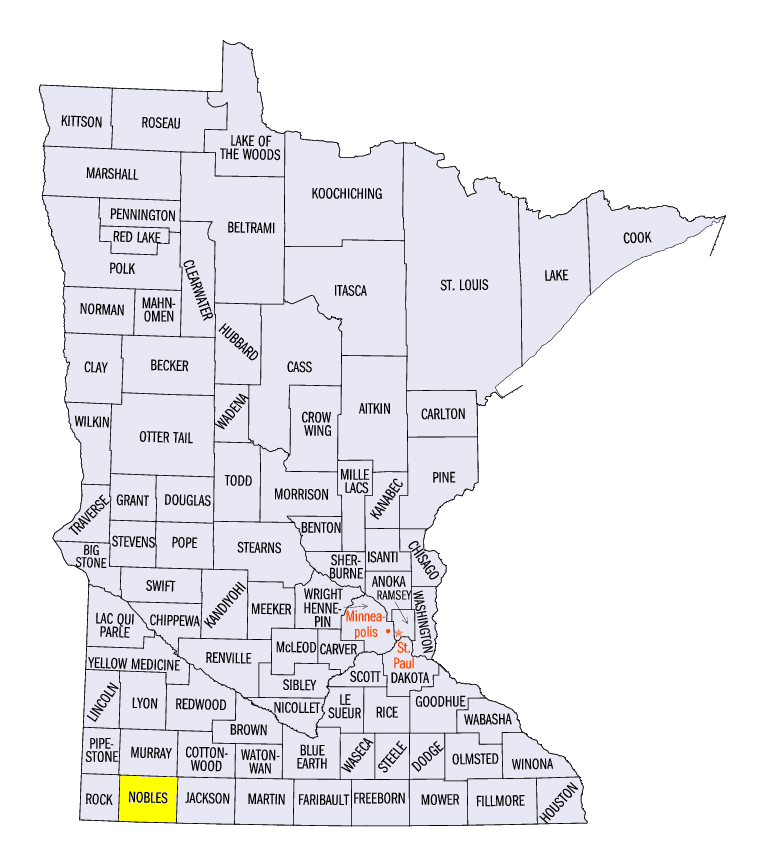
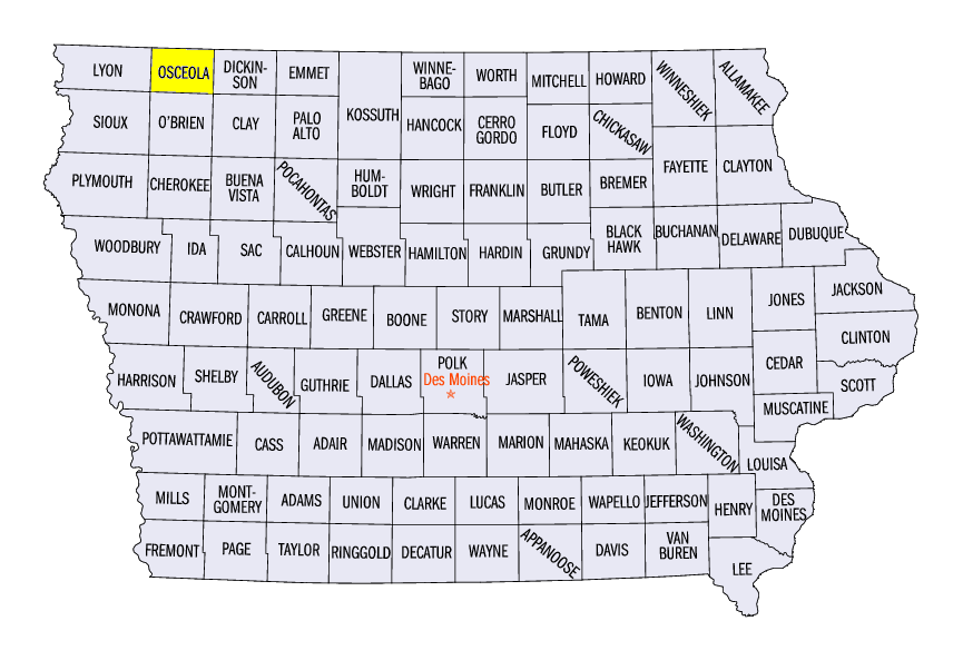
A supercell thunderstorm in southwestern Minnesota on August 18 produced four separate tornadoes along a path from Rushmore, MN (Nobles County) through Melvin, IA (Osceola County). Three of the tornadoes from the supercell were rated EF-1, with the final tornado in the sequence rated EF-2. Damage to crops were reported along the path of the tornadoes, and more than 20 hogs were killed near Rushmore, MN (Nobles County). Several homes and farms were destroyed as well. Fortunately, no injuries were reported. Hail and wind damage was also reported from the supercell, including a two-inch diameter hail stone near Bigelow, MN (Nobles County).
Extreme Drought Added to South-Central Iowa
Rainfall continued to evade Iowa leading up to the release of the August 15 U.S. Drought Monitor, leading to the addition of extreme drought in areas of south-central Iowa (Figure 15). Dryness over the past two to four months was considered a contributor to the degradation of conditions in these areas (Figure 16). Meanwhile, moderate drought remained across northwestern Minnesota, east-central Missouri and a small portion of southwestern Illinois. In addition, abnormally dry conditions were added to west-central Indiana and southern Lower Michigan as well. More than three million people in the Midwest were estimated to be living in drought affected areas.
-BJP-