April 17-23, 2017
Midwest Weekly Highlights - April 17-23, 2017
Some Wet, Some Dry
Precipitation varied across the Midwest during the period
(Figure 1). Some areas were quite wet, including Minnesota, Wisconsin and Michigan to the north, and southern Missouri and Kentucky to the south. Most of these areas received more than double the normal amount of precipitation for the week (Figure 2). Storms occurred on several days across the southern Midwest, with some of the heaviest precipitation through the mornings of April 17
(Figure 3) and April 22 (Figure 4). Precipitation across the Upper Midwest was also spread out across several days, with the majority of the precipitation falling through the morning of April 20
(Figure 5). Across the region, more than 100 daily precipitation records were broken (Figure 6). However, most of Illinois, eastern Iowa, northern Missouri, Indiana and western Ohio were fairly dry. Most of these areas had less than half the normal amount, with parts of Illinois, northern Missouri and eastern Iowa receiving less than a quarter of normal.
Most Remain Warm
Warmer than normal conditions remained across most of the Midwest during the week
(Figure 7). Most of Indiana, Ohio and Kentucky were 3-6°F above normal for the period. Missouri, Iowa, Illinois, and southern parts of Wisconsin and Michigan were also 1-4°F above normal. Several days were quite warm across the southern Midwest, including 80s on April 19 (Figure 8). Several dozen maximum and high minimum temperature records were broken from the warmth that day through the next morning
(Figure 9). Cooler conditions were common across northern Minnesota and the U.P. of Michigan, where temperatures were 1-4°F below normal. Cooler maximum temperatures were the main reason, with areas in the U.P. of Michigan as much as 8°F below normal (Figure 10).
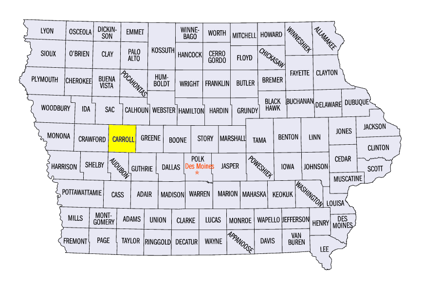
Severe Weather April 19-20
A storm system on April 19-20 brought hail and strong winds to the Upper Midwest and Great Lakes
(Figure 11). Over 50 storm reports were reported on April 19. High winds of 50-60 mph were common across northern Iowa, southeastern Wisconsin and west-central Lower Michigan. Meanwhile, two-inch hail was reported in northeastern Indiana into northwestern Ohio. A tornado was reported near Carroll, IA (Carroll County), with trees down and the doors and roof blown off a machine shed. Several more storm reports were scattered across the region on April 20, with most in Indiana, Michigan and Ohio.
Start of Planting Season
Warmer weather allowed farmers to begin planting across much of the southern Midwest. Freezing conditions have not been an issue in these areas as the last recorded spring freeze was in late March to early April (Figure 12). Soil Temperatures have also reached the 50s, a good temperature range to begin planting corn (Figure 13). According to USDA’s National Agricultural Statistics Service, about a third of corn has been planted in Illinois and Kentucky, with nearly half in Missouri (Figure 14). This was near the five-year average (Figure 15). Planting was further along at this time last year, with Missouri nearly 80 percent planted (Figure 16).
-BJP-