February 8-14, 2017
Midwest Weekly Highlights - February 8-14, 2017
Drier Than Normal for Many
Dry conditions were common across most of the Midwest this week (Figure 1). Only parts of Michigan, far northern Minnesota, Ohio and northern Indiana received more than the normal amount (Figure 2). Meanwhile, most of Iowa, Minnesota, Wisconsin and Missouri had less than two tenths of an inch of precipitation. The lack of precipitation and well-below-normal streamflow in Missouri contriubed to the addition of drought across the eastern half of the state in the February 14 U.S. Drought Monitor (Figure 3).
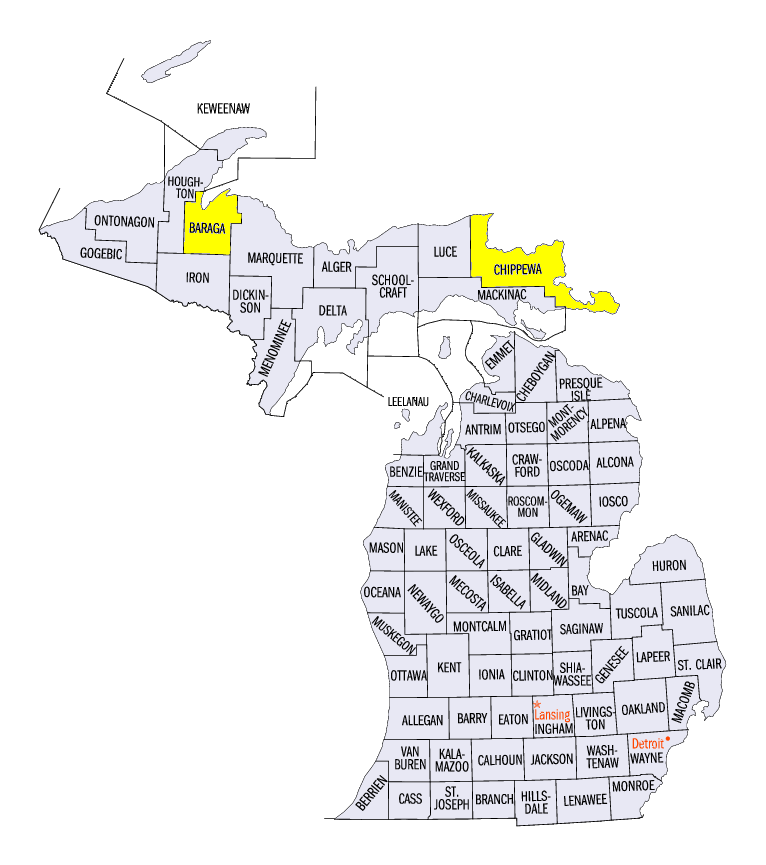
Snowfall during the period was mostly limited to the U.P. of Michigan and central parts of the region (Figure 4). Lake-effect snowfall in the U.P. of Michigan exceeded 8 inches at many stations. Locations with heavy snowfall included 13.2 inches in Herman (Baraga County) and 21.0 inches at the Sault Ste Marie airport (Chippewa County). Central portions of the region received 1-4 inches of snowfall through the mornings of February 8
(Figure 5) and February 9 (Figure 6). Despite the snowfall this week in these areas, the winter season total through February 14 was less than 75 percent the normal amount
(Figure 7).
More Warm Weather
Above-normal temperatures were observed across the entire Midwest this week (Figure 8). Most areas were more than 5°F above normal. Parts of southwestern Minnesota were more than 10°F above normal. Maximum temperatures were even more above normal in most areas
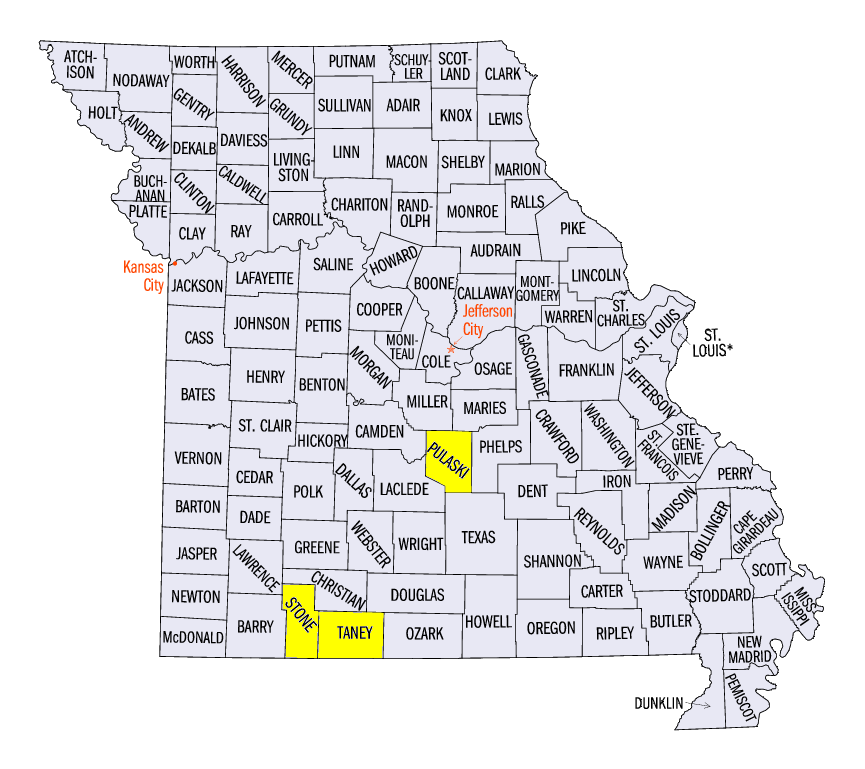
(Figure 9). Nearly 100 daily maximum records were broken during the day on February 11 from temperatures that reached as high as the 80’s in southern Missouri (Figure 10). Some of these record highs included 86°F at Ozark Beach, MO (Taney County), 82°F in Galena, MO (Stone County) and 82°F near Waynesville, MO (Pulaski County). The warmth across the Midwest continued a trend so far in 2017, where the entire region has been above normal since January 1
(Figure 11).
Mild to Moderate AWSSI Winter So Far
The Accumulated Winter Season Severity Index (AWSSI) has most stations across the Midwest in the mild or moderate category through the mid-point of February (Figure 12). A lack of snowfall and above-normal temperatures led to the lower AWSSI scores. Des Moines, IA has had its mildest winter through February 14 on record. Stations in Wisconsin and Michigan were rated in the moderate category as of February 14, with Houghton Lake, MI the only station in the region with an average winter so far.
-BJP-