December 25-31, 2018
Midwest Weekly Highlights - December 25-31, 2018
Warm Weather Remains
Temperatures remained warm across the Midwest for a third consecutive week
(Figure 1). Most of the Ohio River Valley and the Wisconsin, Iowa, Minnesota tri-state area were 6-10°F above normal, with the remainder of the region mostly 3-6°F above normal. Minimum temperatures were the major contributor in the Upper Midwest to the warmth (Figure 2), while maximum temperatures were much warmer in the Ohio River Valley
(Figure 3). More than 50 daily high maximum and minimum temperatures were broken across the region from the warmth (Figure 4). The only areas near to below normal were in northwestern Minnesota, where significant amounts of snow on the ground
(Figure 5) helped keep temperatures cooler.
Wet in the West
Heavy amounts of precipitation fell across the western half of the Midwest in the last week of 2018 (Figure 6). Most of Minnesota, Iowa, Missouri, southern Illinois and Kentucky received more than an inch of liquid equivalent precipitation, with areas in southwestern Missouri receiving more than two inches. Most of this precipitation fell through the mornings of December 27
(Figure 7) and December 28 (Figure 8). Moderate to heavy rain also fell across the southern Midwest through the morning of December 31
(Figure 9). Most of Minnesota and Iowa received four to five times the normal amount, while most of Wisconsin, Illinois and Missouri received two to four times the normal amount (Figure 10). More than 200 daily precipitation records were broken across the region during the week
(Figure 11). Across the Upper Midwest, snowfall was widespread, with the heaviest amounts in northern Minnesota (Figure 12). Light snow covered parts of Iowa, Wisconsin and Michigan.
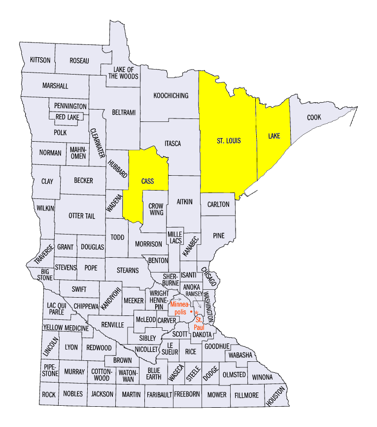
December 26-28 Minnesota Snowstorm
A strong storm system that brought heavy rain to Iowa, Minnesota and Missouri also dumped heavy snow in Minnesota and northern Wisconsin from December 26-28. Light snow began on December 26 and continued into the morning of December 27
(Figure 13). Amounts of 2-4 inches were common across northern Wisconsin, while areas in northern Minnesota had 4-6 inches. Much heavier snow fell across northern Minnesota through the morning of December 28 (Figure 14), where 6-10 inches fell in areas. Storm snowfall totals of over a foot were widespread in northern Minnesota. Some of these values included 24.3 inches in Wolf Ridge (Lake County), 18.9 inches near Island Lake (St. Louis County) and 15.0 inches in Leech Lake (Cass County). Several dozen daily snowfall records were broken during the storm
(Figure 15).
-BJP-