November 8-14, 2018
Midwest Weekly Highlights - November 8-14, 2018
Bitter Cold
Temperatures that were more in line with December than November left the Midwest bitterly cold during the week
(Figure 1). Most of region was 10°F or more below normal, with the exception of eastern Kentucky, eastern Ohio and Michigan. Missouri was exceptionally cold, with more than half of the state 16-18°F below normal. Most of Illinois, Iowa and Minnesota also were 12-16°F below normal. Maximum temperatures were even colder, were some areas in central Missouri 20°F below normal (Figure 2). Maximum temperatures across the remainder of the region were more than 12°F below normal. Daily low temperature records for the full period amounted to more than 550
(Figure 3). More than 250 daily low maximum and minimum temperature records were broken on November 9 through the morning of November 10 alone (Figure 4), where maximum temperatures were in the 30s and 20s
(Figure 5), and minimum temperatures were in the teens to single digits (Figure 6). Widespread cold also continued through the morning of November 11
(Figure 7).
Drier, but Snowy
Most of the Midwest was very dry during the week (Figure 8). Large portions of Illinois, Indiana, Wisconsin and Minnesota had less than a quarter of an inch of precipitation, while most of Iowa had less than a tenth of an inch. This resulted in a majority of the region receiving less than half the normal amount of precipitation (Figure 9). The only areas that received near- to above-normal precipitation were southeastern Kentucky, an the U.P. of Michigan.
With temperatures averaging below freezing across a large area of the Midwest, snowfall was common (Figure 10). Measurable snow fell in all nine states in the region. Moderate snowfall in Missouri was unusual, however. Amounts up to 3 inches fell in northern Missouri through the morning of November 9
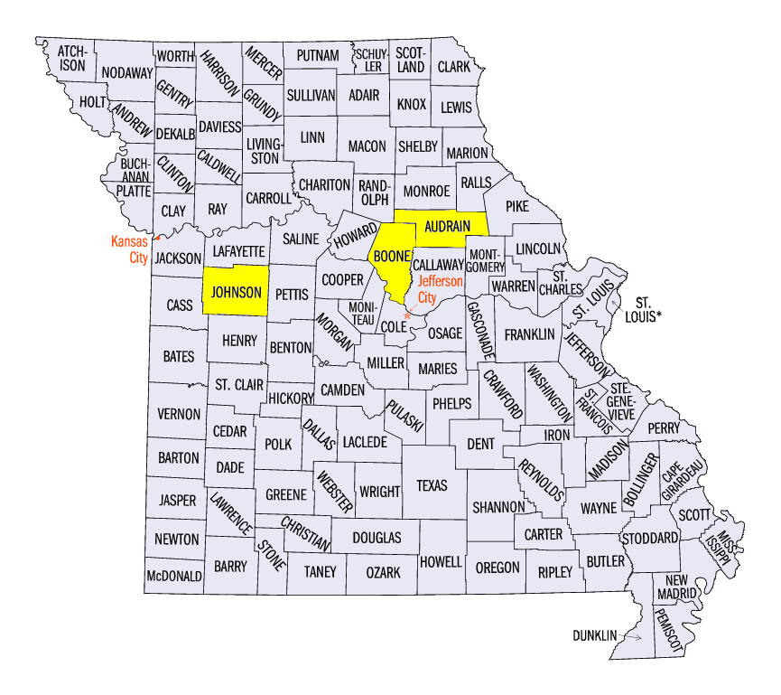
(Figure 11), while more than three inches fell in central and southern Missouri through the morning of November 13 (Figure 12). Weekly amounts in Missouri included 7.0 inches in Vandalia (Audrain County), 6.6 inches in Elm (Johnson County) and 5.6 inches in Columbia (Boone County). The relative rarity of moderate snowfall in the first half of November in the southern Midwest led to more than 200 daily snowfall records, with more than 100 in Missouri alone
(Figure 13).
Michigan Lake-Effect Snowfall
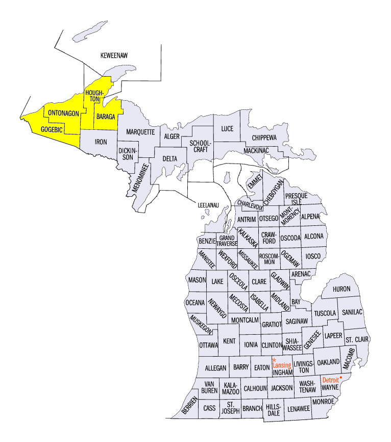
Lake-effect snow was common across the U.P. and northern Lower Michigan, where more than a foot of snow fell in areas (Figure 14). While snow fell on each day during the period in the state, the heaviest amounts fell through the morning of November 10
(Figure 15). Some of the totals through the morning of November 10 included 14.6 inches in Ironwood (Gogebic County), 12.0 inches near Greenland (Ontonagon County) and 12.0 inches near Kearsarge (Houghton County). Heavy amounts were also recorded through the mornings of November 13 (Figure 16) and November 14
(Figure 17). Totals for the week included 26.6 inches at the Bergland Dam (Ontonagon County), 23.6 inches in Ironwood (Gogebic County) and 22.0 inches in Herman (Baraga County).
-BJP-