November 1-7, 2018
Midwest Weekly Highlights - November 1-7, 2018
Cold Days, Warm Nights
Cold maximum temperatures and somewhat warmer than normal minimum temperatures led to slightly below normal average temperatures across most of the region
(Figure 1). Average temperatures were most below normal in southern Missouri, where they were 3-5°F below normal (Figure 2). Maximum temperatures by comparison were 6-8°F below normal in Missouri and parts of western Iowa
(Figure 3). Meanwhile, minimum temperatures were near to above normal across most of the Midwest. The warmest area was in the Ohio River Valley, where most of Kentucky and Ohio were 3-6°F above normal. This led to near-normal average temperatures in these areas.
Heavy Rain in the Ohio River Valley
The Ohio River Valley was doused from two heavy rain events during the week that brought more than three inches of rain to the region (Figure 4). Most of these areas had more than four times the normal amount for the period
(Figure 5). Areas in western Kentucky received more than three inches of precipitation through the morning of November 1 alone (Figure 6). As the storm progressed to the northeast, western Ohio received amounts up to two inches through the morning of November 2
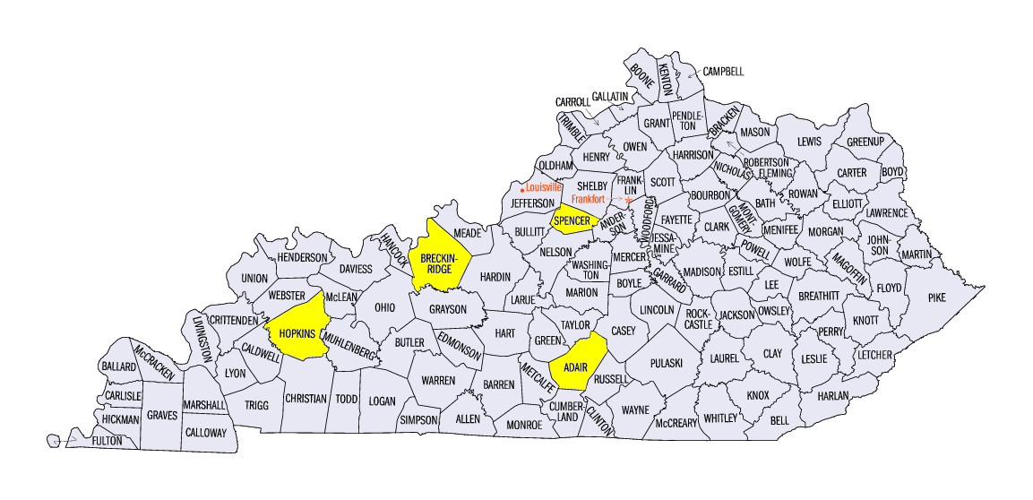
(Figure 7). Another storm through the morning of November 6 brought another two inches of rain to Kentucky, with isolated amounts up to three inches (Figure 8). Weekly totals included 7.62 inches in Madisonville, KY (Hopkins County), 7.04 inches in McDaniels, KY (Breckinridge County) and 6.75 inches at Taylorsville Lake (Spencer County). Many stations in southwestern Ohio also received more than four inches. More than 175 daily precipitation records were broken across the Midwest during the period
(Figure 9).
November 5 Kentucky Tornadoes
Severe weather accompanied heavy rain across Kentucky on November 5 along the northern edge of a storm that caused dozens of tornadoes further south in Tennessee, Mississippi and Alabama (Figure 10). Three separate tornadoes were surveyed. Two of these tornadoes were rated EF-0. The third near Columbia, KY (Adair County) was rated EF-1 with estimated peak winds of 100-105 mph. This tornado snapped power lines, damaged outbuildings and tossed a 1,500 pound roll of hay over a fence according to the National Weather Service survey. All three of these tornadoes occurred well after sunset. Fortunately, no injuries were reported.
Harvest Moves Forward
Mixed conditions for harvesting during the week led to progress in some areas, while the Ohio River Valley’s progress stalled. Most Midwest states were near the five-year average according to the November 4 NASS Crop Progress Reports, with the only major delays coming from soybean harvests in Missouri, Iowa and Wisconsin. Wisconsin and Michigan were the only states in the region with less than 60 percent of the corn harvest completed, while remaining states were 70 percent or more completed.
-BJP-