August 1-7, 2018
Midwest Weekly Highlights - August 1-7, 2018
Mix of Hot and Cool
Temperatures varied across the region during the week
(Figure 1). Most of Lower Michigan, Ohio, northern Indiana, southern Iowa and northern Missouri were 1-4°F above normal. Meanwhile northern Iowa, Minnesota, western Wisconsin and the U.P. of Michigan were 1-4°F below normal. Maximum temperatures during one of the warmer days on August 6 were in the 80s and 90s across most of the region (Figure 2). Several dozen daily high maximum and minimum temperature records were broken as a result
(Figure 3). Meanwhile, maximum temperatures on August 1-2 were only in the upper 50s to low 60s in Minnesota and cooler across the region, leading to several dozen daily low maximum temperature records (Figure 4).
Scattered Thunderstorms
Rain fell across most of the Midwest during the week as afternoon scattered thunderstorms formed
(Figure 5). Two of the wettest days in the period were through the morning of August 1 in the eastern half of the region (Figure 6), and through the morning of August 6 in northern Iowa
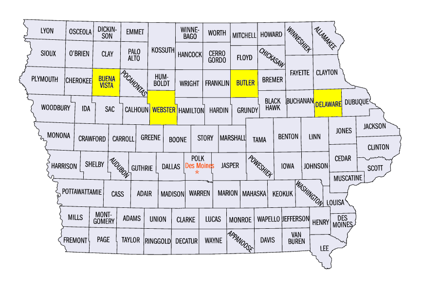
(Figure 7). Several inches of rain fell in many of these areas. Some of the heaviest amounts for the period were in Iowa, with 6.35 inches near Fort Dodge (Webster County), 5.58 inches in Allison (Butler County) and 5.38 inches in Manchester (Delaware County). Nearly 100 daily precipitation records were broken during the period (Figure 8). Meanwhile, most of Missouri, southern Iowa, northern Illinois and northern Minnesota were much drier. Many of these areas had less than half the normal amount, while areas in southwestern Missouri had less than a quarter of normal
(Figure 9).
Missouri Drought Continues to Worsen
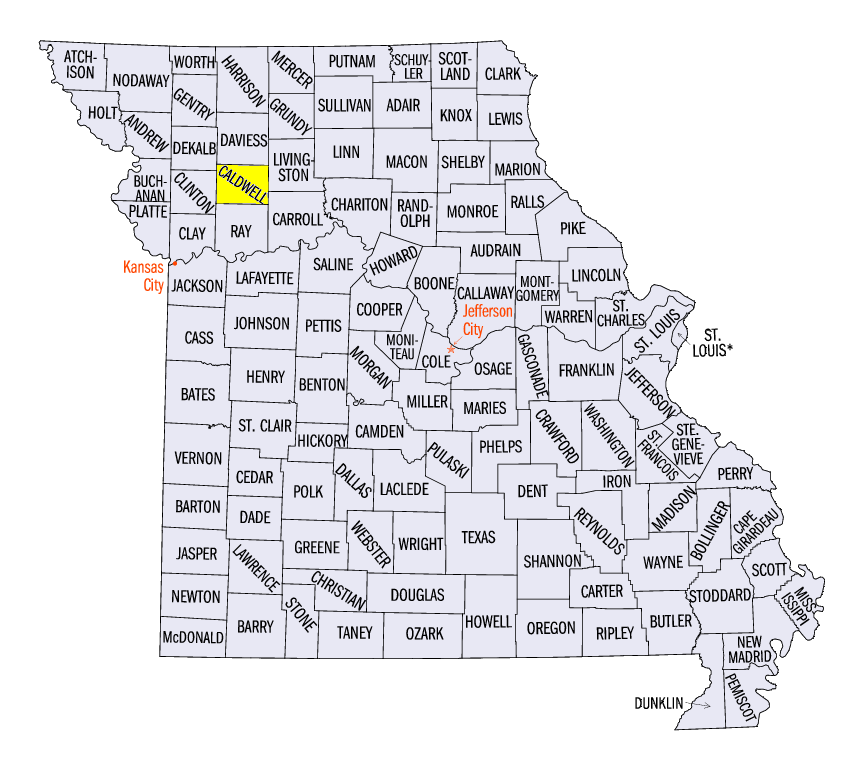
Another week of dry weather in Missouri led to the continued expansion of drought across the state in the August 7 U.S. Drought Monitor (Figure 10). Drought covered nearly 80 percent of the state, while only a few counties in east-central Missouri were not at least abnormally dry (Figure 11). Conditions worsened the most in southern Missouri. Severe drought expanded eastward in southwestern Missouri while areas in the Bootheel were downgraded to severe drought. In northern Missouri, slight improvement was seen in eastern Carrol and Livingston counties, while Exceptional Drought, the highest drought category, was introduced in Caldwell County, MO. This was the first time that Exceptional Drought was classified in the Midwest since a small part of extreme western Iowa was in Exceptional Drought on April 2, 2013 (Figure 12).
Meanwhile, Moderate Drought slightly decreased in several areas in Michigan, while moving farther west in northern Lower Michigan
(Figure 13). Most of southern and eastern Lower Michigan received above-normal rainfall during the past week, while areas in northwestern Lower Michigan were much drier. Abnormally dry conditions expanded in northern Minnesota as well, with Moderate Drought introduced into several counties.
Isolated Severe Weather and Tornadoes
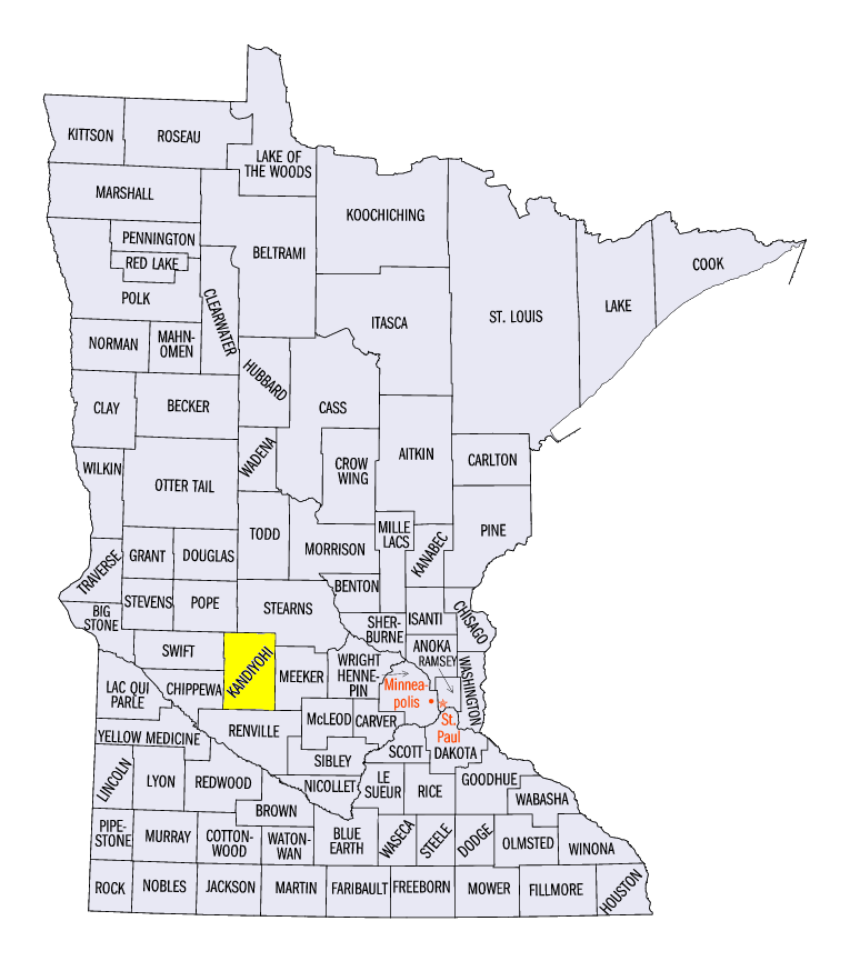
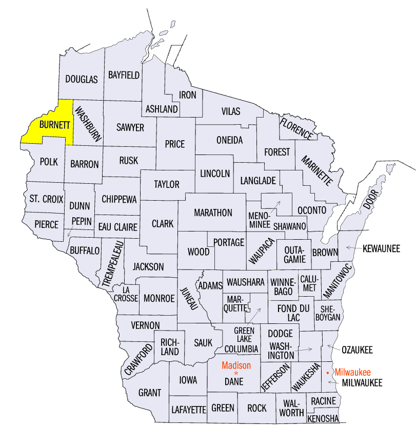
Strong thunderstorm winds, hail or tornadoes were reported on each day during the period (Figure 14). Several small tornadoes were reported, including an EF-0 near Atwater, MN (Kandiyohi County) on August 3, and a weak landspout near Randall, WI (Burnett County) on August 6. Strong wind reports included a 76 mph wind gust reported at the Cincinnati Municipal Airport, and an 80 mph wind gust in Rembrandt, IA (Buena Vista County) on August 4. Widespread wind reports from northwestern Missouri through northern Ohio also occurred on August 6
(Figure 15).
-BJP-