June 24-30, 2018
Midwest Weekly Highlights - June 24-30, 2018
Hot and Humid
Most of the Midwest remained hot during the final week of June
(Figure 1). Only a few areas around the Great Lakes and in southern Illinois were near normal. Northwestern Minnesota, western Missouri and northern Wisconsin were the warmest areas at 3-6°F above normal. Most of the region was 1-3°F above normal. Humid conditions overnight kept minimum temperatures warmer, as most areas were 2-5°F above normal (Figure 2). Many of the more than 125 daily temperature records broken during the period were from record high minimum temperatures on June 29
(Figure 3) and June 30 (Figure 4). Maximum dew point temperatures on June 29
(Figure 5) and June 30 (Figure 6) reached into the 70s across many of these areas. Maximum temperatures on those days were in the 90s
(Figure 7) (Figure 8). Heat Index values neared 110°F. These factors led to the issuance of an Excessive Heat Warning across parts of Minneosta, Iowa, Missouri, Illinois, Indiana and Lower Michigan
(Figure 9). Heat advisories were also issued in many surrounding areas, and these warnings and advisories continued into July 1.
Thunderstorms Across Southern Midwest
Persistent thunderstorms led to 2-4 inches of precipitation in the southern Midwest for the week (Figure 10). This was more than twice the normal amount for most of these areas, with isolated areas receiving more than four times the normal amount
(Figure 11). Most of this precipitation fell through the mornings of June 25 (Figure 12), June 26
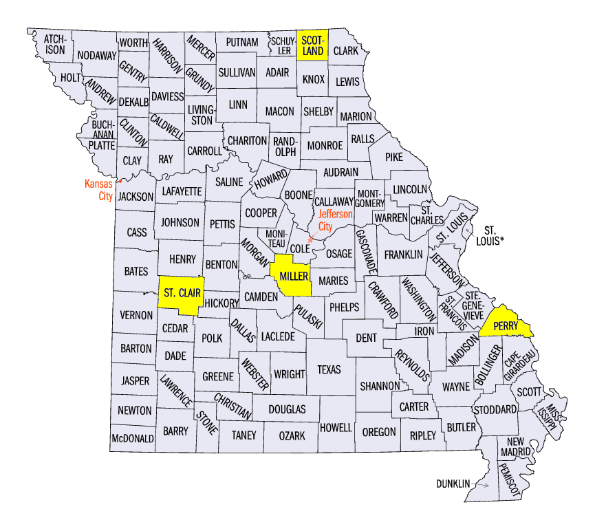
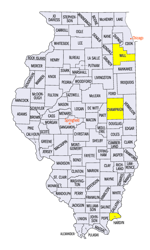
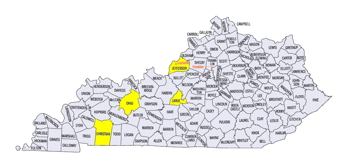
(Figure 13) and June 27 (Figure 14). Totals for the full week included 9.45 inches in Eldon, MO (Miller County), 9.42 inches near Rosiclare, IL (Hardin County) and 6.00 inches in Hodgenville, KY (Larue County). Several dozen daily precipitation records were broken from the precipitation
(Figure 15). Meanwhile, most of Wisconsin, central Illinois, northern Missouri, northern Indiana and Michigan were drier than normal. Very few changes were made to the June 26 U.S. Drought Monitor (Figure 16), with exception to the introduction of moderate drought in several southwestern Missouri counties.
Widespread High Winds and Isolated Tornadoes
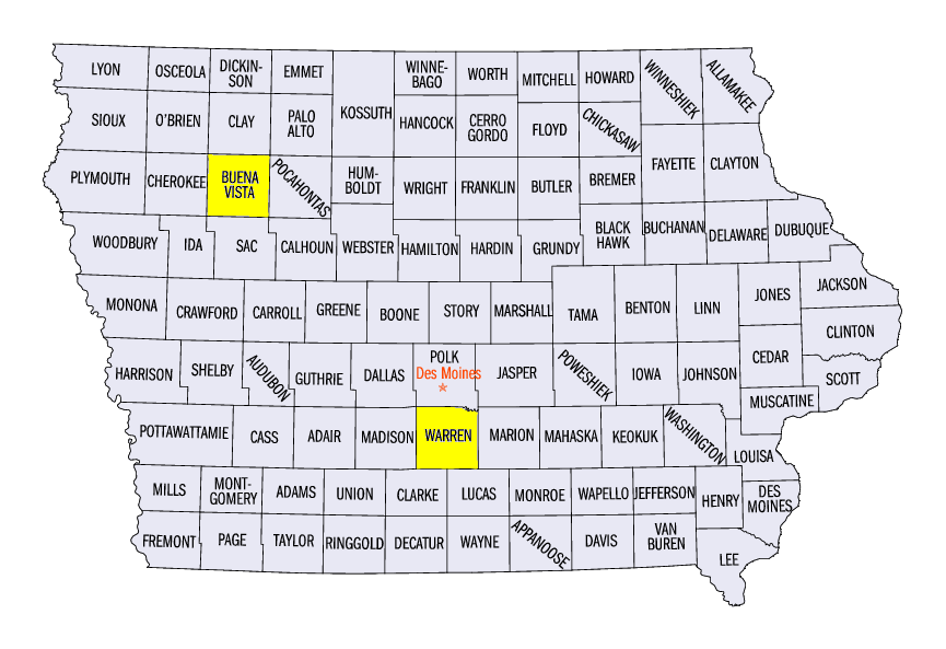
Severe weather was active during the final week of June (Figure 17). There were nearly 700 combined severe weather reports of wind, tornadoes and hail across the Midwest. More than 500 of these reports were for high winds. Many of these high wind reports occurred on June 26 in the southern Midwest (Figure 18) and on June 28 in Minnesota and in Iowa through the mid-Mississippi River Valley (Figure 19). Several of the reported gusts were over 80 mph on June 28. An 88 mph wind gust was measured at a college weather station near Indianola, IA (Warren County) while an 85 mph wind gust was estimated in Norwalk, IA (Warren County). An 80 mph gust was also reported near Hopkinsville, KY (Christian County). Two injuries were reported in Missouri from winds, as a person was hit by an awning in Perrysville (Perry County) and a woman was hit by a falling tree near Memphis (Scotland County).
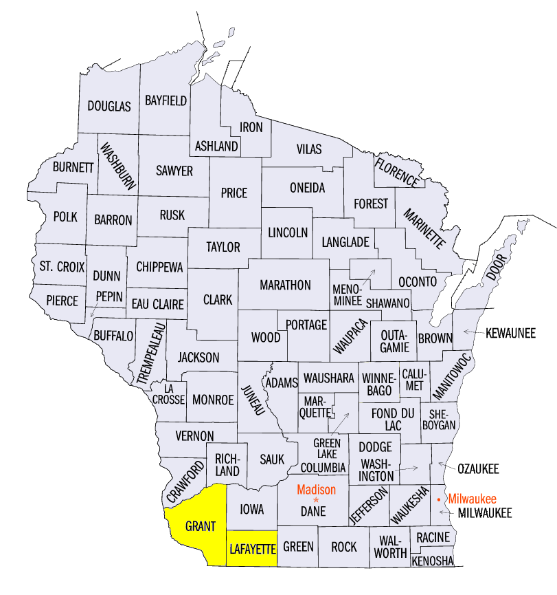
At least one tornado was reported on five of the seven days in the period. Most of these were weak tornadoes rated either EF-0 or EF-1. These included EF-1 tornadoes near McHenry, KY (Ohio County) on June 25, and near Kewee, KY (Jefferson County) and near Osceola, MO (St. Clair County) on June 26. Many more tornadoes spawned on June 26 in Illinois, Kentucky and Wisconsin. Several tornadoes in Grant and Lafayette counties in Wisconsin were reported to cause crop and tree damage, while EF-1 tornadoes were surveyed near Rantoul, IL (Champaign County) and near Manhattan, IL (Will County).
Western Iowa and Mississippi River Flooding
Recovery from flooding that began on June 20-21 in western Iowa was slow during the last week of June (Figure 20). Gauges along the Little Sioux River and the Big Sioux River remained in major flood stage throughout most of the week. The Little Sioux River at Linn Grove, IA (Buena Vista County) had a new record flood stage (Figure 21).
Meanwhile, minor flooding increased along the Mississippi River during the period. Areas in eastern Iowa had received more than three inches of precipitation since June 20 (Figure 22). Moderate flooding was observed at many gauges along the river in southeastern Iowa near the end of the period. Minor flooding also became more prevalent along the river in northern Missouri.
-BJP-