June 10-16, 2018
Midwest Weekly Highlights - June 10-16, 2018
Continued Warm Weather
Temperatures were above normal across most of the Midwest during the period
(Figure 1). Only a few areas near the Great Lakes were near normal. Missouri was the hottest at 5-8°F above normal. Most of Wisconsin, Illinois, Iowa, Minnesota and Kentucky were 1-4°F above normal. More than 100 daily high maximum and minimum temperature records occurred during the period (Figure 2). Most of these occurred through the morning of June 16 in Iowa, Minnesota and Missouri, where minimum temperatures were in the upper 60s and 70s (Figure 3).
Training Thunderstorms
Clusters and lines of thunderstorms that persistently reformed over the same areas brought heavy precipitation to most of Iowa, Illinois, southern Indiana and parts of Ohio, Wisconsin and Minnesota
(Figure 4). Many of these areas had one and a half to two times the normal amount for the period
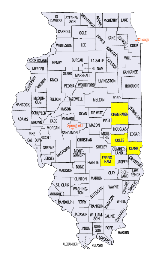
(Figure 5). The wettest of these areas was in east-central Illinois, where more than five inches of rain fell. Some of the heaviest amounts included 7.88 inches in Beecher City (Effingham County), 7.35 inches in Mattoon (Coles County) and 7.17 inches in Casey (Clark County). More than 100 daily precipitation records were broken (Figure 6). Meanwhile, Most of Lower Michigan and Missouri were very dry. Areas in northern Lower Michigan had less than half the normal amount of precipitation, while most of Missouri had less than three-quarters.
June 9-12 Iowa, Illinois and Indiana Flash Flooding
Training thunderstorms led to heavy rain over short periods of time in eastern Iowa, east-central Illinois and southern Indiana on June 9-12
(Figure 7). Storms dumped heavy rain on June 9th through the morning of June 10 in Iowa and northern Illinois (Figure 8). This led to minor flooding in northeastern Iowa
(Figure 9) and soaked soils in northern Illinois. Amounts of 3-5 inches fell across central Illinois and western Indiana through the morning of June 11 (Figure 10). Rain continued to fall in southern Illinois and Indiana through the morning of June 12
(Figure 11). Minor flooding was recorded along the Wabash River and other rivers near the Illinois/Indiana border (Figure 12).
Scattered Severe Weather
Strong winds and hail were reported across the Midwest during the week
(Figure 13). More than 200 wind reports and 75 hail reports were reported, with at least one report on each day in the period. A line of thunderstorms led to wind damage across east-central Illinois on June 10 (Figure 14). Trees and power lines were toppled while two brief EF-0 tornadoes were surveyed along the line in Champaign, IL (Champaign County). Severe thunderstorms caused damage along the western borders of Missouri and Iowa on June 11
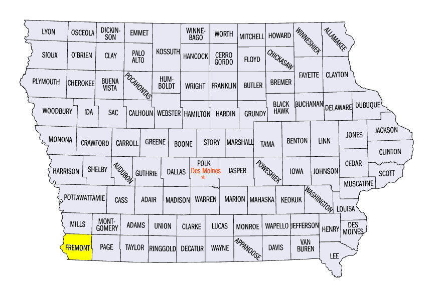
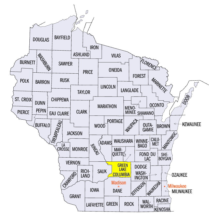
(Figure 15). An 88 mph wind gust was reported near Therman, IA (Fremont County) while a 76 mph wind gust was reported by a wind turbine near Tarkio, MO (Atchison County). Scattered wind and hail reports continued during the remainder of the period, with many occurring in eastern Missouri on June 14 (Figure 16). A brief EF-0 tornado also occurred near Poynette, WI (Columbia County) on June 16.
Severe Drought Expands in Missouri and Iowa
Dry conditions across Missouri and southern Iowa contributed to the addition of a second area of severe drought in southeastern Iowa and northeastern Missouri in the June 12 U.S. Drought Monitor
(Figure 17). Above-normal temperatures, low streamflow and soil moisture deficits were also contributing factors. Meanwhile, a small pocket of moderate drought was introduced into west-central Minnesota as well. Heavy rain in central Illinois and Indiana reduced abnormally dry conditions. Overall, approximately one-fourth of the Midwest was considered either abnormally dry or in drought.
-BJP-