June 1-9, 2018
Midwest Weekly Highlights - June 1-9, 2018
Hot, Except in the Great Lakes
Temperatures were above normal across most of the southern and central Midwest during the week
(Figure 1). Southern Minnesota, Iowa, western Illinois and northern Missouri were the hottest at 5-8°F above normal. The Ohio River Valley was also 1-4°F above normal. Dozens of daily high temperature records were tied or broken across Iowa and Missouri during the period (Figure 2). Meanwhile, temperatures were near normal across most of Lower Michigan and eastern Wisconsin. Cooler than normal temperatures were observed in the Arrowhead of Minnesota and the U.P. of Michigan, where temperatures were as much as 5° below normal.
Scattered Thunderstorms
Pockets of wet and dry areas were common in the Midwest as scattered thunderstorms dropped more than an inch on some areas
(Figure 3). Areas in northern and western Iowa, northern Minnesota and central Kentucky had more than 1.50 inches of rain during the period. Meanwhile, western Missouri, central Illinois and northern Lower Michigan mainly had less than half an inch. These drier areas received less than half the normal amount of precipitation (Figure 4).
Strong Winds and Hail
Severe thunderstorms remained active during the first week of June across the Midwest (Figure 5). At least one storm report occurred on each day during the period, and nearly 300 in total were reported. Most of these occurred on June 6 and June 9.
On June 6, thunderstorms brought strong winds and damaging hail to Iowa. A two inch hailstone was reported in Traer, IA (Tama County) while a 76 mph wind gust was observed at a home weather station near Napier, IA (Boone County). Tree limbs and power lines were felled throughout the state.
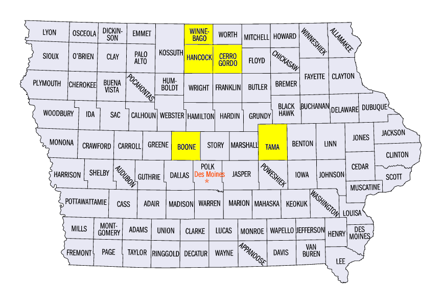
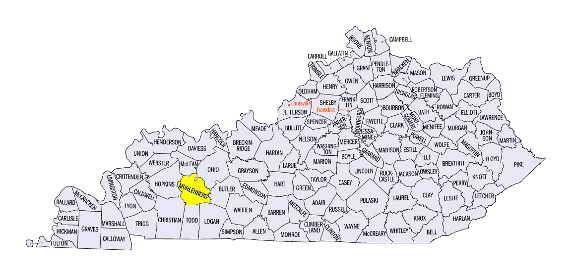
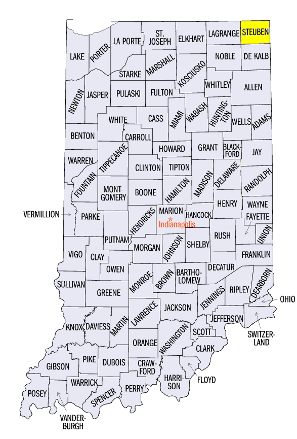
On June 9, strong thunderstorms were scattered from eastern Iowa, through the Ohio River Valley. Strong winds brought down trees and power lines in these areas. A tree fell on a mobile home near Central City, KY (Muhlenberg County), injuring two. Hail as large as 2.50 inches was also reported near Leland, IA (Winnebago County). Weak tornadoes were also reported in Hancock and Cerro Gordo counties, IA and Steuben County, IN, with the strongest an EF-1 near Angola, IN.
Abnormally Dry Conditions in Illinois
A record warm month of May combined with drier conditions contributed to the addition of abnormally dry conditions across nearly 40 percent of Illinois and a portion of Indiana in the June 5 U.S. Drought Monitor (Figure 6). Decreased soil moisture was evident as farmers reported curling of corn leaves in these areas. However, significant amounts of rainfall occurred in these areas after June 5, which could mitigate flash drought risk. Moderate to severe drought increased slightly in southern Iowa and northern Missouri. These areas remain the only areas in the Midwest affected by drought, and account for less than four percent of the region. In Minnesota, precipitation in the northern half the state helped decrease abnormally dry conditions by over 20 percent.
-BJP-