May 8-14, 2018
Midwest Weekly Highlights - May 8-14, 2018
Narrow Band of Precipitation
Moderate to heavy rain fell on an isolated stretch across the central Midwest this week
(Figure 1). Northern Iowa, southern Minnesota, southern Wisconsin and southern Lower Michigan were the only areas with more than an inch of precipitation. Most of these areas had more than twice the normal amount (Figure 2). Below normal precipitation was common through the rest of the Midwest, however. Little to no precipitation fell across southern Missouri and the Ohio River Valley.
Sharp Temperature Divide
An incredibly sharp divide between well above normal temperatures in the southern Midwest and below normal temperatures in northern Iowa and southern Minnesota
(Figure 3). Most of Missouri, southern Illinois, southern Indiana, southern Ohio and Kentucky were 7-12°F above normal. Meanwhile northern Iowa and southern Minnesota were 1-2°F below normal. Maximum temperatures were a major factor, as most of the southern Midwest was 9-12°F above normal, with 3-6°F below normal in northern Iowa and southern Minnesota (Figure 4). Precipitation and cloud cover played a major role in keeping maximum temperatures low across the Upper Midwest. The most prominent differences in maximum temperature were seen through the mornings of May 12
(Figure 5) and May 13 (Figure 6). Maximum temperatures struggled to reach the 50s in northern Iowa, southern Minnesota, Wisconsin and Michigan. Meanwhile, temperatures were in the upper 80s across the southern third of the region. Several hundred daily high maximum and minimum temperature records were broken across the region
(Figure 7), while several dozen daily low maximum and minimum records were also recorded (Figure 8).
Severe Weather
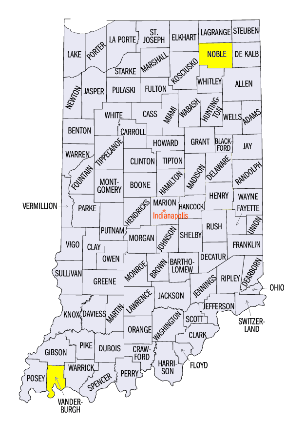
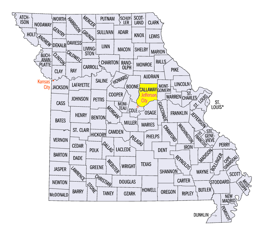
Severe weather was widespread across the Midwest as more than 200 reports of wind, hail and tornado damage occurred during the week
(Figure 9). On May 9, two EF-0 tornadoes were reported in southern Wisconsin, while strong winds caused damage in Illinois, northern Indiana and southwestern Lower Michigan. Two-inch hail was reported with a storm on May 10 in Evansville, IN (Vanderburgh County) along with wind damage. Several isolated reports of hail and wind occurred on May 11-13 in the region, with most of these on May 13 in southern Ohio. A strong line of thunderstorms on May 14 led to widespread wind damage in eastern Missouri and west-central Illinois. Hail as large as 2.5 inches was reported near Bloomfield, MO (Callaway County). A National Weather Service survey also showed that a microburst caused major damage to outbuildings near Ligonier, IN (Noble County).
Planting Accelerates in Southern Midwest
A warm and fairly dry first few weeks of May allowed many farmers in the southern Midwest to plant fields (Figure 10). As of the week ending May 13, Missouri and Illinois corn were more than 90 percent planted. Indiana was also at 73 percent planted, which was 21 percent above the five year average. While Iowa, Michigan and Kentucky were near average, Wisconsin and Minnesota continue to lag behind. Minnesota’s 40 percent corn planted was 25 percent behind the five year average.
-BJP-