March 8-14, 2018
Midwest Weekly Highlights - March 8-14, 2018
Colder
Temperatures dipped below normal during the second week of March across the Midwest
(Figure 1). The Ohio River Valley was the most below normal at 3-5°F below normal. The remainder of the region was mostly 1-4°F below normal. A few areas of near-normal temperatures were in western Iowa, northern Minnesota and the U.P. of Michigan. The only area with above normal temperatures was the eastern U.P. of Michigan.
Very Dry
Little to no precipitation fell across a majority of the Midwest this week (Figure 2). Only a few isolated areas in Kentucky, Lower Michigan and northeastern Ohio had more than the normal amount
(Figure 3). Most of Minnesota, Iowa, Missouri, Illinois, Indiana, Ohio and Wisconsin had less than half the normal amount (Figure 4). However, moderate amounts of lake-effect snowfall fell in Michigan and northeastern Ohio, while heavy snowfall fell across Kentucky
(Figure 5).
Kentucky Winter Storm March 11-12
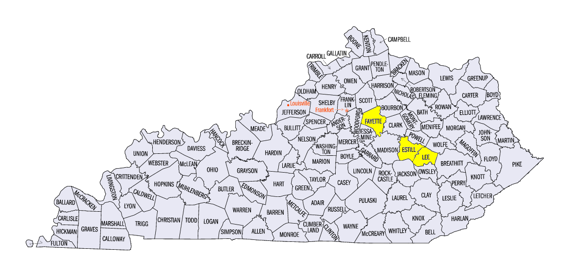
A strong snowfall event also occurred in Kentucky on March 11 through the morning of March 12 (Figure 6). Amounts in the one to three inch range were common, with areas in central Kentucky receiving more than six inches. Areas in eastern Kentucky received more snowfall through the morning of March 14 as well
(Figure 7). Some of the heaviest totals for the week included 9.8 inches at the Lexington Bluegrass Airport (Fayette County), 8.3 inches in Cressy (Estill County), and 7.4 inches near Beattyville (Lee County). Most of Kentucky typically receives less than two inches of snowfall in the month of March (Figure 8). More than a dozen daily snowfall records were broken across the state from the event
(Figure 9).
-BJP-