November 1-9, 2019
Midwest Weekly Highlights - November 1-9, 2019
Bitter Chill
Temperatures were much colder than normal across the entire Midwest during the period
(Figure 1). Large areas of Iowa, Minnesota, Wisconsin, Illinois, Indiana Kentucky and Michigan were 8-11°F below normal. Some areas in Wisconsin were more than 12°F below normal. While minimum temperatures were only near freezing in the first half of the period, Arctic air moved into the region through the mornings of November 7 (Figure 2), November 8
(Figure 3) and November 9 (Figure 4). Minimum temperatures in the single digits were common across Minnesota, Iowa and Wisconsin, with a few areas in the single digits below zero. Maximum temperatures also were very cold. This resulted in more than 400 daily low maximum and minimum temperature records across the region
(Figure 5).
Mostly Dry
Precipitation amounts across the Midwest were minimal except for areas in southern Missouri, eastern Ohio, northern Lower Michigan and parts of Kentucky (Figure 6). Most of northern Missouri had no precipitation for the period. Illinois, northern Wisconsin, central Illinois and southern Iowa all had less than a quarter the normal amount
(Figure 7). Meanwhile, heavy rain fell in extreme southern Missouri. Amounts over two inches were recorded, which was more than three times the normal amount.
Upper Midwest Snow
Snow fell throughout the period in the Upper Midwest from both lake-effects and a storm system (Figure 8). A system that moved through southern Minnesota, Wisconsin and Michigan through the mornings of November 6
(Figure 9) and November 7 (Figure 10) led to 3-5 inches in some areas. Light to moderate snow was also observed through the morning of November 1 in northern Illinois and southeastern Wisconsin
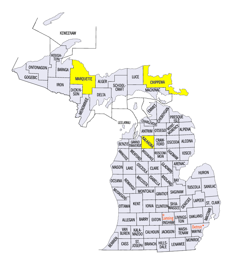
(Figure 11). Lake-effect snow in Michigan led to more than a foot of snow in some areas. Some of the heaviest snowfall in Michigan included 26.1 inches in Paradise (Chippewa County), 18.9 inches in Kalkaska (Kalkaska County) and 16.0 inches near Big Bay (Marquette County).
Drought Area Decreased
While most of the Midwest was drier than normal, precipitation in Kentucky, Indiana and Ohio led to a large reduction of drought coverage in the November 5 U.S. Drought Monitor (Figure 12). Only a small portion of southeastern Kentucky remained in drought, decreasing coverage across the region to less than half of one percent. Abnormally dry conditions also decreased to less than four percent of the region.
-BJP-