October 22-31, 2019
Midwest Weekly Highlights - October 22-31, 2019
Winter Chill
Temperatures were well below normal cross the western half of the Midwest during the period
(Figure 1). Values 8-10°F below normal were common across southern Minnesota, Iowa, northern Missouri and western Wisconsin. Cold temperatures were common from the start of the period in the Upper Midwest, with an Arctic blast at the end of the period. Temperatures were in the 20s and lower 30s across the western half of the region on the morning of October 31 (Figure 2), with some areas in the lower teens in southwestern Minnesota. Maximum temperatures were even further below normal
(Figure 3), with areas in Missouri and western Iowa 11-13°F below normal. More than 240 daily low maximum temperature records were broken across the region as a result (Figure 4). Meanwhile, eastern areas of the region were near to above normal for the period. Eastern Ohio and eastern Kentucky were 2-4°F above normal.
Above-Normal Precipitation
Several systems led to moderate to heavy rainfall across a large portion of the Midwest
(Figure 5). Amounts over 3 inches were common in Illinois, Indiana, western Kentucky and extreme southeastern Missouri. Locally heavier amounts over four inches were also recorded. This translated to between two and four times the normal amount of precipitation for the period (Figure 6). Moderate to heavy rainfall in the Ohio River Valley aided in a decrease of drought in the October 29 U.S. Drought Monitor
(Figure 7). The only significantly drier area in the region was southern Iowa and northwestern Missouri, with some areas receiving less than a quarter the normal amount.
Record October Snowfall
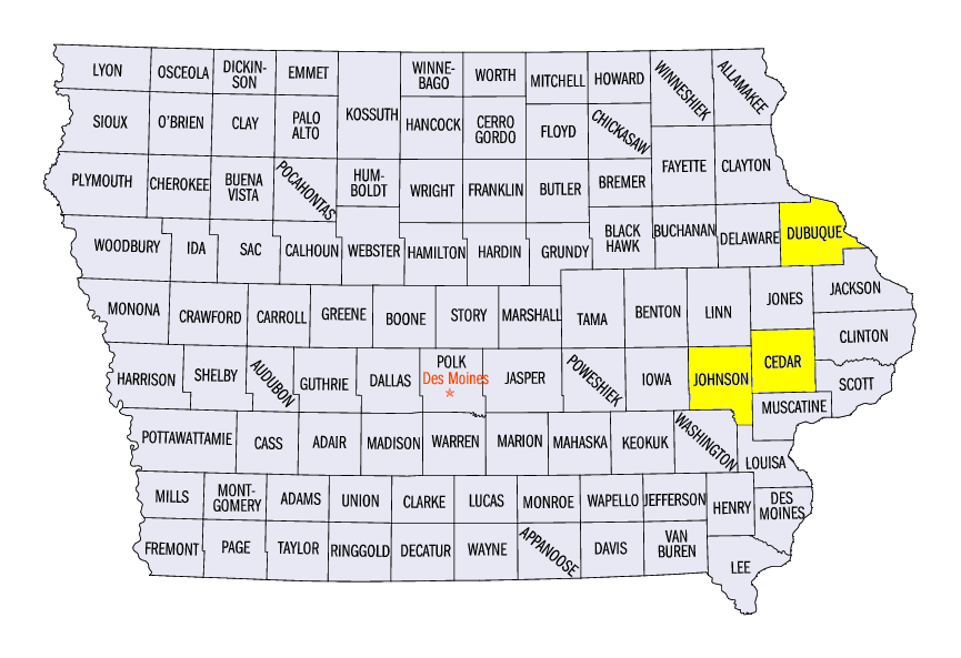
Unseasonably cold temperatures in the western half of the region led to record-breaking snowfall for some areas from October 28 through the morning of November 1 (Figure 8). Amounts of 2-4 inches were common from eastern Iowa through southern Wisconsin. Locally heavier amounts over 8 inches were also reported. Some of the heaviest totals included 11.1 inches in Middleton, WI (Dane County), 10.5 inches in Lowden, IA (Cedar County) and 10.2 inches in Broadhead, WI (Green County). The heaviest amounts fell through the mornings of October 29 (Figure 9) and October 31 (Figure 10).
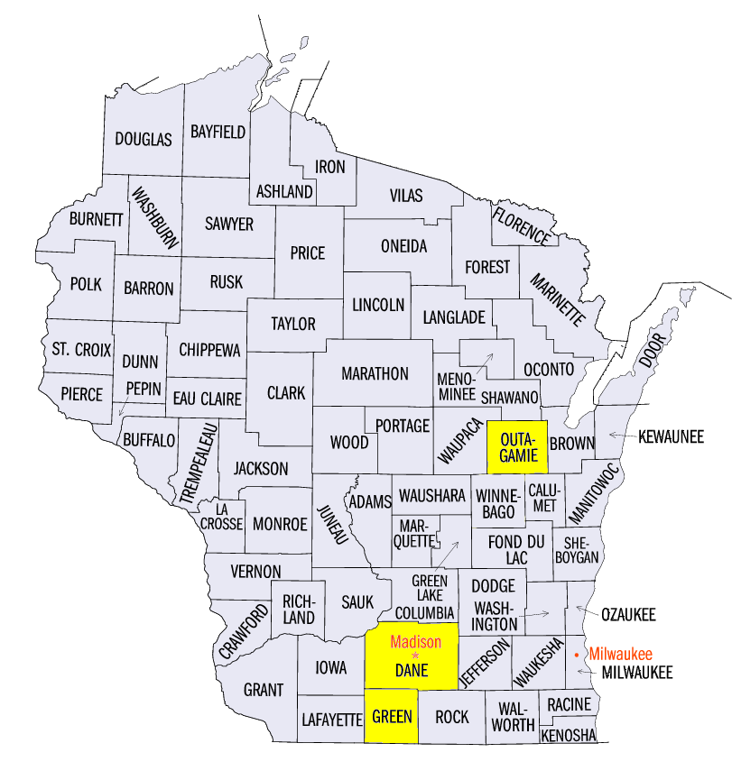
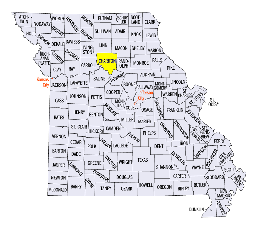
The heavy snowfall over this period led to monthly records for the month of October at more than 30 stations. Some of these cities included Madison, WI (Dane County), Appleton, WI (Outagamie County), Dubuque, IA (Dubuque County), Iowa City, IA (Johnson County) and Salisbury, MO (Chariton County).
Harvest Remains Behind
Wetter weather made harvest progress difficult as every state except Kentucky was behind according to USDA NASS Crop Progress Reports for October 27. Corn progress was more than 20 percent below the five-year average in Wisconsin, Iowa, Illinois and Missouri, and more than 30 percent below in Minnesota
(Figure 11). Michigan, Indiana and Ohio were all more than 15 percent behind. Progress was slightly closer to average for soybeans across the Ohio River Valley, with Indiana and Ohio less than 10 percent behind the five-year average (Figure 12). Wisconsin was 27 percent behind, while Minnesota was 31 percent behind. Sugarbeets in Minnesota were also 35 percent behind the five-year average, while Michigan was 10 percent behind
(Figure 13).
-BJP-