September 2019
Monthly Overview - September 2019
Extremes in Precipitation
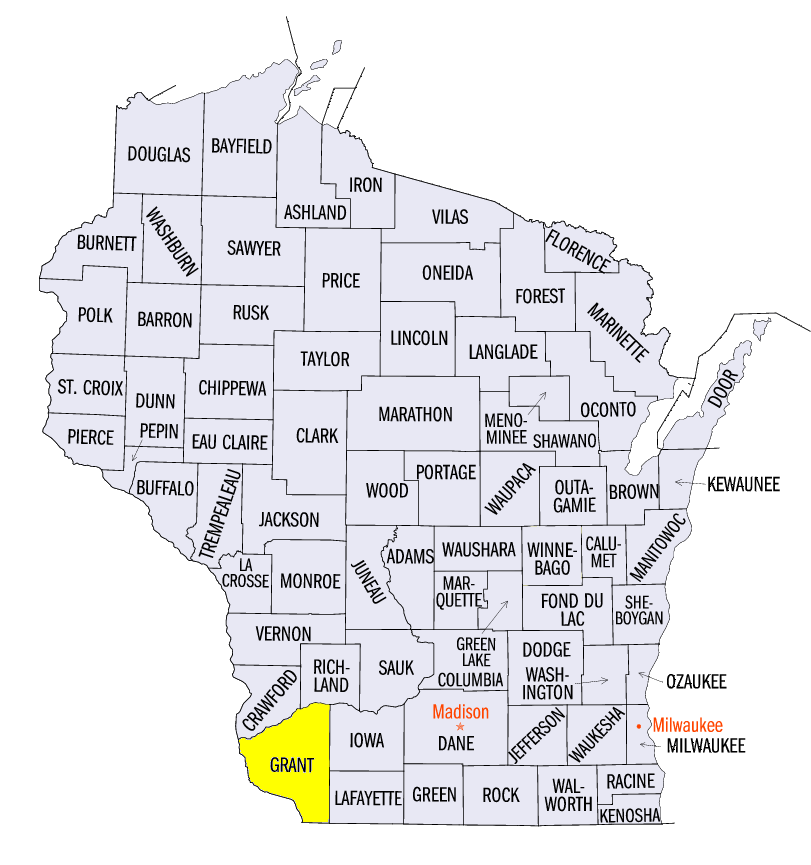
Precipitation was divided from north to south across the Midwest in September
(Figure 1), with some areas record wet and others record dry. Regionwide precipitation was 4.39 inches which was 0.95 inches above normal. Most of the Upper Midwest received 150-200 percent of normal, while areas in the Ohio River Valley had less than 25 percent (Figure 2). Extremely wet conditions were observed in Wisconsin, eastern Iowa and northern Illinois. More than 30 stations in Minnesota, Wisconsin, Iowa and Illinois broke their precipitation record for September. The Green Bay, WI Area (134 years on record) was one of these records. The Green Bay, WI Area had already recorded their January-December record (133 years on record) with three months left in the calendar year. In Lancaster, WI (Grant Conuty), 18.62 inches fell in September, which broke the previous record by more than 6 inches (118 years on record). Nearly 450 daily precipitation records were broken as well across the region
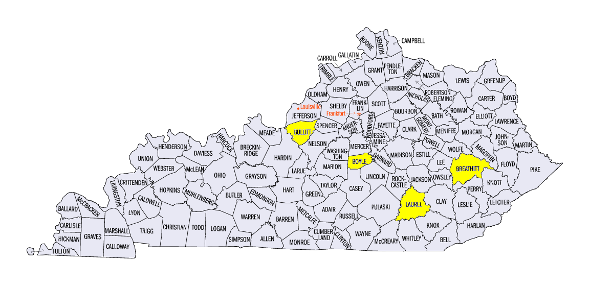
(Figure 3). Meanwhile, record low precipitation fell across parts of the Ohio River Valley. Statewide, Kentucky had its driest September on record (1895-2019) with just 0.23 inches. More than 25 stations in the Ohio River Valley recorded their driest September on record. Seven stations in Kentucky recorded no precipitation for the entire month, including Jackson (Breathitt County), Lexington, Shepherdsville (Bullitt County) and Danville (Boyle County). Other notable low precipitation records included the Evansville, IN Area (123 years on record), the Louisville, KY Area (148 years on record) and London, KY (Laurel County) (62 years on record).
Summer-Like Temperatures
September felt closer to summer than fall across the Midwest, as temperatures were warmer than normal across almost the entire region (Figure 4). Average temperature for the Midwest was 67.7°F which was 4.8°F above normal. This was the 2nd warmest September on record (1895-2019) for the region. Every state except Minnesota and Wisconsin ranked among the 10 warmest Septembers on record (1895-2019), with Illinois, Indiana, Kentucky, Missouri and Ohio ranking among the 5 warmest. Ohio’s temperature of 69.9°F was the warmest on record, breaking its previous record from 2018. Nearly 100 stations broke their average temperature record for September. Some of these cities included Akron, OH (129 years on record), Dayton, OH (126 years on record), Springfield, MO (132 years on record), St. Louis, MO (145 years on record), Indianapolis, IN (149 years on record), Lexington, KY (135 years on record) and Louisville, KY (148 years on record). More than 120 high average minimum temperature records were also broken across the region for the month, along with nearly 50 high average maximum temperature records. More than 1,000 daily high temperature records were broken in the Midwest
(Figure 5), with more than 700 of them from high minimum temperatures.
Drought Develops in Kentucky
Exceptionally dry conditions in Kentucky led to moderate and severe drought in September according to the U.S. Drought Monitor (Figure 6). Record low precipitation quickly dried soils while near-record heat increased evaporation. More than half the state was in drought as of September 24, with more than 90 percent of the state in drought by the end of the month
(Figure 7). Meanwhile, drought and abnormally dry conditions across the Upper Midwest decreased significantly with heavy rainfall in September. All of Minnesota, Iowa and Wisconsin were free of abnormally dry conditions by end of September, while only a few counties in Michigan were affected by drought.
Severe Weather
Heavy precipitation in the Upper Midwest often brought severe weather, leading to more than 500 reports of thunderstorm wind damage, hail and tornadoes across the Midwest (Figure 8). An EF-3 tornado was reported near Elk Mound, WI on September 24, destroying several structures and injuring two people. More than a dozen other small tornadoes were reported across the region during the month. Strong winds were reported across Michigan on September 11
(Figure 9), with gusts over 70 mph reported. The National Weather Service surveyed a storm near Grand Rapids, MI and found evidence of wind speeds up to 100 mph.
Slow Start to Harvest Season
While warmer temperatures were welcomed by farmers who were forced to plant late this spring, the harvest season remained well behind across the Midwest. Corn maturity was more than 30 percent behind the five-year average in every Midwest state except Kentucky and Missouri according to USDA NASS Crop Progress Reports for September 29 (Figure 10). Minnesota and Illinois were 45 and 46 percent behind respectively. Soybeans were also significantly behind
(Figure 11). As of September 22, Illinois soybeans dropping leaves were 42 percent behind the five-year average, with Iowa, Indiana and Ohio more than 30 percent behind. Warmer weather fortunately also meant that first freezes were not recorded across most of the region (Figure 12), allowing the growing season to continue.
-BJP-