July 22-31, 2019
Midwest Weekly Highlights - July 22-31, 2019
Cooling Off
After a hot few weeks in mid-July, temperatures finally cooled across the region
(Figure 1). Average temperatures were 1-3°F below normal across most of Minnesota, Iowa, Missouri, Illinois, Indiana and Kentucky. Most of Wisconsin, Michigan and Ohio were near normal, with a few areas in the U.P. of Michigan above normal. Maximum temperatures only averaged in the low 80s and upper 70s across most of the region (Figure 2) with minimum temperatures reaching the lower 50s and 40s in the upper Midwest through the morning of July 31
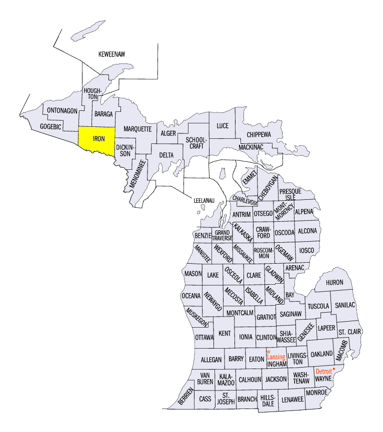
(Figure 3). A temperature of 34°F was recorded near Amasa, MI (Iron County) with several other readings in the upper 30s in the U.P. of Michigan and northern Wisconsin. In total, more than 70 daily low temperature records were recorded (Figure 4).
Fairly Dry
Precipitation amounts were generally low across most of the Midwest during the period
(Figure 5). Only the southern third of the region and parts of central and northeastern Minnesota received more than an inch of rain. As a result, these were the only major areas with above-normal precipitation (Figure 6). Meanwhile, most if Iowa, Wisconsin and northern Illinois had less than half the normal amount, with southeastern Iowa, northwestern Illinois, southeastern Wisconsin and northwestern Minnesota receiving less than a quarter of normal.
Abnormally Dry Conditions Expand
Continued dry weather across parts of Iowa, Illinois and Indiana led to the expansion of abnormally dry conditions in the July 30 U.S. Drought Monitor
(Figure 7). Expansion also occurred in the western U.P. of Michigan. More than 8 percent of the region was considered abnormally dry. July has been particularly dry across the largest area of abnormally dry conditions in eastern Iowa and northwestern Illinois, with less than half the normal amount of precipitation (Figure 8). Soil compaction from heavy spring rains along with excessive heat in the previous weeks stressed cash crops in these areas, causing further concern for agriculture. Despite the increase in abnormally dry conditions, the Midwest remained drought free for a seventh consecutive month to start 2019. The 31-consecutive drought-free weeks more than doubled the previous record length of 14 consecutive weeks since the start of the U.S Drought Monitor in January 2000.
Limited Severe Weather
Severe weather was sparse across the region, with most reports coming from eastern Minnesota and northern Wisconsin
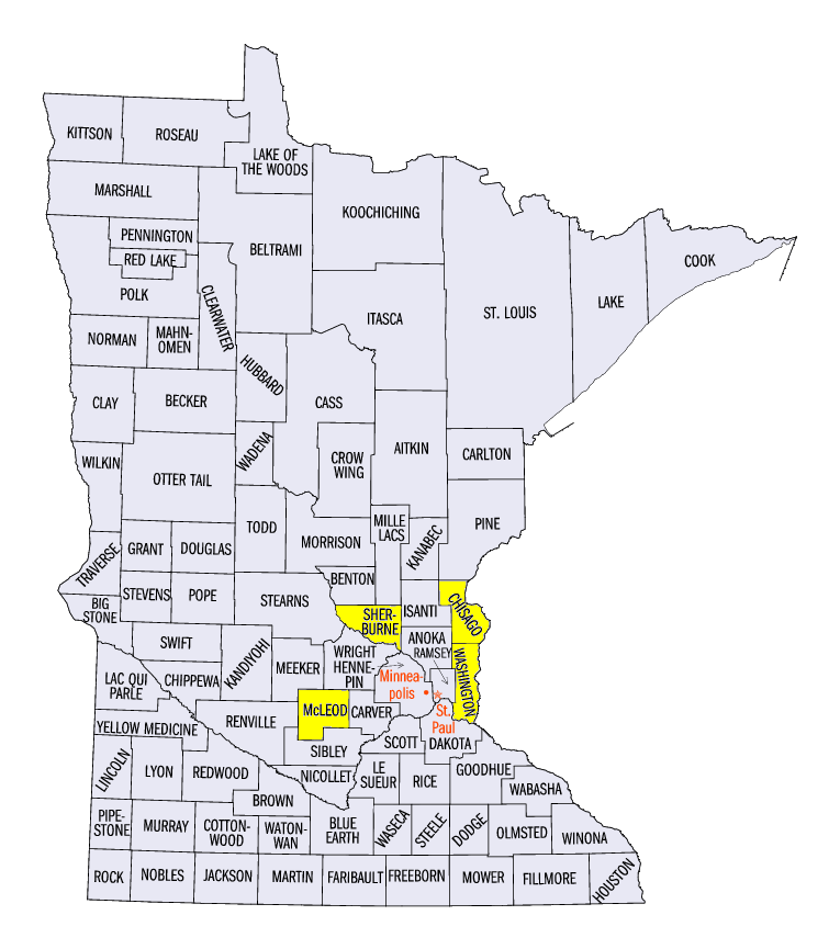
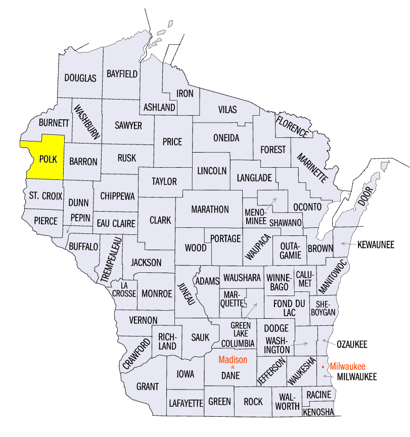
(Figure 9). Hail diameters of 1-3 inches were reported in Minnesota on July 26. A 4-inch diameter hail report came near Clear Lake, MN (Sherberne County), which is softball sized. Several tornadoes were also reported on July 28 in Minnesota and Wisconsin. Three EF-1 tornadoes were reported near Silver Lake, MN (McLeod County), Forest Lake/Scandia, MN (Washington and Chisago counties) and Luck, WI (Polk County). Several other EF-0 tornadoes touched down in these areas as well.
-BJP-