February 22-28, 2019
Midwest Weekly Highlights - February 22-28, 2019
More Cold
Temperatures remained cold across a majority of the Midwest during the last week of February
(Figure 1). Most of Iowa, Wisconsin and Minnesota were 10°F or more below normal. Parts of western Iowa and Minnesota were up to 20°F below normal. Maximum temperatures were a major contributor to the cold, as parts of western Iowa were more than 20°F below normal (Figure 2). Most of the more than 180 daily temperature records were from daily low maximum temperatures
(Figure 3). Southeast of the extreme cold, temperatures were gradually warmer. Lower Michigan was only 2-5°F below normal. Most of the Ohio River Valley was near to 5°F above normal.
Wet and Snowy
Precipitation amounts were high across the Upper Midwest and Kentucky during the period as storms rolled through (Figure 4). Liquid amounts of over an inch were recorded in parts of Iowa, Wisconsin and the U.P. of Michigan, while more than two inches was recorded in southern Kentucky. This was more than double the normal amount in most of these areas
(Figure 5). Parts of northern Iowa, southeastern Minnesota, northern Wisconsin and the U.P. of Michigan had four to five times the normal amount from heavy snowfall in these areas (Figure 6). More than 150 daily precipitation
(Figure 7) and 100 daily snowfall (Figure 8) records were broken during the period.
February 23-25 Winter Storm
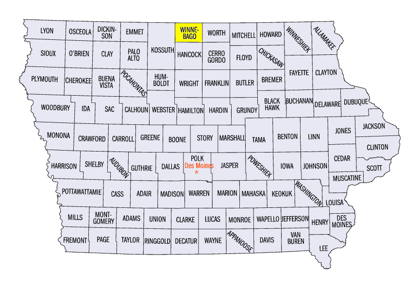
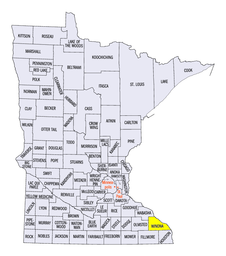
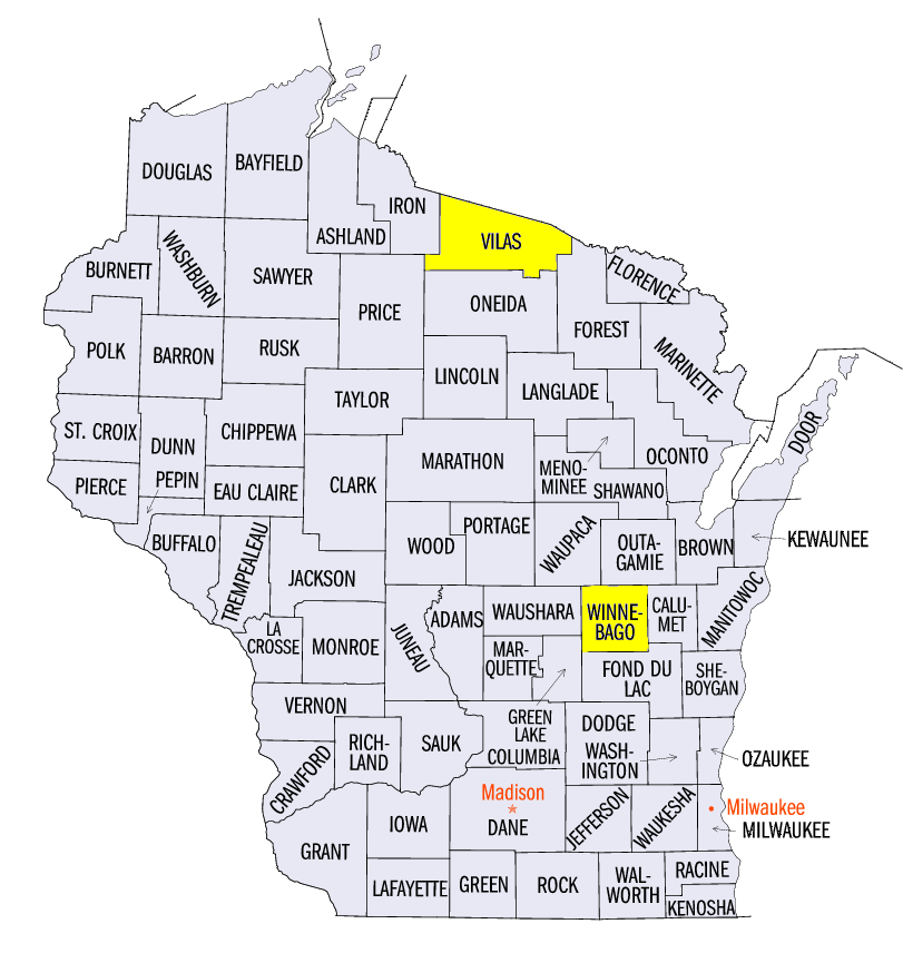
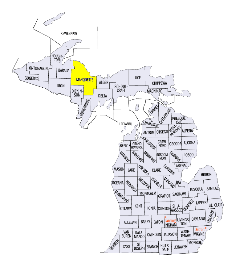
Heavy snow from a major winter storm caused hazardous conditions across Minnesota, Iowa, Wisconsin and Michigan from February 23-25 (Figure 9). The storm began through the morning of February 23 in Minnesota and northern Wisconsin, where amounts of 2-5 inches of snow were common (Figure 10). The heaviest snowfall occurred through the morning of February 24 (Figure 11). A large area from western Iowa through the U.P. of Michigan received 8-12 inches with locally higher amounts. Lake-effect snow continued through the morning of February 25 in the U.P. of Michigan as well (Figure 12). Some of the heaviest amounts from the storm included 15.0 inches in Lake Mills, IA (Winnebago County), 14.5 inches near the Winona Dam, MN (Winona County), 21.5 inches in Eagle River, WI (Vilas County) and 26.4 inches near Big Bay, MI (Marquette County).
Impacts were widespread and damaging as roads were slick and impassible at times. Strong winds helped create whiteout conditions on February 24
(Figure 13). A major accident involving 131 vehicles on Interstate 41 near Neenah, WI (Winnebago County) led to more than 70 injuries and one death during a whiteout. More than 700 calls to 911 were received in Winnebago County due to weather-related emergencies.
Ohio and Mississippi River Flooding
Heavy rain and saturated soils in the southern Midwest during the month of February culminated in major flooding along the Ohio River during the week (Figure 14). Several gauges, including Paducah, KY
(Figure 15) and Cairo, IL (Figure 16) reached major flood stage. Gauges along the Illinois, Wabash and White rivers also reached minor to moderate flood stage.
Drought-Free Year Continues
For the 9th consecutive week, the Midwest remained drought free according to the U.S. Drought Monitor
(Figure 17). In the February 26 update, the Midwest was completely free of abnormally dry conditions as well for the first time since May 2, 2017 and for only the third time since the U.S. Drought Monitor began in January 2000. Soil moisture reached extreme heights across a large part of the Midwest (Figure 18), leading to concerns ahead of the planting season. A large portion of the Ohio River Valley and the Upper Midwest were at or near record soil moisture for the end of February. Delays in planting were expected unless ponding in fields subsided in the early spring.
-BJP-