January 8-14, 2019
Midwest Weekly Highlights - January 8-14, 2019
Temperatures Remain Warm
Average temperatures remained warm across the Midwest
(Figure 1). The Upper Midwest was much warmer than the Ohio River Valley, however. Temperatures in Minnesota, Iowa and Wisconsin were 5-8°F above normal, with most of Missouri, Kentucky, Illinois, Indiana Ohio and Michigan near to 2°F above normal. The warmest day in the period was January 8, where both maximum (Figure 2) and minimum
(Figure 3) temperatures were abnormally warm. More than 90 daily high temperature records were tied or broken for the day (Figure 4). Sharp contrasts between maximum and minimum temperatures were observed during the remainder of the week. Minimum temperatures were as warm as 15°F above normal in northern Minnesota
(Figure 5). Meanwhile, maximum temperatures in southern Missouri and the Ohio River Valley were 1-3°F below normal (Figure 6).
Heavy Precipitation in Missouri
A winter storm brought heavy precipitation to Missouri and parts of southern Iowa and Illinois during the week
(Figure 7). Most of this precipitation fell through the mornings of January 12 (Figure 8) and January 13
(Figure 9). More than twice the normal amount was recorded in these areas, with most of northern Missouri receiving 3-4 times the normal amount (Figure 10). Heavy snow accompanied this storm across the southern half of the region, including areas that received more than a foot of snowfall
(Figure 11).
January 11-13 Winter Storm
A near-historic winter storm dumped more than a foot of snow over a large area of Missouri and Illinois (Figure 12). This storm began during the day of January 11 in Missouri, before waves of snow affected parts of Illinois and Indiana through the morning of January 12 (Figure 13). The system then stalled during the day of January 12 and continued into the early morning hours of January 13 (Figure 14). Storm total amounts of 8-12 inches were common. More than a foot of snow fell throughout Missouri and west-central Illinois, with isolated higher amounts.
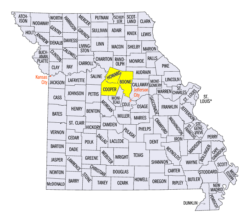
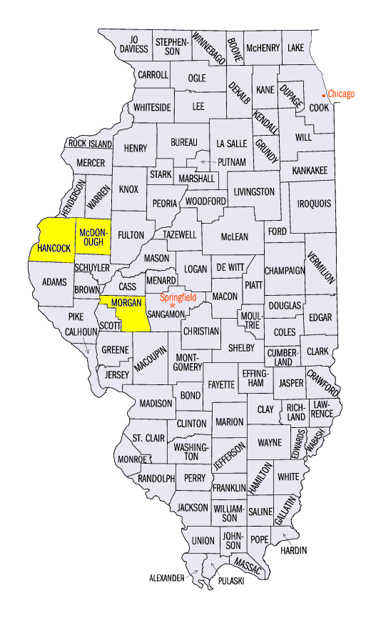
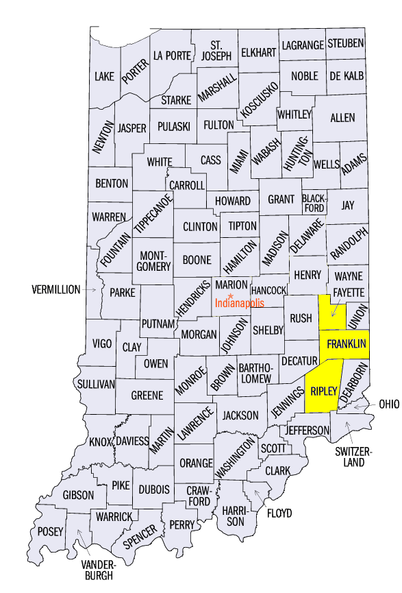
Totals in Missouri from the storm included 17.0 inches near Boonville, (Cooper County), 16.9 inches in Columbia (Boone County) and 16.4 inches near New Franklin (Howard County). Columbia, MO also recorded its second highest one-day snow total on record (1889-Current) on January 11 with 10.4 inches. In Illinois, storm totals included 15.5 inches in Augusta (Hancock County), 15.0 inches in Jacksonville (Morgan County) and 14.2 inches in Macomb (McDonough County). Significant amounts also fell in Indiana with 12.0 inches near Napoleon (Ripley County), 10.1 inches near Alpine (Fayette County) and 9.5 inches near Brookville (Franklin County). More than 150 daily snowfall records were broken across the region from the storm (Figure 15).
With very heavy snowfall an uncommon event in some of these areas, the impacts were widespread. The University of Missouri in Columbia closed on January 11 ahead of the storm. The Missouri State Highway Patrol reported more than 1,700 stranded motorists and more than 850 weather-related crashes across the state. These resulted in 57 injuries and 4 fatalities. A state trooper in the Chicago area was also killed when a driver struck him at a crash scene.
January 8-10 Lake-Effect Snow
The U.P. of Michigan experienced moderate to heavy amounts of lake-effect snow from January 8-10. The heaviest amounts fell through the morning of January 8 in the eastern half of the Peninsula (Figure 16). More than 6 inches of snow fell in most of these areas, with some receiving more than a foot. Moderate amounts of 4-6 inches also fell through the mornings of January 9
(Figure 17) and January 10
(Figure 18) across the peninsula. Some of the heaviest totals over the 3-day period included 20.0 inches at Halfway Lake (Luce County), 19.0 inches in Detour Village (Chippewa County), and 17.2 inches in Sault Ste Marie (Chippewa County).
-BJP-