December 8-14, 2020
Midwest Weekly Highlights - December 8-14, 2020
Extreme Warmth
Temperatures were very warm across the Midwest during the week
(Figure 1). In Minnesota and Wisconsin, temperatures were 7-10°F above normal. Meanwhile, areas across the Ohio River Valley and Missouri, temperatures were 6-9°F above normal. The warmth was most prominent in maximum temperatures (Figure 2), where areas in the Ohio River Valley were more than 10°F above normal. More than 300 daily high temperature records were broken across the region
(Figure 3). Most of these records were broken from maximum temperatures on December 10 (Figure 4) and December 11
(Figure 5). Temperatures on these days were in the 50s and 60s across most of the region. A strong storm system at the end of the period brought in cold weather, however, with minimum temperatures below zero in northern Minnesota on the morning of December 14 (Figure 6).
Wetter and Snowier
A storm in the central Midwest led to moderate precipitation amounts during the period
(Figure 7). More than an inch of precipitation fell from eastern Iowa through Lower Michigan. Most of this precipitation fell as snow (Figure 8). Areas in southeastern Missouri and southern Kentucky also had more than an inch. More than 80 daily precipitation records were broken during the period
(Figure 9). However, dry slots were observed across the northern Ohio River Valley and the Upper Midwest. Most of southern Minnesota received no precipitation for the period. Most of these two areas had less than a quarter of the normal amount for the week (Figure 10).
Upper Midwest Snowstorm December 12-14
A strong storm system moved through the Midwest through the mornings of December 12-14, bringing moderate to heavy snow to Iowa, southern Wisconsin and Michigan
(Figure 11). Most of this snowfall fell through the morning of December 12 (Figure 12), with a large area along the path of the storm receiving 3-5 inches of snowfall. Snow continued eastward into Michigan through the morning of December 13
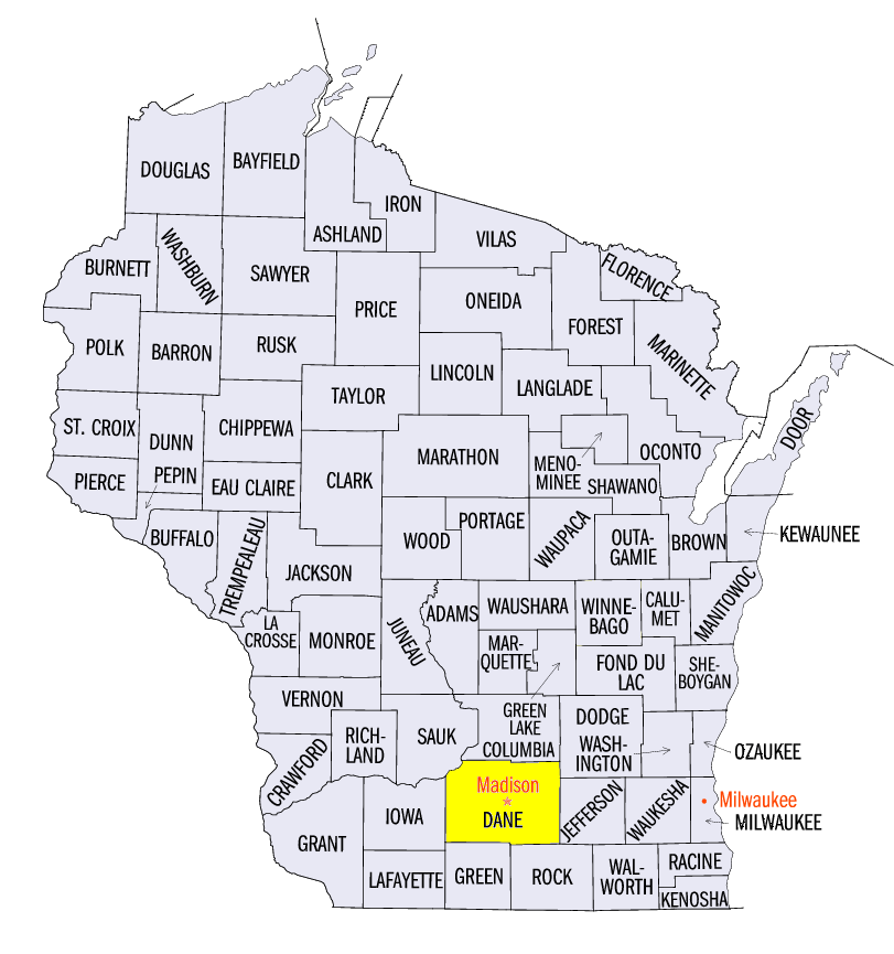
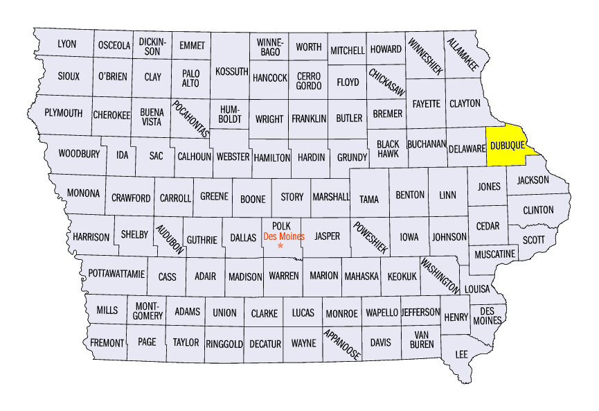
(Figure 13), with lingering snow showers in southern Wisconsin. Some areas in northern Lower Michigan received more than 4 inches. Lake-effect snowfall increased as winds turned to the southeast through the morning of December 14 in the U.P. of Michigan (Figure 14). However, amounts were limited to less than 4 inches in most areas. Some of the heaviest amounts across the region from the storm included 10.2 inches in Middleton, WI (Dane County), 9.4 inches outside of Dubuque, IA (Dubuque County) and 13.9 inches at the Alpena, MI Airport (Alpena County). A total of 20 daily records were broken from the snowfall.
-BJP-