November 10-16, 2020
Midwest Weekly Highlights - November 10-16, 2020
Warmth Slowly Departs
After a week where hundreds of records were broken, colder temperatures began to slowly move into the northwestern parts of the Midwest
(Figure 1). Temperatures were 4-7°F below normal across Minnesota and western Iowa, with northern Wisconsin, northwestern Missouri and the western U.P. of Michigan 1-3°F below normal. However, the remaining two-thirds of the region was still above normal. Areas in eastern Kentucky and eastern Ohio were 4-6°F above normal. The record heat from the previous week continued through the mornings of November 10 (Figure 2) and November 11
(Figure 3), with more than 450 daily records on November 10 and more than 100 records on November 11.
Wet Across the Upper Midwest
Precipitation amounts increased across the Upper Midwest during the period (Figure 4). Heavy amounts over 1.50 inches were recorded in Wisconsin and the U.P. of Michigan, with most of Iowa receiving over half an inch. Most of these areas had more than twice the normal amount
(Figure 5), with some areas receiving three to four times the normal. Most of this precipitation fell through the mornings of November 10 (Figure 6) and November 11
(Figure 7) as a strong storm system moved through the region. Eastern Kentucky also had heavy rain through the morning of November 12 (Figure 8). Elsewhere, precipitation was near to slightly above normal, with only a few areas in northwestern Minnesota, southern Missouri, southern Kentucky and northeastern Ohio below normal.
Heavy Snow
Cooler temperatures along with a strong storm system brought moderate to heavy snow in Minnesota, northwestern Wisconsin and the U.P. of Michigan
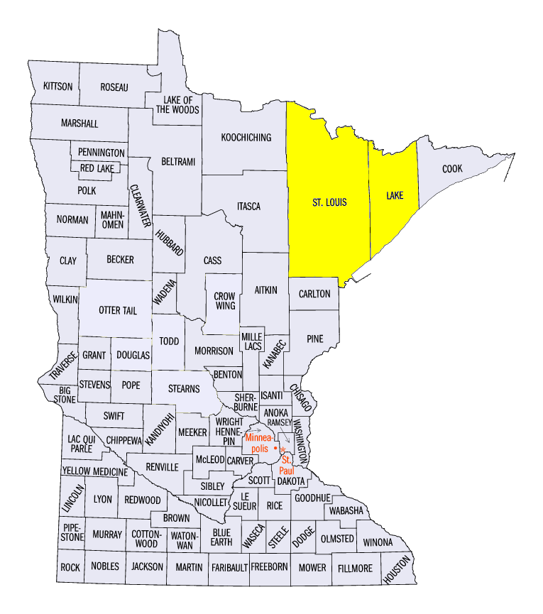
(Figure 9). Amounts of 6-8 inches were common across northeastern Minnesota with heavier amounts over 8 inches reported. Some of the heaviest amounts included 16.7 inches in Duluth, MN (St. Louis County), 10.2 inches near Two Harbors, MN (Lake County) and 9.5 inches near Floodwood, MN (St. Louis County). While most of this snow fell through the morning of November 11 (Figure 10), scattered snowfall also occurred through the mornings of November 12 (Figure 11) and November 13 (Figure 12). Lake-effect snowfall in northeastern Minnesota through the morning of November 15
(Figure 13) and the U.P. of Michigan through the mornings of November 16 (Figure 14).
Severe Weather
Rounds of severe weather hit the Midwest during the week on November 10
(Figure 15), November 14 (Figure 16) and November 15
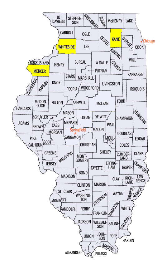
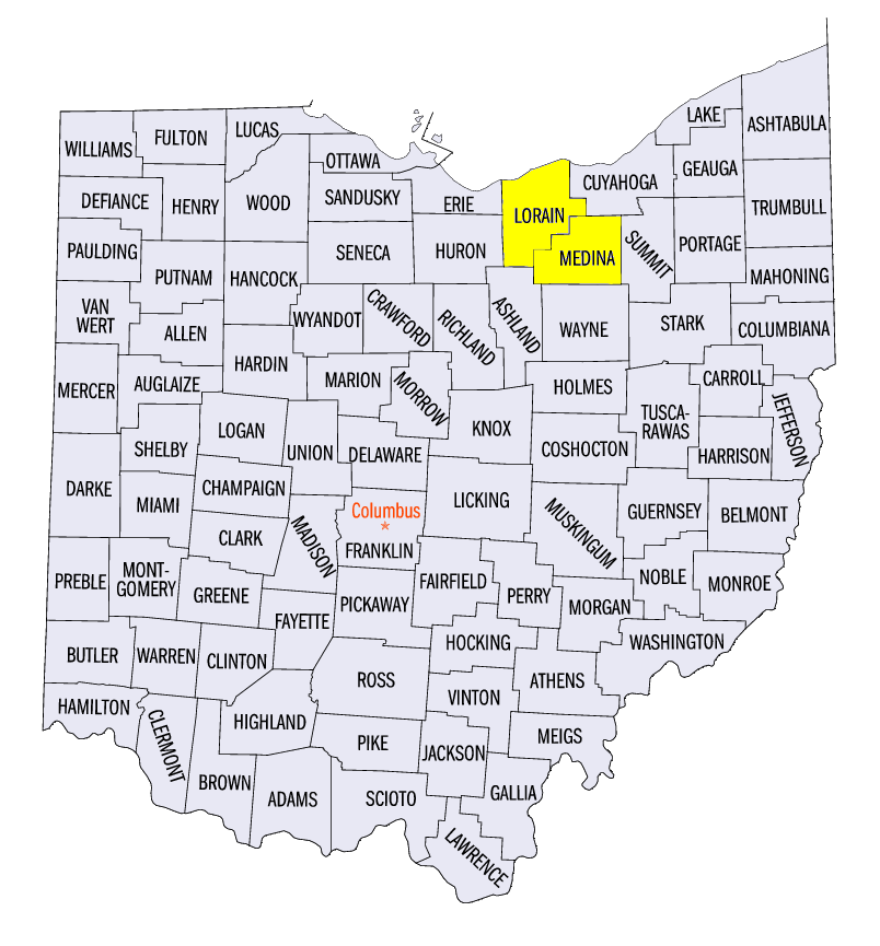
(Figure 17). The first round on November 10 impacted northern Illinois and southwestern Michigan with strong winds and tornadoes. An EF-1 tornado with winds estimated at 100 mph traveled through Whiteside County, IL while another tornado was reported in Mercer County, IL. Trees and limbs were downed along with damage to outbuildings. Wind gusts of 79-mph were reported in Sugar Grove, IL (Kane County) in northern Illinois and at the Milwaukee General Mitchell Airport in Wisconsin as well. On November 14, strong storms impacted southern Missouri with wind gusts up to 60 mph. Large trees and power lines were knocked down while damage to roofs were also reported. Storms formed across Ohio the next day, November 15, bringing strong winds once again. A 79-mph wind gust was reported near Lorain, OH (Lorain County) while a 76-mph wind gust was reported near Brunswick, OH (Medina County).
-BJP-