September 22-30, 2020
Midwest Weekly Highlights - September 22-30, 2020
Warmer Temperatures Prevail
Temperatures were above normal across much of the Midwest during the last week of September
(Figure 1). Most of Minnesota, Iowa, Wisconsin and Michigan were 2-6°F above normal, while northern Illinois, northern Ohio and extreme northern Indiana were 1-2°F above normal. Cooler conditions were observed across southern Kentucky, however, with temperatures 1-2°F below normal. Most of the northern Ohio River Valley was near normal for the period.
Dry Weather Continues
Another drier week was observed across most of the Midwest (Figure 2). Many areas in Iowa, Indiana, and Illinois had less than 0.75 inches for the week. A few wetter areas were observed in northern Wisconsin and the U.P. of Michigan where more than twice the normal amount of rain fell
(Figure 3). Most of this precipitation fell through the mornings of September 24 (Figure 4), September 25
(Figure 5) and September 26 (Figure 6).
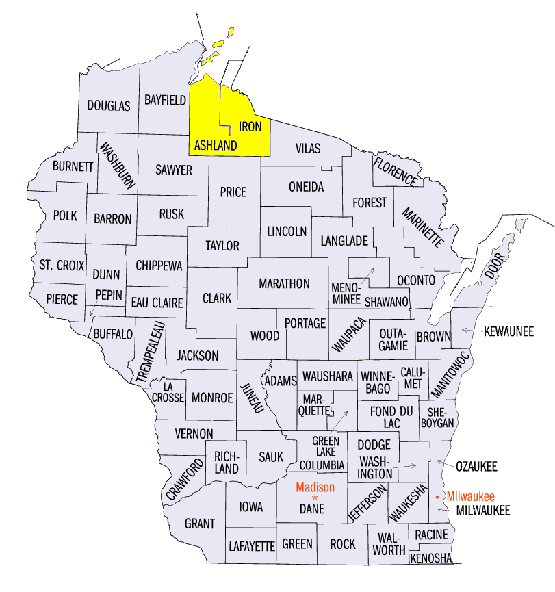
September 25-26 Severe Weather
Isolated storms in northern Wisconsin and the U.P. of Michigan led to severe weather on September 25-26
(Figure 7). A tornado was reported near Upson, WI (Iron County) while 2-inch diameter hail was reported near Morse, WI (Ashland County) on September 25. On September 26, hail was also reported in northern Wisconsin and northern Michigan.
Abnormal Dryness Expands
Dry conditions across southern Illinois and Indiana increased according to the September 29 U.S. Drought Monitor (Figure 8). Lack of rainfall in these areas persisted through most of September, especially during the 2nd half of the month. This led to an increase of more than eight percent in abnormal dryness across the Midwest. Drought in Indiana also increased by ten percent. More than 1.6 million people were estimated to be living in drought-affected areas.
-BJP-