September 8-14, 2020
Midwest Weekly Highlights - September 8-14, 2020
Heavy Rain in Eastern Iowa
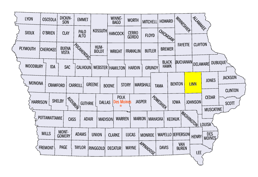
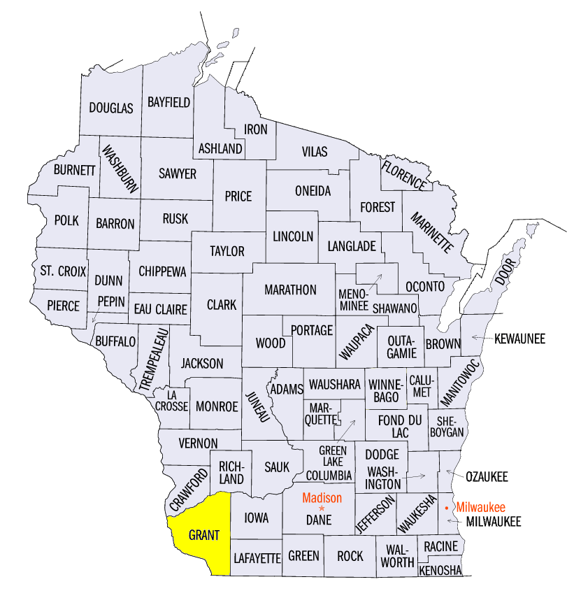
Thunderstorms in eastern Iowa, northwestern Illinois and southwestern Wisconsin dropped very heavy rain during the period
(Figure 1). Amounts of over 3 inches were common, with amounts over 4 inches in many areas. A persistent pattern of rain remained over these areas from September 8 through the morning of September 13, with amounts of half an inch to two inches common daily. Precipitation in these areas was more than five times the normal amount (Figure 2). Some of the heaviest amounts included 5.99 inches near Rockford, IL (Winnebago County), 6.08 inches near Cedar Rapids, IA (Linn County) and 5.56 inches near Lancaster, WI (Grant County). Meanwhile, moderate to heavy rain fell on western Iowa as well where severe and extreme drought expanded in the September 8 U.S. Drought Monitor
(Figure 3). In total, more than 120 daily precipitation records were recorded (Figure 4). Drier conditions were common across Minnesota, southern Missouri, southern Illinois and southern Indiana, however. Some of these areas in southern Indiana and southeastern Missouri had little to no precipitation.
Exceptional Cold Moves In
A very cold airmass moved into the western and northern Midwest during the period
(Figure 5). Most of Minnesota, northwestern Wisconsin, Western Iowa and northwestern Missouri had temperatures 10°F or more below normal. Maximum temperatures were even colder (Figure 6), with some areas in Iowa and northwestern Missouri more than 15°F below normal. Minimum temperatures in northern Minnesota and northern Wisconsin averaged in the 30s
(Figure 7), while most of Iowa averaged below 50°F. More than 825 daily records were broken from the cold (Figure 8), including more than 750 from daily low maximum temperatures. Meanwhile, temperatures were sharply warmer in the Ohio River Valley. Most of Ohio, Kentucky, Indiana, southern Illinois and southeastern Missouri were 1-3°F above normal.
First Freezes in the Upper Midwest
Minimum temperatures from September 8-11 reached the mid to lower 30s across northern areas of the Upper Midwest, leading to first fall freezes
(Figure 9). Some of the coldest minimums occurred in northern Minnesota on the morning of September 9 (Figure 10), where minimum temperatures were in the upper 20s. Extensive areas of northern Wisconsin and the western U.P. of Michigan reached freezing as well through the mornings of September 10
(Figure 11) and September 11 (Figure 12). These freezes were the eastern edge of a very intense temperature shift in the northern Great Plains and Rockies as temperatures went from as high as 100°F to below freezing with snowfall in just two days.
-BJP-