July 2020
Monthly Overview - July 2020
Heavy Thunderstorm Rain
Thunderstorms scattered heavy precipitation across the Midwest in July
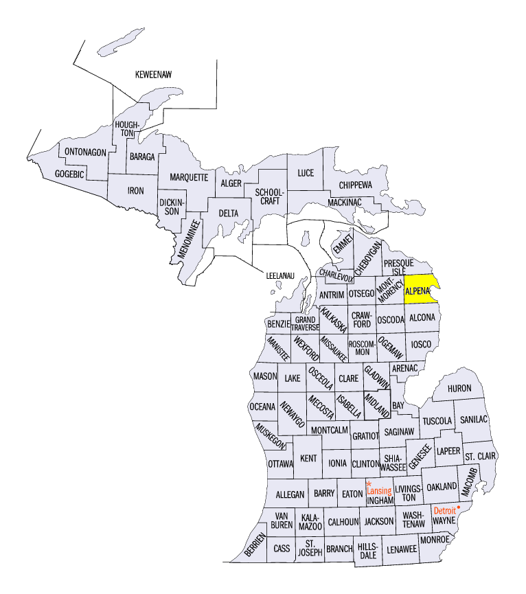
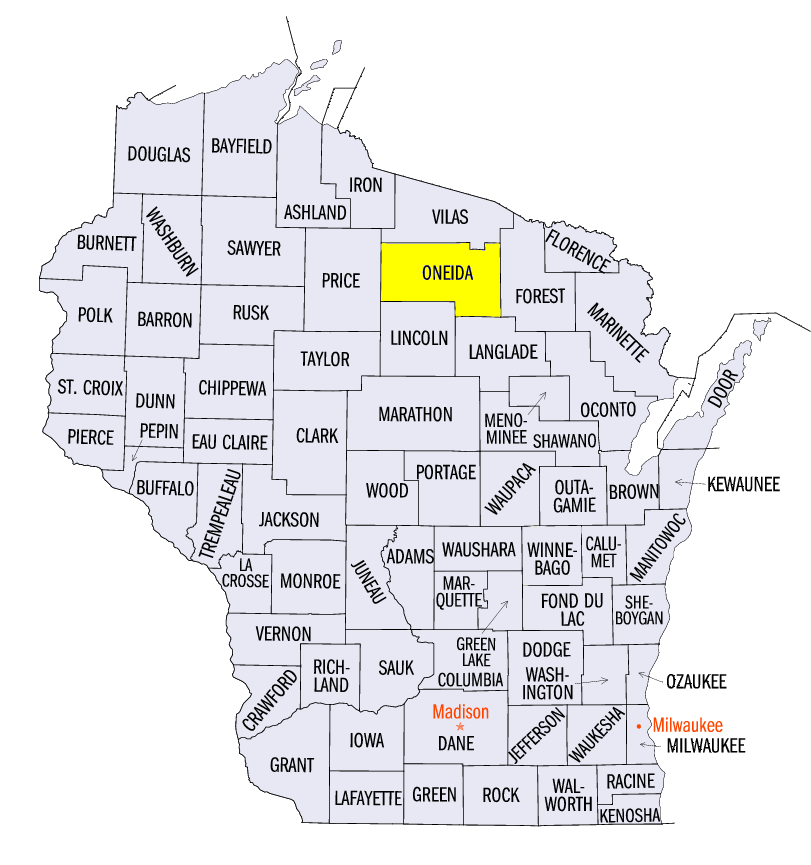
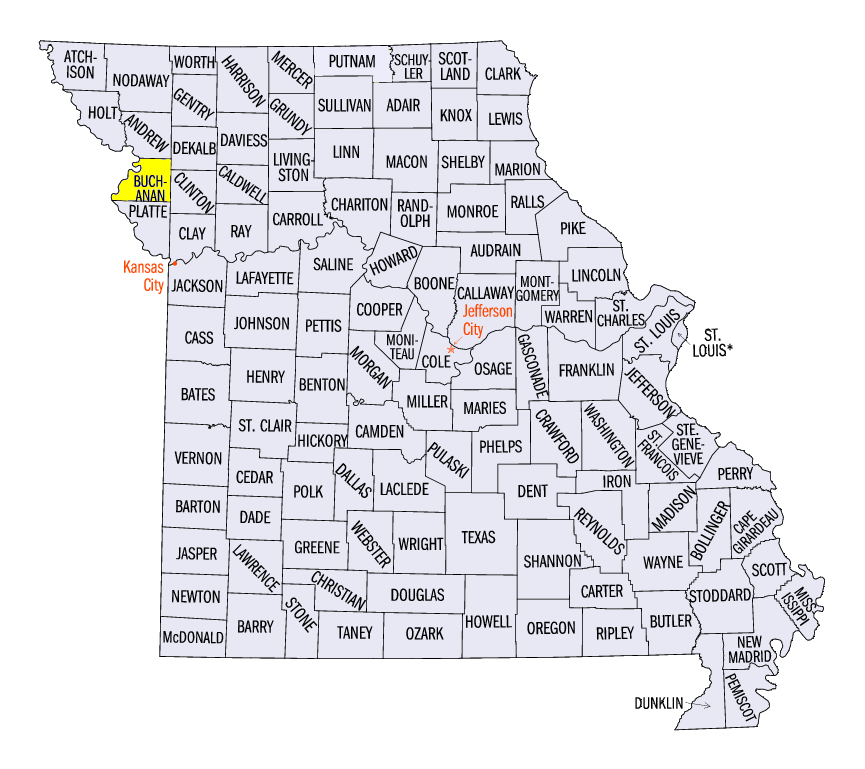
(Figure 1). Amounts for the region totaled 4.68 inches which was 0.62 inches above normal. This ranked as the 21st wettest July on record (1895-2020). Areas in northern Minnesota, northern Wisconsin, the U.P. of Michigan, northern Missouri and southern Illinois were very wet during the month, receiving more than 150 percent of normal (Figure 2). Michigan’s Climate Division 2 which covers the eastern U.P. had it’s wettest July on record (1895-2020). Station records for July were broken in Alpena, MI (Alpena County, 104 years on record), Rhinelander, WI (Oneida County, 111 years on record) and St. Joseph, MO (Buchanan County, 117 years on record) among others. More than 440 daily precipitation records were broken across the region as well
(Figure 3). However, much drier weather impacted Iowa, northern Indiana, Ohio and south-central Missouri. Most of Iowa had less than half the normal amount of precipitation for the month.
July Heat
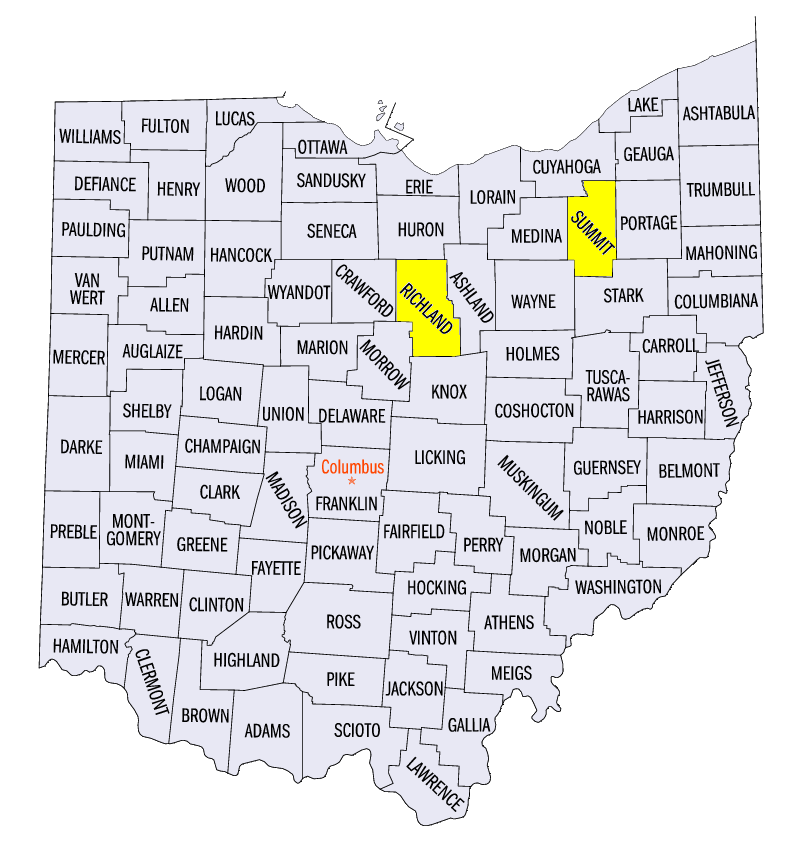
Heat was widespread in July throughout the Midwest (Figure 4). Average temperature for the region was 75.2°F which was 2.6°F above normal. This ranked among the 15 warmest July’s on record (1895-2020). Ohio was one of the warmest states, with records for average temperature in Akron (Summit County, 128 years on record) and Mansfield (Richland County, 101 years on record). Extreme heat impacted the region during the first week of the month
(Figure 5), with maximum temperatures averaging above 90°F and heat index values over 100°F (Figure 6). Temperatures moderated only slightly during the remainder of the month, with most areas near to slightly above normal. More than 300 daily high temperature records were broken across the region
(Figure 7), with more than 200 from daily high minimum temperatures.
Drought Expands
Drought expanded in the Midwest in July (Figure 8). While northern Minnesota was the only major area in drought at the beginning of the month
(Figure 9), areas in Western Iowa, Ohio, Indiana, eastern Michigan and southern Missouri had drought as of the July 28 U.S. Drought Monitor. July heat along with well below-normal precipitation led some areas to be in severe drought in western Iowa. Soils in these areas were stressed as corn and soybean crops reached important stages of development (Figure 10).
Active Severe Weather
Severe weather was prevalent in July, with more than 1,500 reports of thunderstorm winds, large hail and tornadoes. Many of these reports came from two separate episodes from July 8-11 and July 17-19. A line of storms on July 11 accounted for more than 340 reports
(Figure 11). Strong winds and large hail began in southern Minnesota and led to more than 2-inch diameter hail in portions of central Iowa. Winds became stronger as the storm moved into northern Illinois and southern Indiana. A powerful EF-4 tornado also impacted rural western Minnesota on July 8, with estimated wind speeds of 170 mph. A 30-year old man was killed from the tornado with two others injured along with damage to numerous structures.
-BJP-