April 15-21, 2020
Midwest Weekly Highlights - April 15-21, 2020
Extreme Cold
Temperatures plunged well below normal across the Midwest during the week
(Figure 1). Average temperatures were 8-12°F below normal across most of the Midwest. Minimum temperatures averaged below freezing across the northern half of the region (Figure 2). One of the coldest mornings for the region was April 15
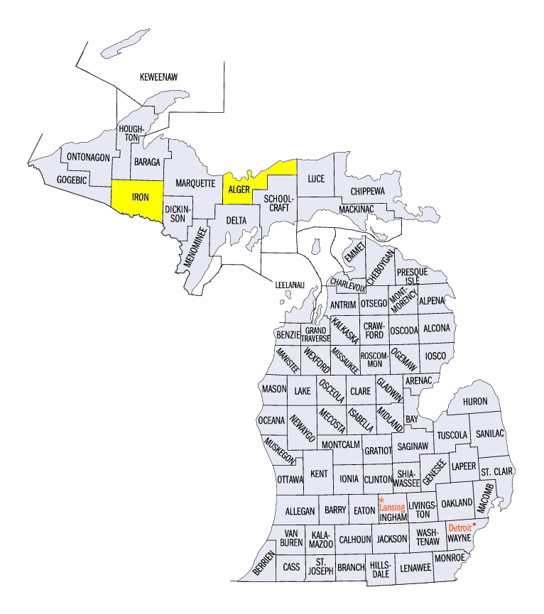
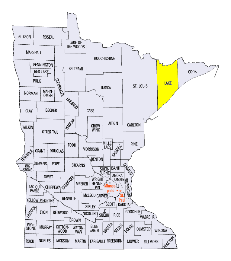
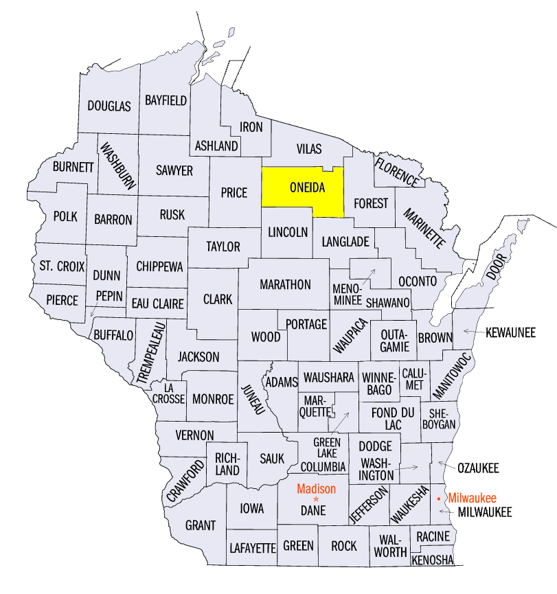
(Figure 3), where some areas of northern Wisconsin and the U.P. of Michigan were near to below zero. Some of the coldest temperatures during the period included -5°F near Amasa, MI (Iron County), -4°F at Doe Lake, MI (Alger County), -1°F near Isabella, MN (Lake County) and 1°F near Minocqua, WI (Oneida County). More than 450 daily low temperature records were broken across the Midwest (Figure 4), with more than 300 from minimum temperatures alone. More than 300 of these records occurred on April 15
(Figure 5) and April 16 (Figure 6).
Drier with Some Snow
Conditions were drier across most of the Midwest during the week
(Figure 7). Only a few areas in northern Missouri had more than an inch of precipitation. Along with northern Lower Michigan, these were the only areas that had amounts above normal for the period (Figure 8). Meanwhile, most of the Ohio River Valley received less than half the normal amount. Wisconsin had less than a quarter of normal while most of Minnesota and parts of northern Iowa had little to no precipitation. However, colder temperatures allowed for snow events from southern Iowa and northern Missouri through northern Ohio
(Figure 9).
April 15-18 Snowfall
Several storm systems impacted the central Midwest with moderate to heavy snowfall from April 15-18. While moderate amounts from 1-2 inches fell on April 15 (Figure 10) in southern Iowa, and in northern Ohio and southern Iowa through the morning of April 16
(Figure 11), the main snowfall event was through the morning of April 17 (Figure 12). Heavy snow was widespread from southern Iowa and northern Missouri through northwestern Illinois. Amounts ranged mostly from 4-6 inches in these areas. As the system moved east, areas in Lower Michigan had 2-4 inches through the morning of April 18
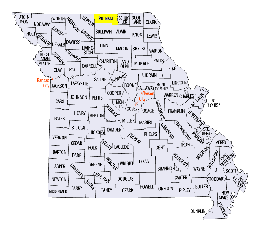
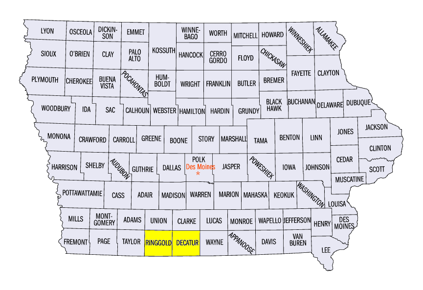
(Figure 13). Some of the heaviest totals for the period included 11.5 inches in Unionville, MO (Putnam County), 11.0 inches in Mount Ayr, IA (Ringgold County) and 10.0 inches in Lamoni, IA (Decatur County). More than 150 daily snowfall records were broken from snowfall during the period (Figure 14).
Abnormally Dry Conditions Return
While the Midwest remained drought-free for the 24th consecutive week, abnormally dry conditions returned to the region in the April 21 U.S. Drought Monitor
(Figure 15). This broke a streak of 14-consecutive weeks without abnormally dry conditions in the region, the second longest streak in the history of the U.S. Drought Monitor (2000-present). Conditions in central Minnesota and central Lower Michigan have been dry for several months, contributing to the introduction of abnormally dry conditions. However, drier weather has had positive impacts for agriculture as planting season begins.
Planting Season Begins
Drier conditions in the central and southern Midwest allowed farmers to get into their fields and begin planting. In Kentucky, 25 percent of corn was reported as planted, while 11 percent was reported in Missouri and 8 percent in Illinois (Figure 16). Soybeans were also in the beginning stages
(Figure 17), with 9 percent planted in Kentucky and 2 percent in Illinois and Indiana. Drier weather in the first few weeks of April was key in allowing farmers to complete spring tilling after soils were near saturation at the end of March. This abated worries of a repeat of the 2019 planting season, where saturated soils and heavy spring rainfall led to long delays and prevent plant scenarios.
Spring Frost and Freeze Damage
A very warm March brought some vegetation out of dormancy early in the Midwest and led to damage from freezing temperatures during the week. While the southern Midwest was the only area where growing degree days were at or above 150 units (Figure 18), early vegetable planting in Indiana and Illinois were also impacted. Limited damage was also reported in southern Michigan to fruits such as apple trees and grape vines from deep freezes into the teens.
-BJP-