Vegetation Resources
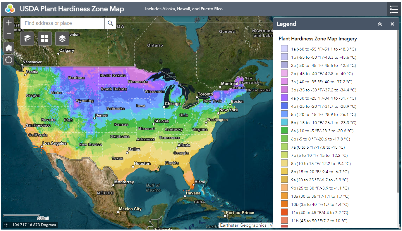 USDA Plant Hardiness Zone Map: Hardiness zones are based on the average annual extreme minimum temperature during a 30-year period in the past. View USDA Plant Hardiness Zones.
 Purdue Plant & Pest Diagnostic Laboratory: Submit your digital sample via P&PDL's app. The Plant Diagnostic Sample Submission app is a joint effort with 8 universities to provide a way to easily submit digital images of plant problems or pests on the go. Available for iOS.
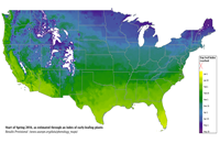 National Phenology Network: Phenology refers to key seasonal changes in plants and animals from year to year—such as flowering, emergence of insects and migration of birds—especially their timing and relationship with weather and climate.
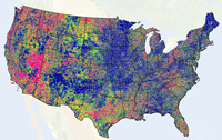 USDA VegScape: From the National Agricultural Statistics Service of the USDA, this tool allows you to view vegetation indices in a GIS format for years back to 2000. The GIS format allows you to zoom far into the county level, get statistics for the chosen area, and output into a pdf file.
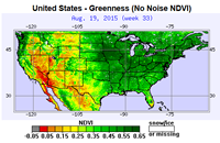 NOAA STAR Global Vegetation Health Products: The Center for Satellite Applications and Research at NOAA has a tool with 17 vegetation health products, ranging from Vegetation Heath and Greenness to Fire Risk and Thermal Stress. Output is a large image in png format.
 Specialty Crop Information: Serves as a general source of information pertaining to climate impacts on various types of vegetation. Submit suggested resources to mrcc@purdue.edu.
 Pest & Disease Management Resources: Modeling tools at the USpest.org program of Oregon State University.