June 15-21, 2021
Midwest Weekly Highlights - June 15-21, 2021
Temperatures Cool Slightly
Temperatures remained warmer than normal across the western half of the Midwest
during the week (Figure 1), but were cooler than the first two weeks of June. Most of Iowa was 2-5°F above normal, with Missouri 3-6°F below normal. Meanwhile, most of the Ohio River Valley and the Great Lakes were within 2°F of normal. Some areas in northeastern Minnesota and the western U.P. of Michigan were 2-3F below normal. Storms brought several cold fronts through the region, leading to cooler temperatures at times during the period.
Scattered Strong Thunderstorms
Several storm systems quickly traversed the Midwest during the week, bringing heavy rain to central portions of the region (Figure 2). More than an inch of rain fell across southern Iowa, west-central Illinois and northern Missouri, with additional pockets of more than an inch in Wisconsin, southern Michigan and the northern Ohio River Valley. Some of these areas had more than twice the normal amount of rain for the period
(Figure 3), mainly in southern Michigan and southern Indiana. Meanwhile, precipitation was spotty across the rest of the region. Southern Minnesota, southern Missouri, southern Illinois and most of Kentucky had less than half the normal amount for the period.
Widespread Severe Weather
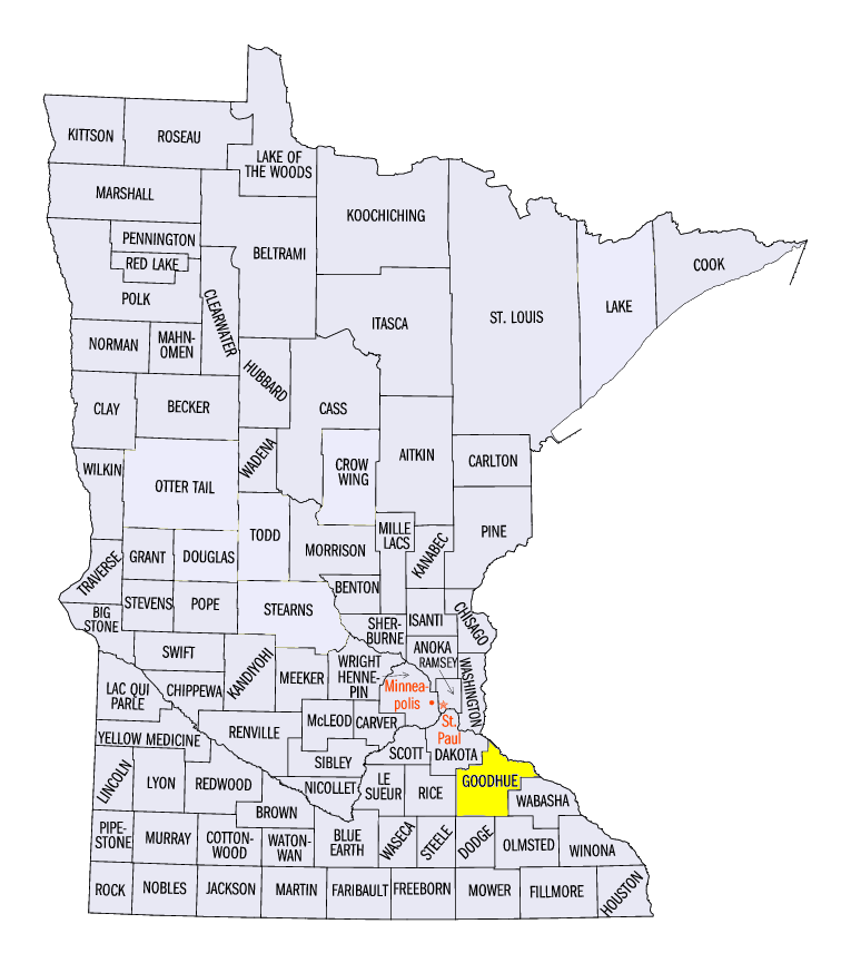
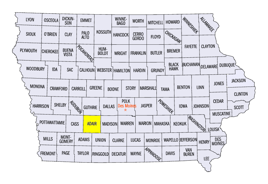
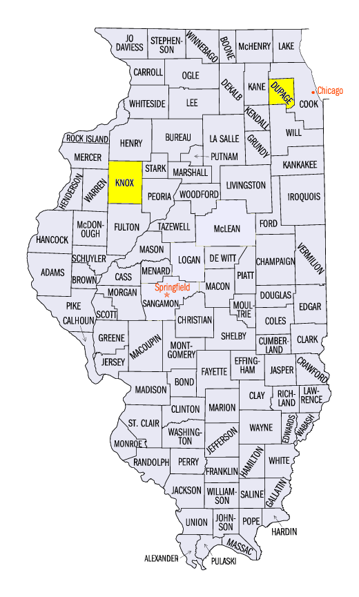
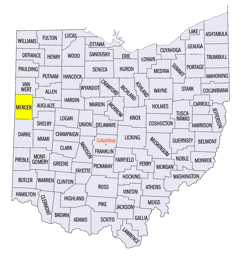
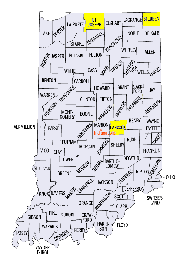
As storm systems moved through the Midwest during the week, hundreds of severe weather reports occurred from June 16-21 (Figure 4). Highlights of this severe weather included a strong hail event in southeastern Minnesota on June 17. More than 20 reports of hail of 2 inches in diameter or larger were reported, with 3-inch diameter hail reported near Canon Falls, MN (Goodhue County). On June 18, storms formed across southern Iowa, bringing large hail over 2 inches, with scattered severe wind gusts in central Illinois. A 4-inch diameter hailstone was reported near Bridgewater, IA (Adair County) along with several other irregular shaped hailstones, while a 90-mph wind gust was reported near Saint Augustine, IL (Knox County). Central Indiana and southwestern Ohio were strongly impacted by winds and several tornadoes as well. An EF-2 tornado was surveyed near Fort Recovery, OH (Mercer County). Hail 3.25 inches in diameter was also reported in New Palestine, IN (Hancock County).
Another widespread event took place on June 20 from eastern Iowa and northern Missouri through northern Illinois, northern Indiana, southern Lower Michigan and northern Ohio. The worst of these storms produced an EF-3 tornado near Naperville, IL (DuPage County), injuring 11 people. Winds were estimated at 140 mph along a 16-mile path. Several other tornadoes were reported, including an EF-1 tornado near Woodland, IN (St. Joseph County) and an EF-1 tornado near Lake James, IN (Steuben County). As the storm system for this event moved east, strong winds toppled trees and power lines in eastern Ohio and eastern Kentucky on June 21. In total, more than 600 severe weather reports were recorded across the region during the week.
Drought Persists
With only pockets of heavy rain, drought largely persisted with few changes in the June 22 U.S. Drought Monitor
(Figure 5). Some improvements from severe drought to moderate drought were noted in southern Lower Michigan, southeastern Wisconsin and northeastern Illinois. However, severe drought expanded in northern Iowa along with some areas of southern Minnesota and southwestern Wisconsin. Most of the Ohio River Valley and Missouri remained free of drought and abnormally dry conditions.
-BJP-