May 1-10, 2021
Midwest Weekly Highlights - May 1-10, 2021
Cool Spring Temperatures
Cooler than normal temperatures were widespread across the Midwest during the first ten days of May
(Figure 1). Only a few areas of northeastern Iowa and extreme southeastern Minnesota and southwestern Wisconsin were near normal. The coldest areas were in northern Indiana and Michigan, where temperatures were 4-6°F below normal. Most of Wisconsin, Minnesota and Missouri were 1-3°F below normal while Kentucky was 2-4°F below normal.
Ohio River Valley Rain
Precipitation amounts were heavy across portions of Indiana, Ohio and Kentucky during the period (Figure 2). Amounts of over an inch were recorded across most of the southern half of the region, with more than two inches across most of Ohio, northern Indiana, western Kentucky and southern Missouri. Most of this rainfall came from two separate storms through the mornings of May 4
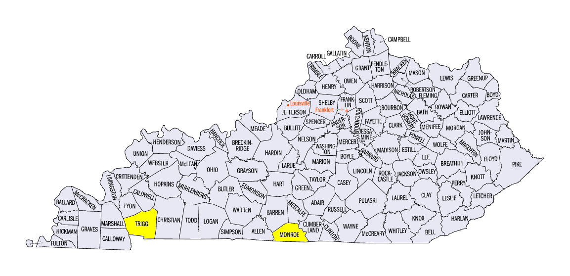
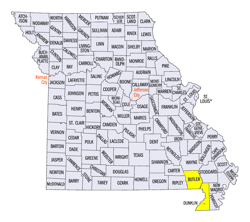
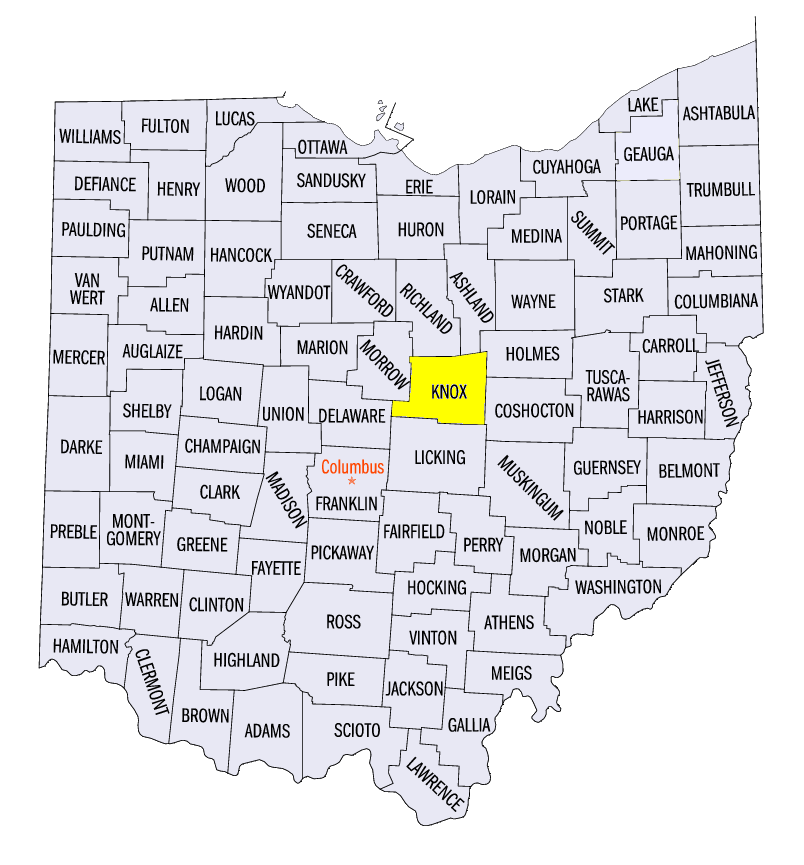
(Figure 3) and May 5 (Figure 4) and through the mornings of May 9
(Figure 5)and May 10 (Figure 6). The first storm largely impacted southern Missouri and Kentucky, while the second impacted northern Illinois through Ohio. Localized areas received more than 4 inches from these storms. Some of the heavier amounts for the period included 10.65 inches near Cadiz, KY (Trigg County), 6.06 inches in Poplar Bluff, MO (Butler County), and 5.00 inches near Centerburg, OH (Knox County). In areas where the heaviest rain fell, values were more than twice the normal amount
(Figure 7). More than 130 daily precipitation records were broken across the region (Figure 8). Meanwhile, much drier conditions were observed in the Upper Midwest. Most of Minnesota and northern Wisconsin received less than a quarter inch of precipitation.
May 3 and May 6 Severe Weather
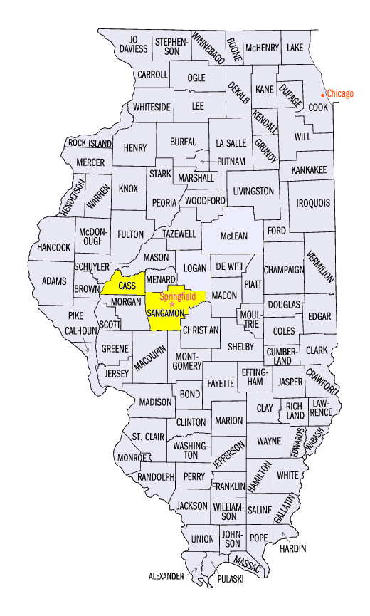
Storms in the southern half of the region were strong to severe on May 3 and May 6 (Figure 9). Strong winds and several tornadoes impacted extreme southern Missouri and Kentucky as well as west-central Illinois on May 3. An EF-1 tornado was reported near Tompkinsville, KY (Monroe County) while several weak tornado touchdowns were recorded across Cass County and Sangamon County in Illinois. A 75-mph wind gust was also reported near Senath, MO (Dunklin County). Several brief tornado touchdowns were also reported on May 6 in southern Illinois. One-inch hail was also reported in southern Illinois along with strong winds in western Kentucky.
-BJP-