February, 2021
Monthly Overview - February 2021
Brrr! Cold Air Arrives in the Region
Extreme cold impacted the Midwest in February. Though the coldest conditions were centered further to the west, the Midwest also experienced very cold temperatures (Figure 1). The monthly average temperature for the region was 15.3°F which was 11.1°F below normal. This ranked as the 8th coldest February for the region since 1895. Iowa had its 2nd coldest February while Missouri ranked 5th, Illinois 7th, Wisconsin 8th, and Michigan 9th in their respective histories. The first week of the month was slightly below normal, and then the real cold settled in for the next two weeks before a warmer week to end the month. More than 2,300 daily record-low maximum or minimum temperatures were set or tied from February 7th to the 18th (Figure 2). During the mid-month cold snap, temperatures were 20°F to 30°F below normal at many locations in the western half of the region (Figure 3). Further east, average conditions were milder but still below normal and much of the region experienced temperatures that fell below zero on the 17th (Figure 4). Only large parts of Kentucky and areas along the Ohio River escaped the sub-zero temperatures on that date. The warmer temperatures in the last week of February moderated the monthly values somewhat.
Drier Than Normal, But Snowy South
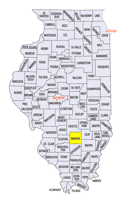
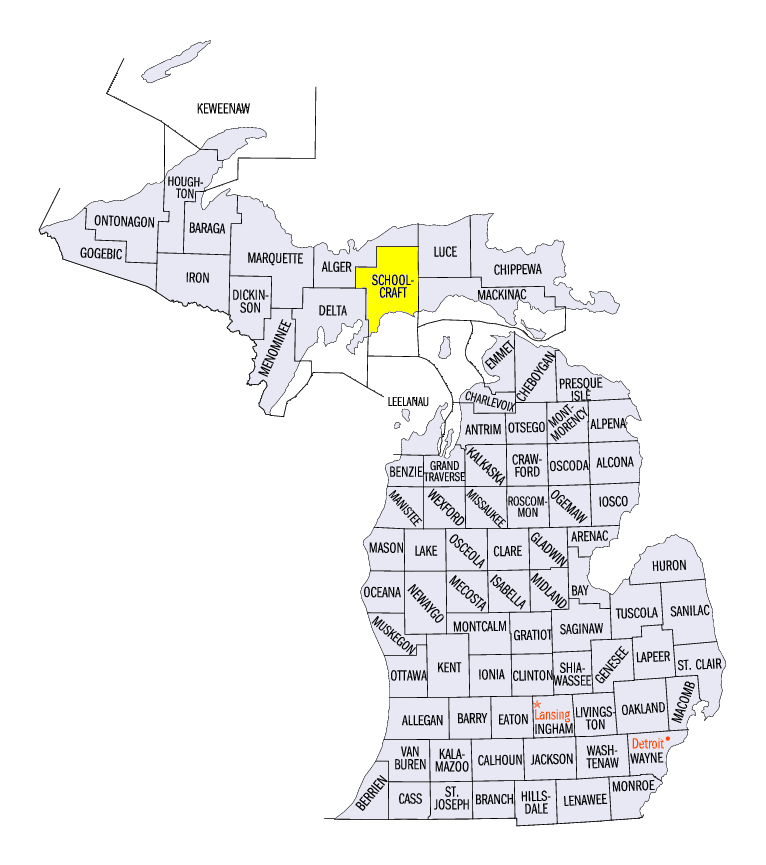
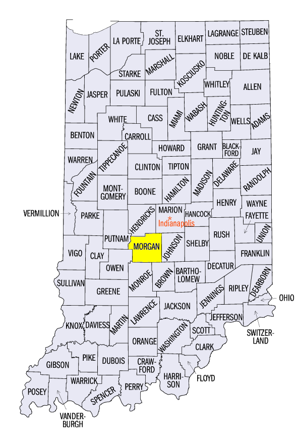
Much of the Midwest was below normal for February precipitation (Figure 5). The average precipitation for the region was 1.04 inches which was 0.69 inches below normal. This ranked as the 19th driest February since 1895. Minnesota ranked as the 6th driest in its history while Missouri ranked as the 12th driest. Some areas with above normal precipitation for February included most of Kentucky, which got a drenching on the last few days of the month, along with northwestern Iowa, northern Wisconsin, and northern Michigan. The wettest area was in eastern Kentucky with about twice the normal precipitation for the month and the driest area was northwestern Minnesota where many locations had less than 25 percent of normal (Figure 6). Snow totals were generally less than normal across Minnesota, slightly above normal in Wisconsin and western Michigan, and well above normal in southeastern Michigan and the other six Midwest states (Figure 7). Snow totals were two to five times normal for much of Missouri, Illinois, Indiana, Kentucky, and western and central Ohio. More than 350 daily snowfall records were set in February (Figure 8). Some monthly snowfall records were set including Salem (Marion County), Illinois (97 years on record), Manistique (Schoolcraft County), Michigan (79 years on record), and Martinsville (Morgan County), Indiana (77 years on record).
Drought Holds Steady
According to the US Drought Monitor (Figure 9), drought conditions were relatively steady in the Midwest in February. Drought areas in central Illinois and northwestern Indiana shrunk slightly in February, as did the areas in western Iowa. Drought areas in Minnesota remained nearly the same throughout February, however the areas of abnormally dry expanded to the east, encompassing northeastern Wisconsin and Upper Michigan.
Flooding in Kentucky
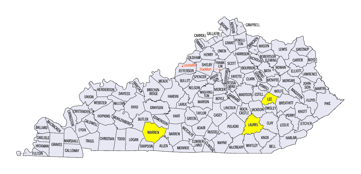
Seven stations in Kentucky reported over 4 inches of rain, including two with more than 6 inches. London Corbin Airport (Laurel County) reported 6.78 inches and Bowling Green Airport (Warren County) reported 6.16 inches. Numerous highways were closed due to flooding and some water rescues were needed. Thirteen counties, mostly in eastern Kentucky, declared emergencies. Beattyville (Lee County), along the Kentucky River, had flood levels unseen since 1957.
Winter Recap
Winter temperatures were within 2°F of normal across nearly all of the region, with just a small area in northwestern Minnesota more than 2°F above normal for the season (Figure 10). Warm conditions in December and January offset the very cold conditions in February.
Winter precipitation was below normal for most of the Midwest (Figure 11). A few areas including central and Eastern Kentucky, southern Iowa, and northern and western Missouri had slightly above normal winter precipitation totals. Averaged over the region, precipitation totaled 4.40 inches which was 1.31 inches below normal. The Midwest winter ranked as the 19th driest since 1895. Winter snowfall was well above normal in Iowa, northern Illinois, and the Ohio River Valley and below normal in most of the northern areas (Figure 12). The lake-effect snow areas downwind of the Great Lakes were generally below normal for the winter.
-MST-