October 22-31, 2026
Temperature
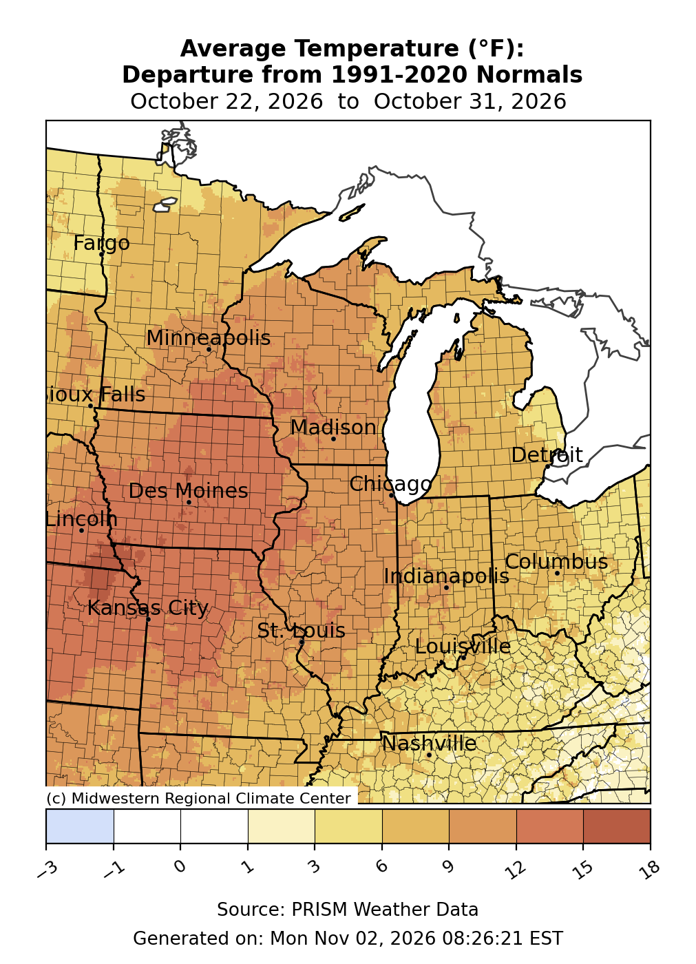
Temperatures were above normal across the entire region (Figure 1). Average temperatures were most above normal west of the Mississippi River in Iowa and northern Missouri, where they were up to 15°F above normal. Across Wisconsin, southern Minnesota, Illinois, and central Missouri, average temperatures were roughly 10°F above normal. Much of the region observed average temperatures that were 5-10°F above normal.
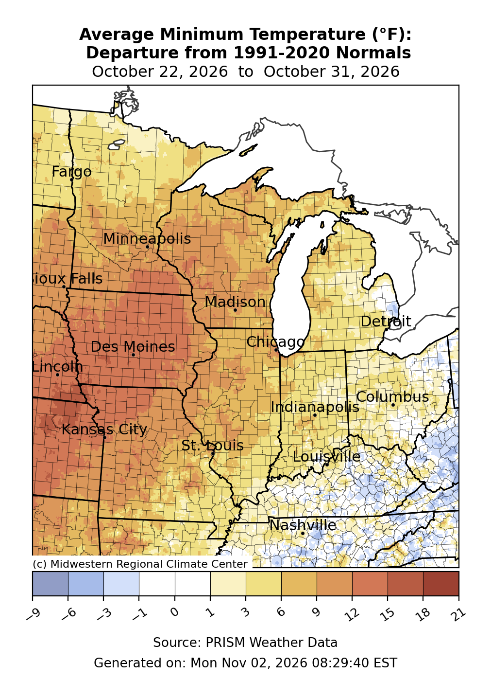
Minimum temperatures were most above normal to the west (Figure 2). Across Iowa and northwestern Missouri, minimum temperatures were 12-15°F above normal. Heading east, minimum temperatures were less anomalous, with places like Michigan and Indiana generally 3-6°F above normal, while temperatures were only slightly above normal or near normal across Kentucky and Ohio.
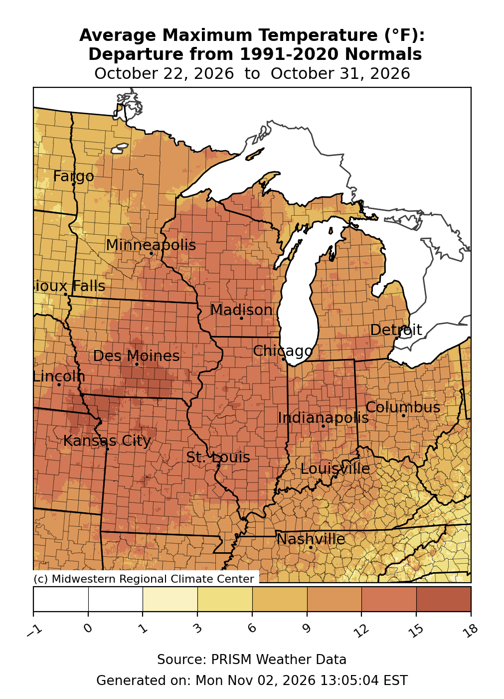
Maximum temperatures were 12-15°F above normal for a large section of the region from Wisconsin down the Mississippi River to Missouri (Figure 3). Elsewhere, maximum temperatures were around 10°F above normal, with the edges of the region in the Kentucky Coalfields and western Minnesota 6-9°F above normal.
Much of the region observed temperatures well into the 70s and 80s, often 20°F+ above normal to end the month. As a result, many observing locations broke records for the number of 70°F+ and 80°F+ days to end October. Cincinnati had 26 days where temperatures rose above 70°F in October, the 2nd most of any October since records began there in 1871. In St. Louis, there were 27 days of temperatures at or above 70°F in October, the most for any October since records began there in 1874. Indianapolis observed 27 days of temperatures at or above 70°F, which tied 1963 for the most number of 70°F+ days in October.
Precipitation/Drought
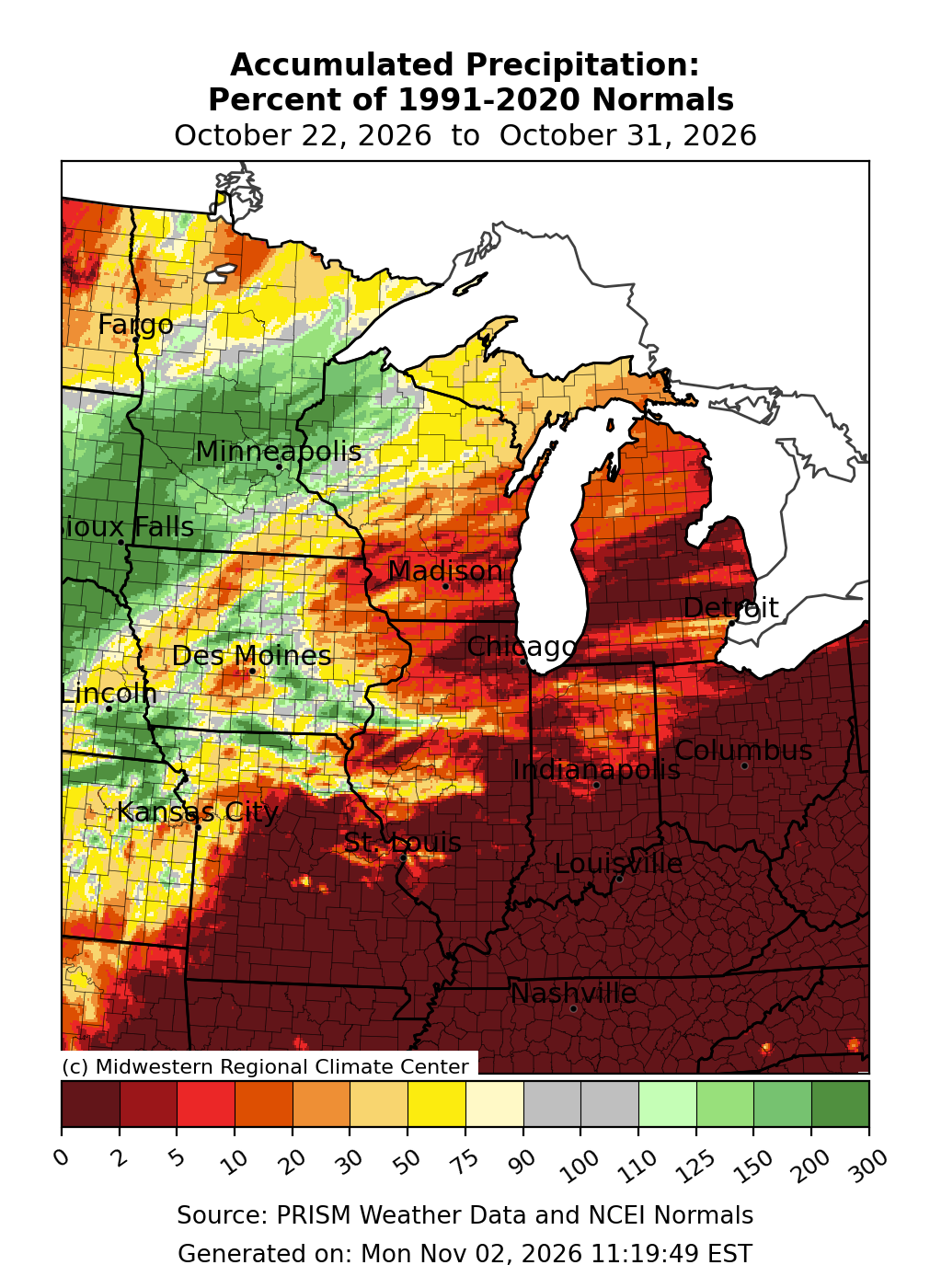
Precipitation was lackluster, as nearly half the region observed no measurable precipitation (Figure 4). Precipitation was present to the north and west, particularly over Minnesota, where precipitation was over 100 percent of normal.
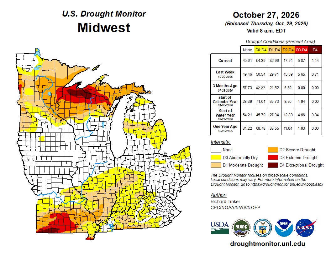
From October 20 to October 27, drought expanded across all categories (Figure 5). D0 (abnormally dry) expanded in coverage from 50 percent of the region to 54 percent of the region. D1 (moderate drought) covered one-third of the region as of October 27. D2 (severe drought) expanded from 15 percent coverage to 17 percent coverage. Both D3 (extreme drought) and D4 (exceptional drought) expanded, albeit slightly. D4 expanded to cover over 1 percent of the region, with expansions noted in both southern Missouri and the Upper Midwest.