September 15-21, 2026
Temperature
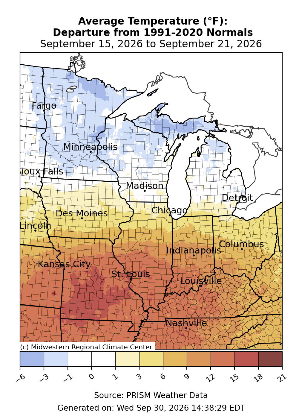
Temperatures averaged above normal south of I-80 and near-to-below normal north of I-80 (Figure 1). Much of Minnesota, northern Wisconsin, and Michigan’s Upper Peninsula (UP) were 1-3°F below normal. Meanwhile, the region’s southernmost locations, particularly south of I-70, were 10-15°F above normal. In Missouri, central and southern areas from Columbia to Springfield were as much as 15-18°F above normal for the week.
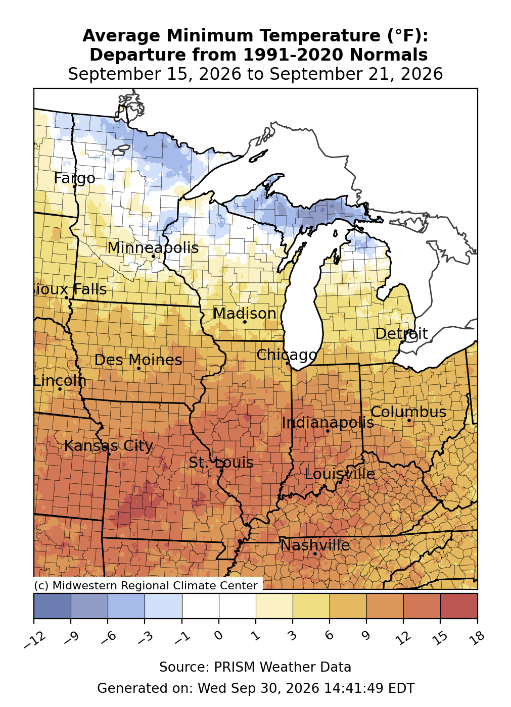
Minimum temperatures were above normal by 5-10°F for many locations south of I-80 (Figure 2). Many locations near and south of I-70 in Indiana, Illinois, and Missouri were over 10°F above normal for the week. Across the far north, minimum temperatures averaged below normal, with the greatest departures of 3-6°F across Michigan’s UP.
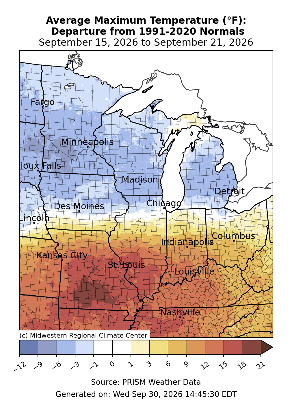
Maximum temperatures were most above normal across the far south, specifically Missouri and southern Illinois, where they were over 15°F above normal (Figure 3). Across southern Indiana and Kentucky, maximum temperatures were 10-15°F above normal. Along the I-80 corridor, maximum temperatures were near normal. The entire Upper Midwest observed maximum temperatures that were mostly 3-6°F below normal. In St. Louis, Missouri, temperatures remained above 95°F for 3 consecutive days from September 17-19, which tied the record for most consecutive days of 95°F+ this late in the calendar year since records began in 1874. In Springfield, Missouri, the temperature rose to 95°F or above for 6 consecutive days from September 15-20, which was also the most consecutive 95°F+ days in the calendar year since records began in 1874. As of September 21, both Joplin, Missouri, and Springfield had observed 16 days at or above 95°F, far outpacing the record for the most 95°F+ days in September for each location, with 9 days of the month still left.
Precipitation & Drought
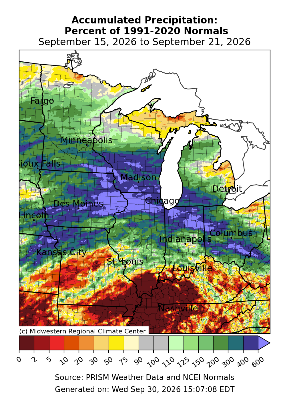
Precipitation was varied, with pockets of both above and below normal precipitation (Figure 4). Most of the precipitation occurred along a front that remained largely stationary across eastern Iowa, northern Illinois, northern Indiana, and Ohio. These locations received over 500 percent of normal precipitation for the week. Across the Upper Midwest, precipitation was mostly around 140-200 percent of normal. Across the region’s far south, where high pressure largely dominated, precipitation was nonexistent across western Kentucky, southern Illinois, and the Missouri Bootheel.
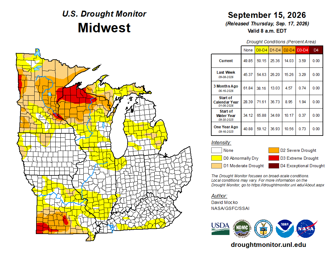
Drought diminished slightly across most categories from August 8 through August 15 (Figure 5). D0 (abnormally dry) was removed from much of Kentucky and central Missouri while appearing across northern Illinois and Northwest Indiana. D1 (moderate drought) remained largely unchanged while covering one quarter of the region. D2 (severe drought) expanded across southwestern Missouri while decreasing across eastern Minnesota and northern Wisconsin. D3 (extreme drought) was the only category that expanded, albeit slightly, across northern Wisconsin.
Storm Reports
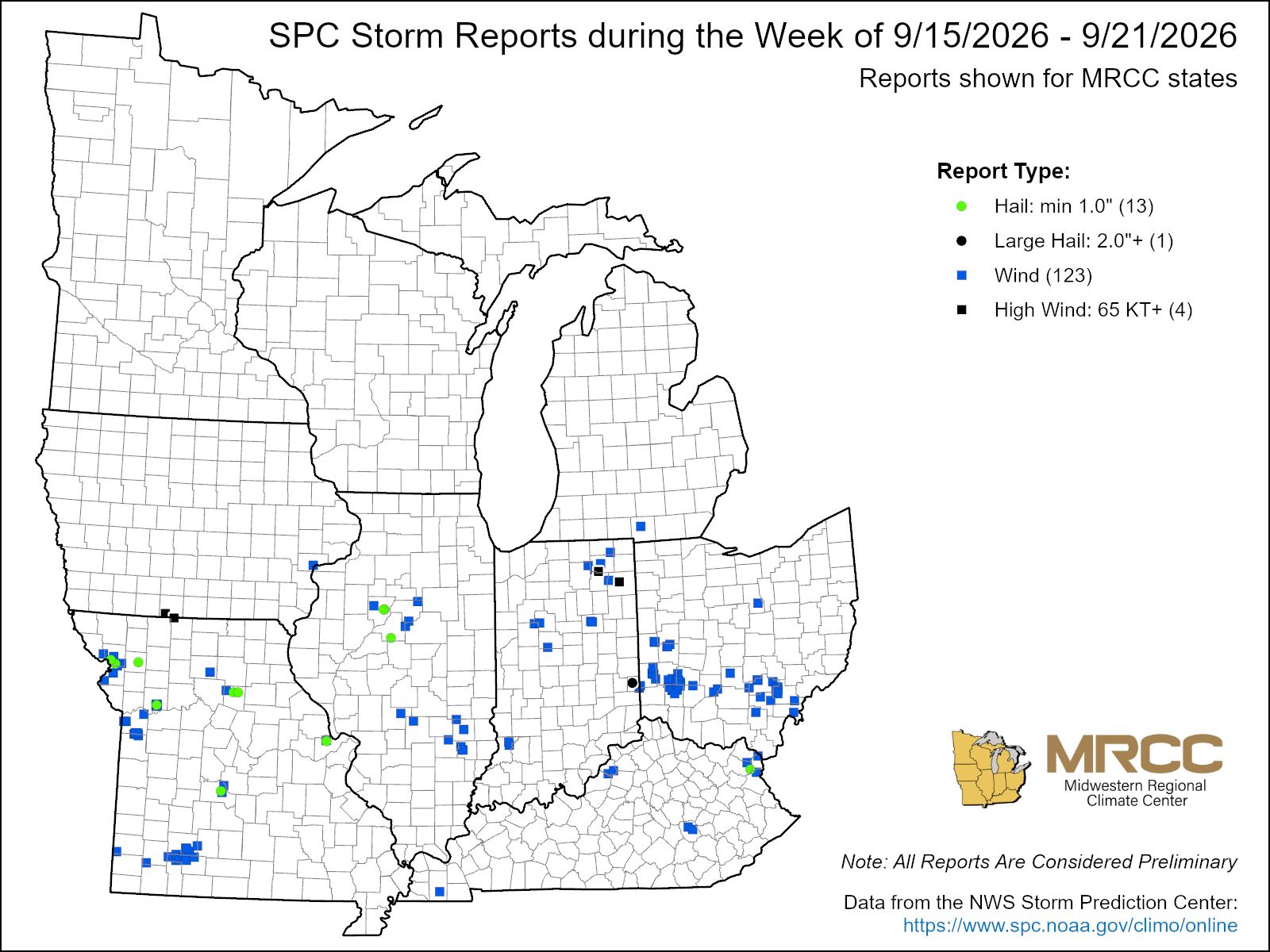
Severe weather was limited, with just 127 wind reports and 14 hail reports across the region (Figure 6). Straight-line winds reaching 83 mph were reported in Noble County, Indiana on August 15. 1 person was injured when several trees fell as a result of straight-line winds near Ashland, Kentucky, on September 17. Straight-line winds of 75-80 mph were reported along the Iowa/Missouri border on September 19.