September 8-14, 2026
Temperatures
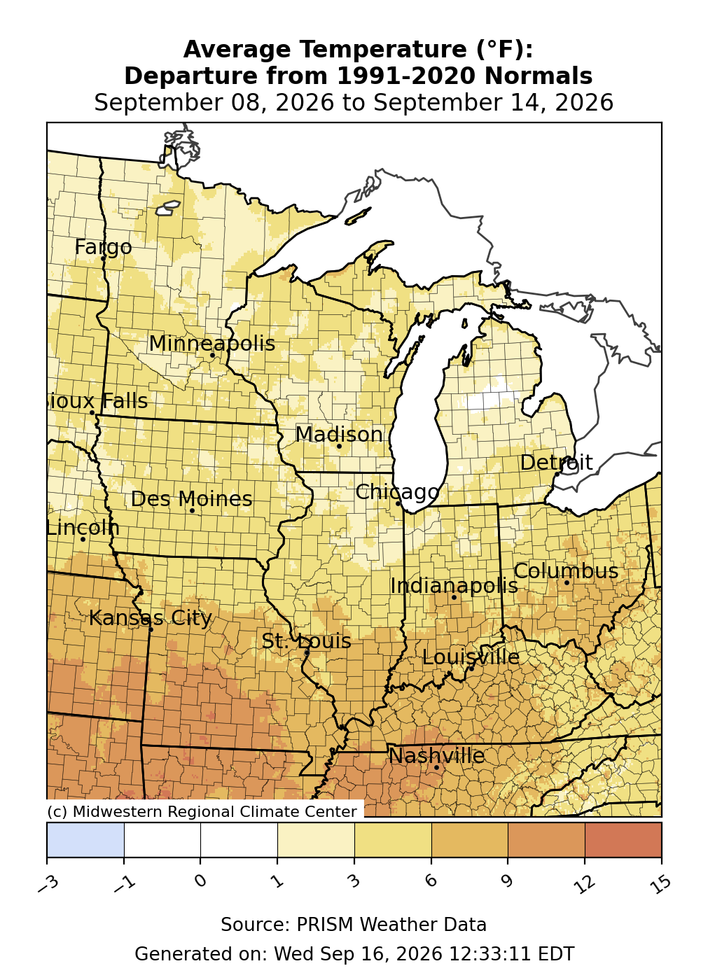
Temperatures remained above normal following a warm start to the month (Figure 1). Average temperatures were most above normal to the south, where portions of Missouri were as much as 9-12°F above normal. Much of the region south of I-70 was 6-9°F below normal. Anywhere north of I-70 was mostly 3-6°F above normal, though parts of the Upper Midwest were slightly less than that.
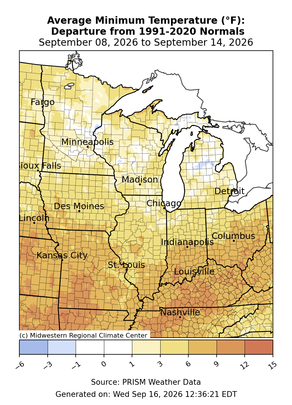
Minimum temperatures were near to slightly above normal across the Upper Midwest (Figure 2). South of I-80, minimum temperatures were 3-9°F above normal, while parts of Kentucky and Missouri averaged up to 9-12°F above normal for the week.
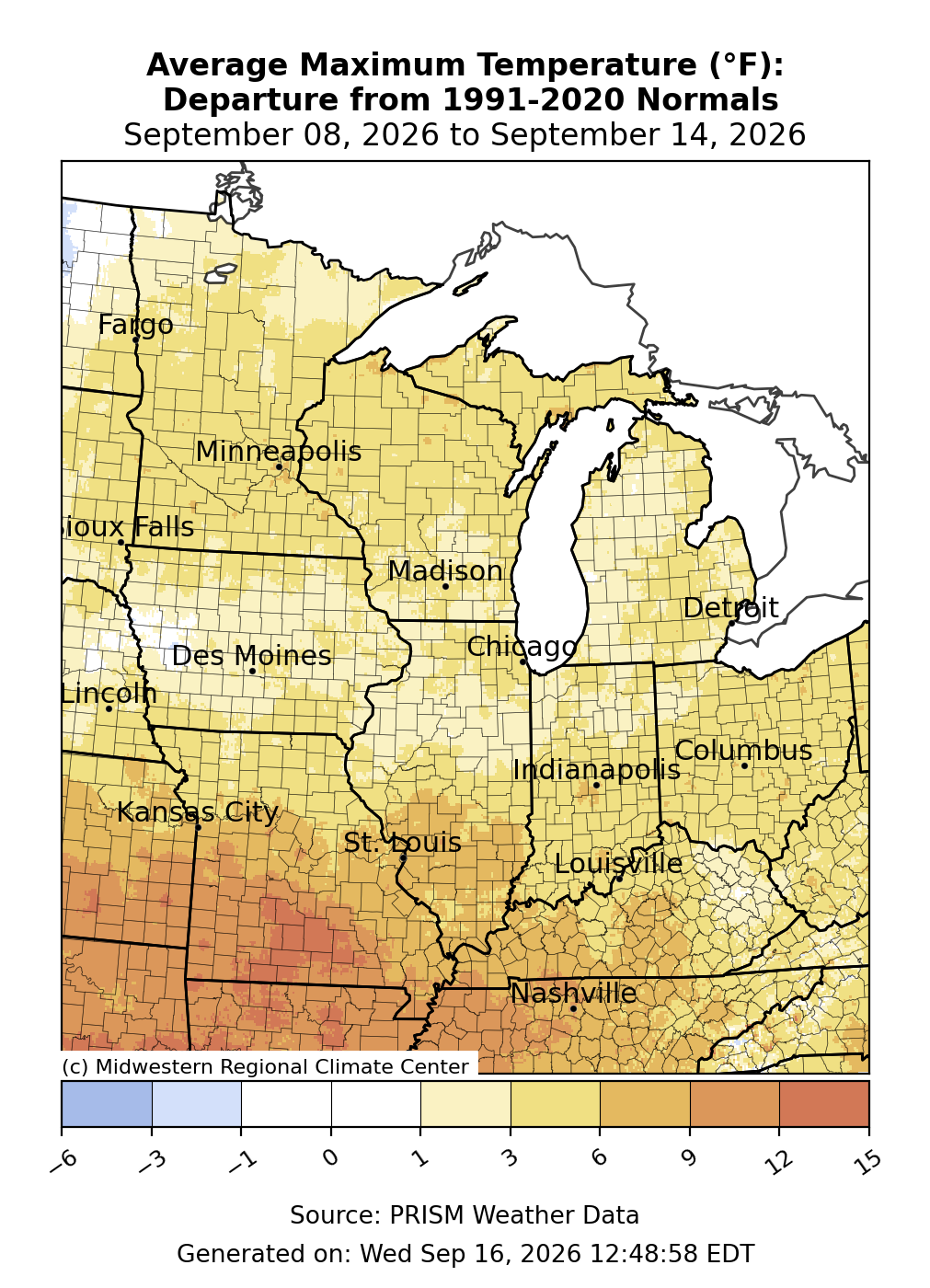
Maximum temperatures were above normal by 3-6°F for much of the region (Figure 3). Across the far south, average temperatures were 6-9°F above normal, and parts of Missouri were up to 15°F above normal. In Joplin, Missouri, a stretch of 9 consecutive days with temperatures at or above 100°F ended on September 9, marking the longest stretch of temperatures at or above 100°F in Joplin in September since records began in 1902.
Precipitation/Drought
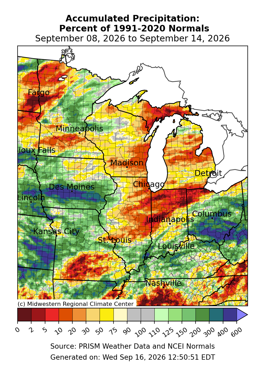
Precipitation was above normal for certain parts of the region, particularly much of Ohio, northern Missouri, and southern Iowa. Some of the aforementioned locations had over 300-400 percent of normal precipitation (Figure 4). In Des Moines, 8.35 inches of precipitation fell during the two-week period ending on August 14, making it the wettest start to September since. Among Great Lakes locations, precipitation was lackluster, with much of Illinois, northern Indiana, northwestern Ohio, Michigan, and eastern Wisconsin receiving less than 30 percent of normal precipitation.
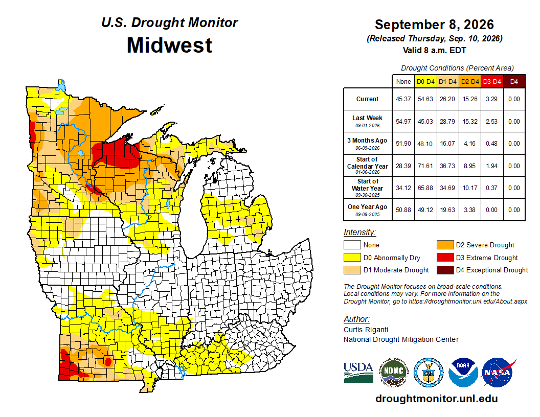
As of September 8, drought both decreased and expanded across the region (Figure 5). The region was drying, as shown by a nearly 10 percent expansion in D0 (abnormally dry). While D1 (moderate drought) and D2 (severe drought) improved slightly across the Upper Midwest, the improvements were isolated. These modest improvements were offset by drought expansion across the region’s south, where D3 (extreme drought) was reintroduced in southern Missouri.
Severe Weather
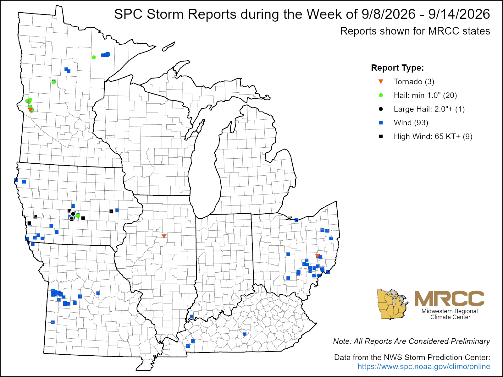
Severe weather reports were limited this week, with just over 100 reports (Figure 6). There were 93 wind reports, 20 hail reports, and 2 tornado reports. Most of the reports were of downed trees from straight-line damaging winds. A severe weather outbreak across central Iowa on September 8 brought 2.25-inch hail and 75 mph straight-line winds to Ankeny.