June 2026
June 2026 Overview – Midwestern Regional Climate Center
Temperature
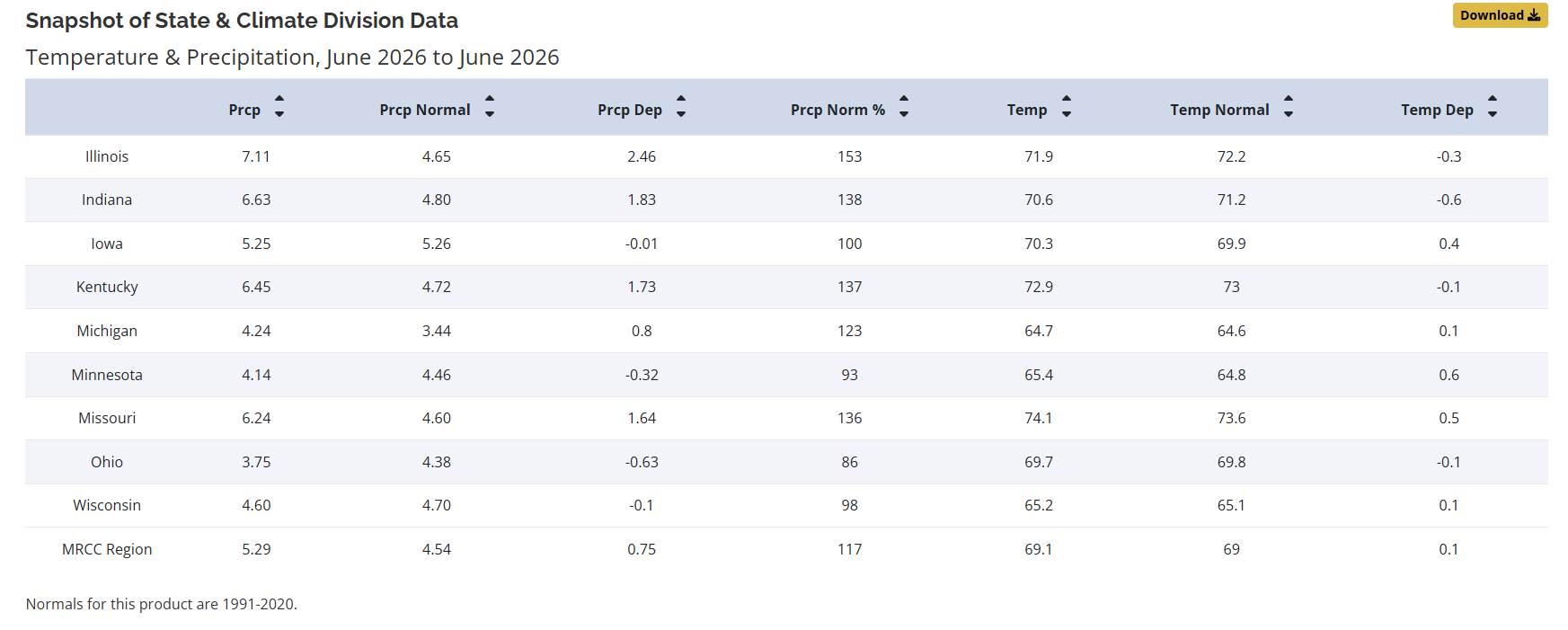
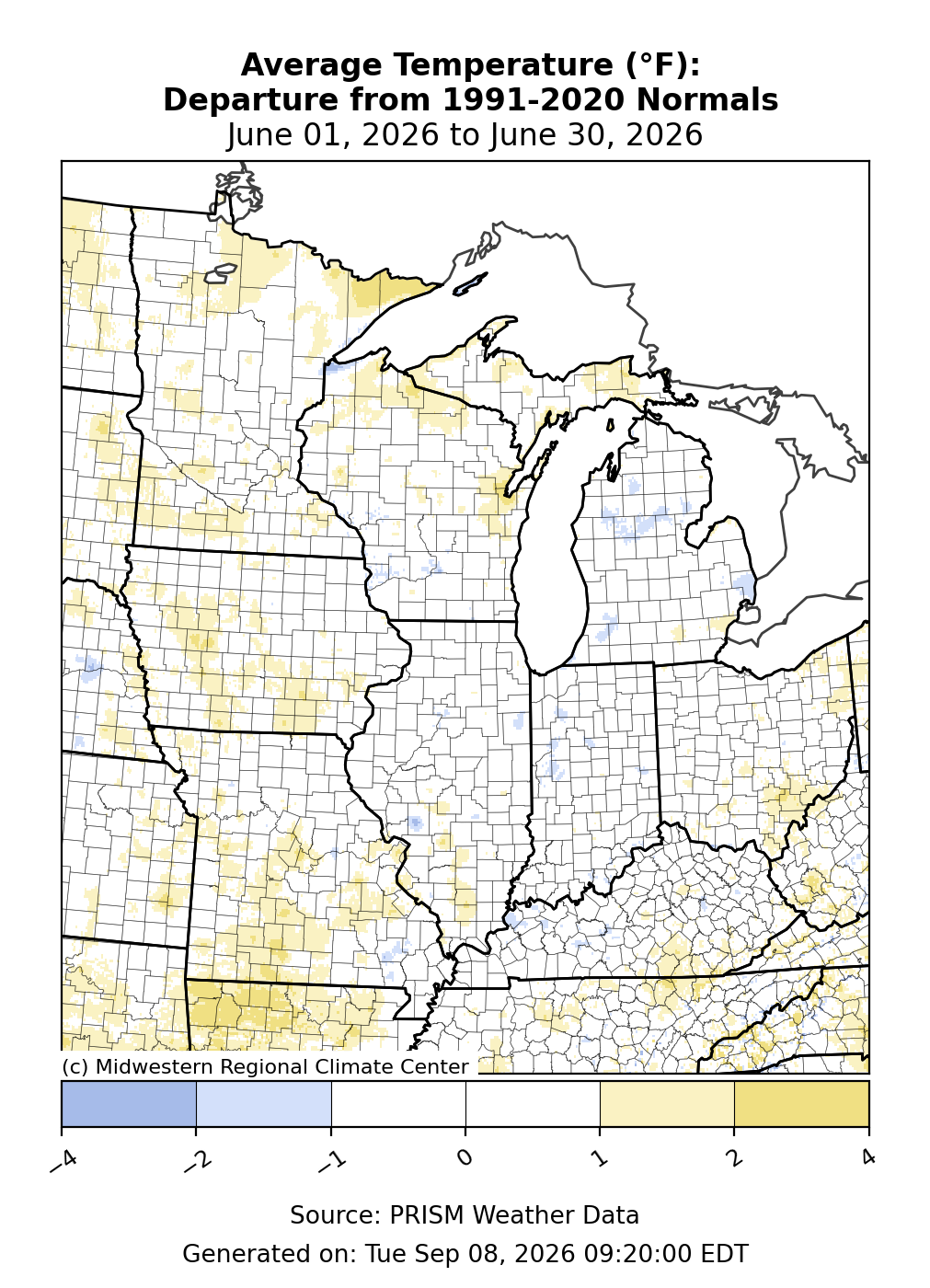
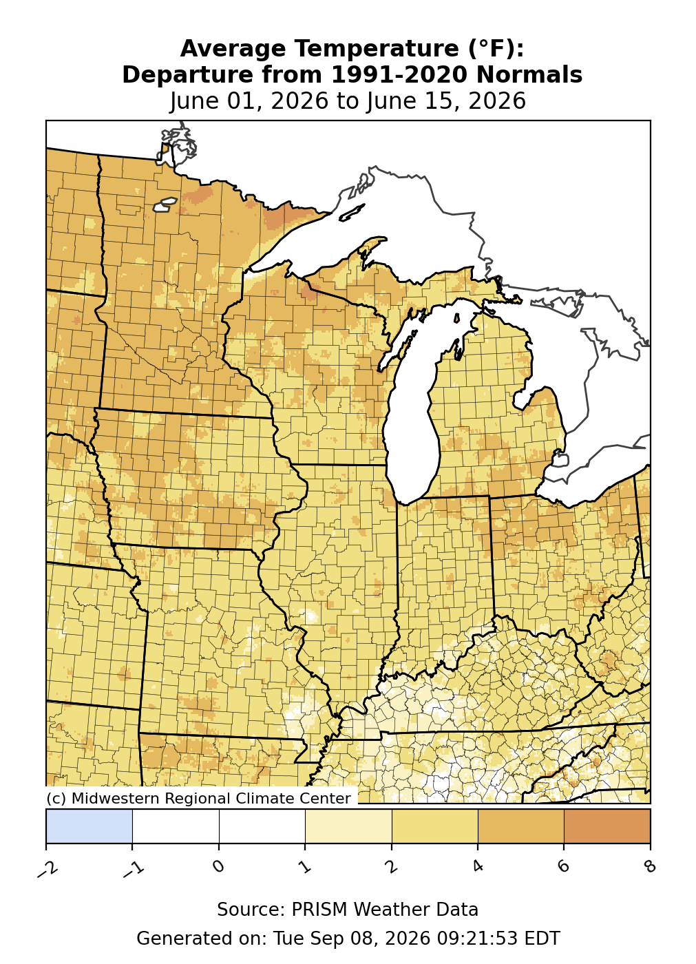
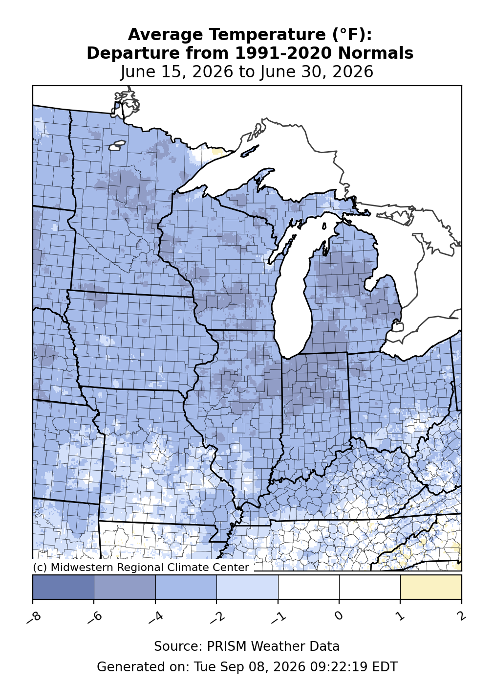
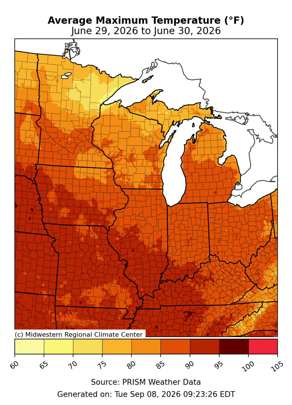
The average June temperature for the Midwest was 69.1°F, which was 0.1°F above the 1991–2020 normal (Figure 1). Statewide average temperatures ranged from 0.6°F below normal in Indiana to 0.6°F above normal in Minnesota. Regionwide, temperatures were within 2°F of normal, with no distinct spatial pattern in the temperature anomalies when averaged over the month (Figure 2). Generally, the first half of June was several degrees above normal (Figure 3), while the second half was several degrees below normal (Figure 4). A notable weather pattern shift occurred late in the month, allowing hot and humid conditions to blanket the Midwest on June 29 and 30. Temperatures exceeded 90°F for all but the far upper Midwest (Figure 5), and heat index values rose to triple digits for the first time this summer.
Precipitation
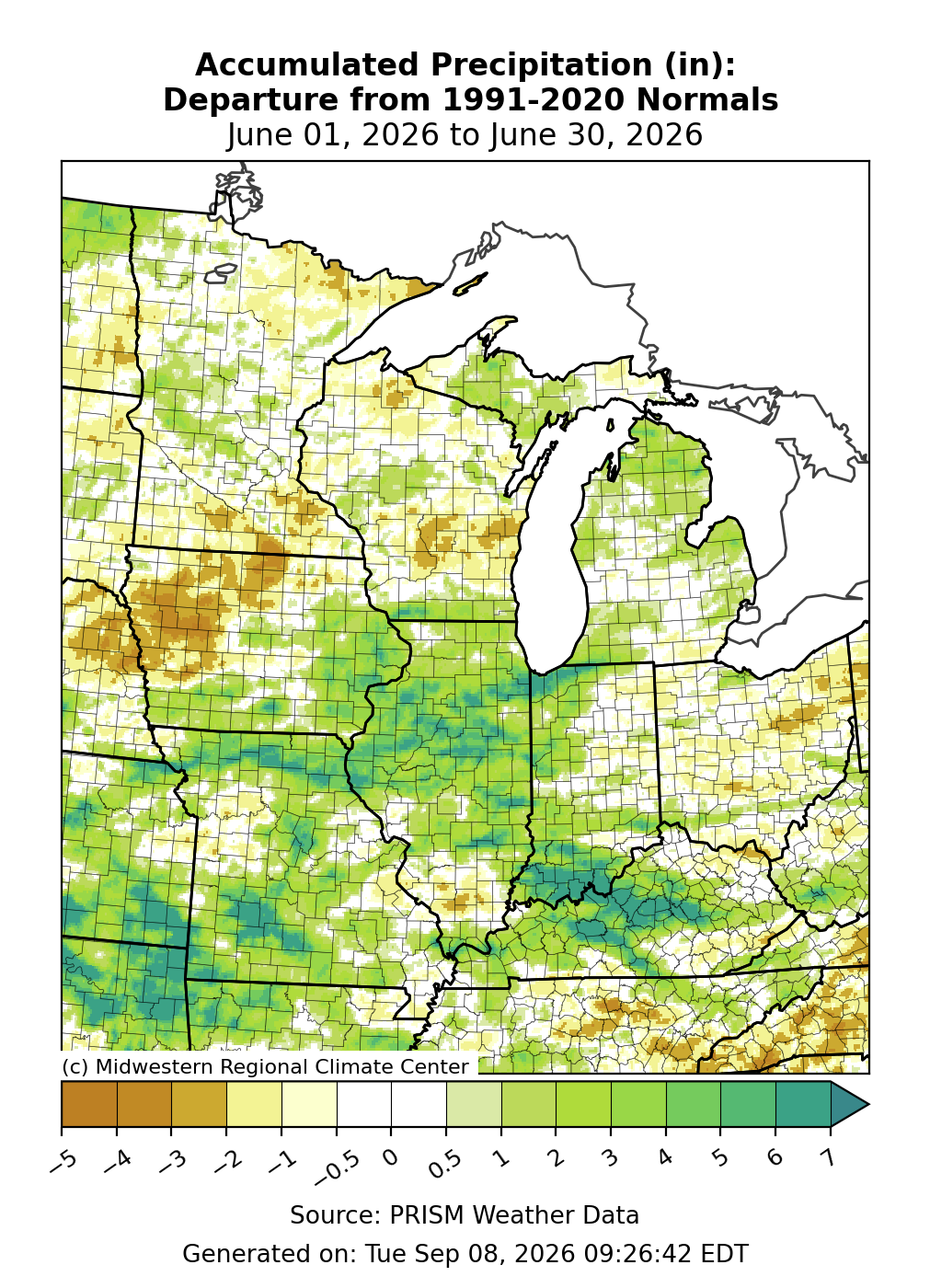
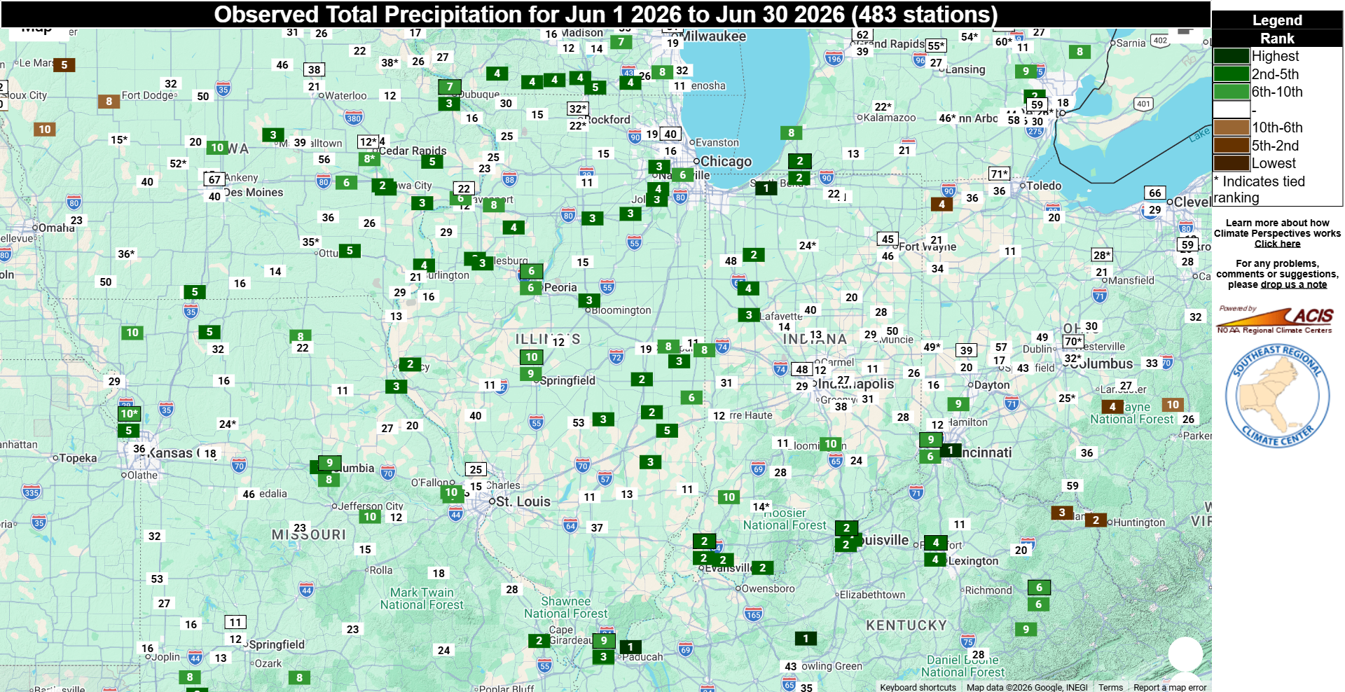
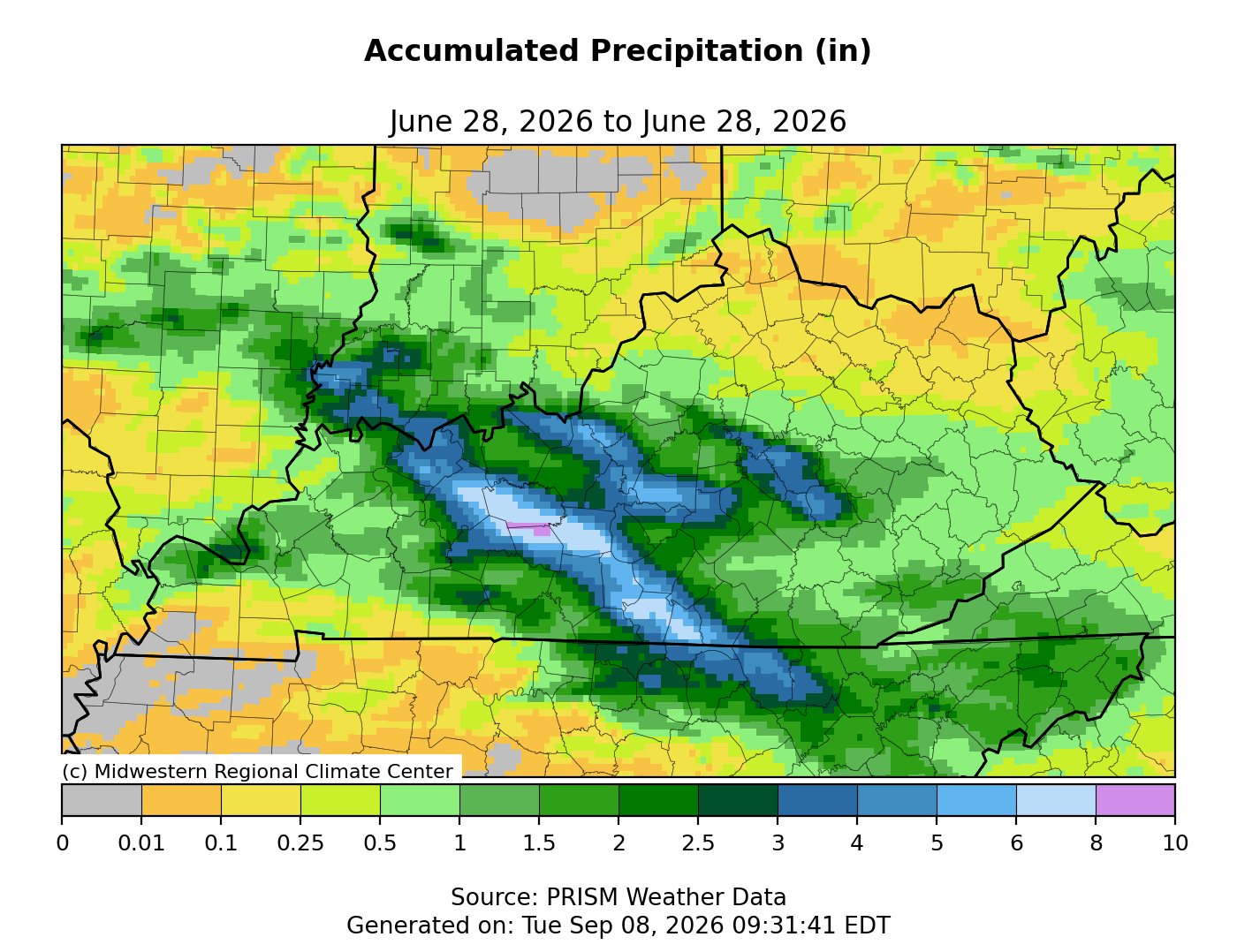
June precipitation totaled 5.29 inches for the Midwest, which was 0.75 inches above normal, or about 117 percent of normal (Figure 1). Final rankings indicate the Midwest had its 22nd wettest June dating back to 1895. Precipitation totals were highly variable across the region, ranging from 3 to 5 inches below normal in the northwest and Ohio and 6 to 10 inches above normal across wide swaths of the central and lower Midwest (Figure 6). Statewide precipitation totals ranged from 2.46 inches above normal in Illinois to 0.63 inches below normal in Ohio. Final rankings indicate that Illinois had its 6th wettest June on record, while Kentucky and Indiana had their 8th and 9th wettest, respectively. Numerous long-running weather stations across the central and lower Midwest had a top-10 wettest June (Figure 7). While an active weather pattern brought thunderstorms with intense rainfall on numerous days throughout the month across the region, the most notable rainfall observation occurred on June 28 in western Kentucky, where 9.09 inches fell in just 24 hours (Figure 8). According to a weather observer in Grayson County, 6 of the 9 total inches fell in a three-hour period, resulting in localized flooding that washed away roads and buildings, including the complete destruction of the Caneyville Community Center.
Drought
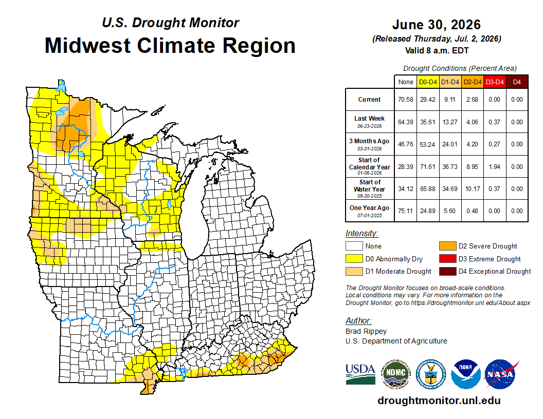
Ample rainfall throughout June greatly reduced drought coverage and intensity across the central and lower Midwest, with notable improvements in conditions across southeast Missouri and Kentucky (Figure 9). Conversely, drought worsened across Minnesota's northern half. Overall, June ended with about 20 percent of the Midwest abnormally dry and 9 percent in drought. Illinois, Indiana, Ohio, and Michigan were all drought-free as of June 30.
June 10–11 Derecho and Tornado Outbreak
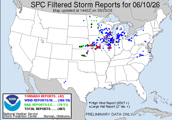
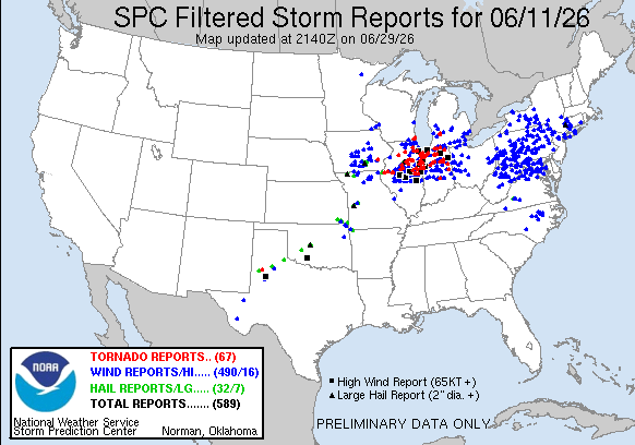
Two consecutive days of severe weather affected the central Midwest, each accompanied by widespread wind damage, power outages, and heavy rainfall. On June 10, a derecho—a long-lived, organized line of severe thunderstorms and damaging winds—traversed the upper and central Midwest, with 60 to 80 mph wind gusts reported across Iowa, Wisconsin, Illinois, and northern Indiana (Figure 10). The following day, on June 11, a large outbreak produced at least 52 confirmed tornadoes across portions of Illinois, Indiana, Wisconsin, and Michigan (Figure 11). This tally includes six storms rated EF-2 or higher, with the strongest in Hebron, Indiana, reaching winds up to 165 mph.