August 22-31, 2026
Temperature
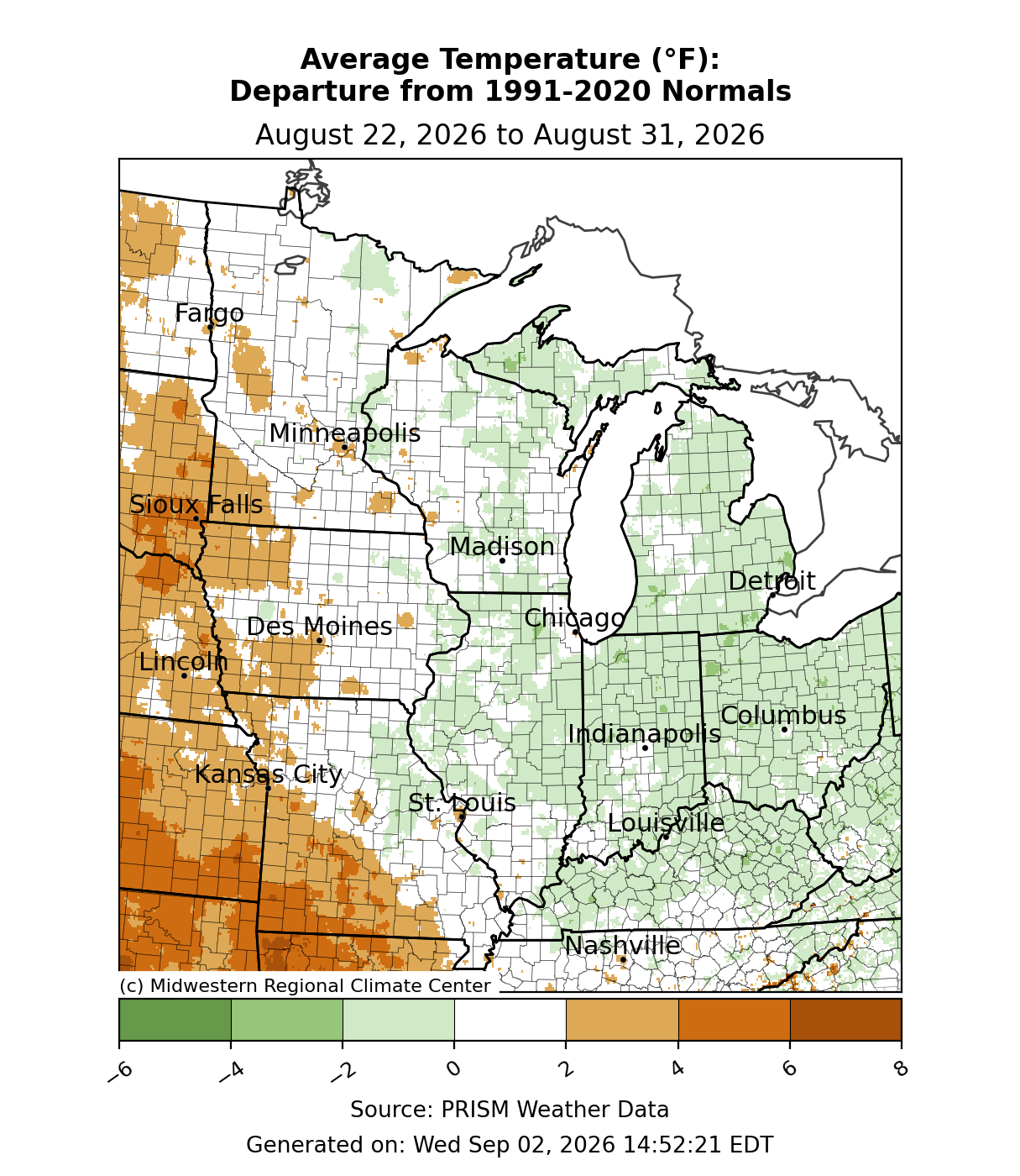
Average temperatures were generally near normal for much of the region (Figure 1). Eastern locations were up to 2°F below normal, while most places along and west of the Mississippi River were near to slightly above normal. The highest departures were over southwestern Missouri, where average temperatures were 3-6°F above normal.
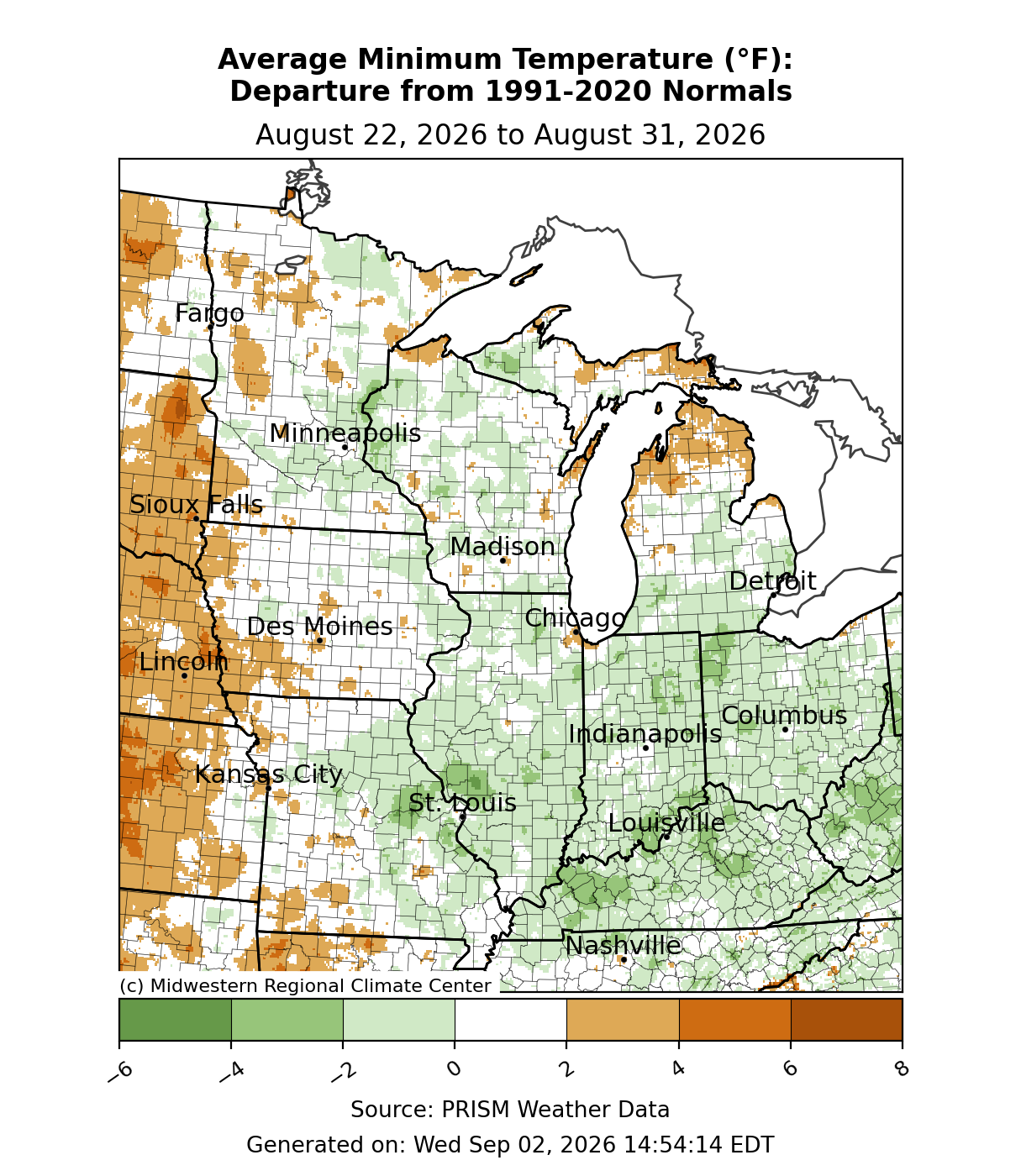
Minimum temperatures were slightly below normal for much of the corn belt from the Mississippi River eastward through Illinois, Indiana, Ohio, and Kentucky (Figure 2). Elsewhere, minimum temperatures were near normal, with pockets of slightly above-normal temperatures across northern Michigan and western Iowa. In Des Moines, Iowa, minimum temperatures remained at or above 75°F for two consecutive days, August 30-31. This was the third-latest consecutive stretch of 75°F+ minimum temperatures in Des Moines within the calendar year since records began in 1878, and the latest consecutive stretch since 1939.
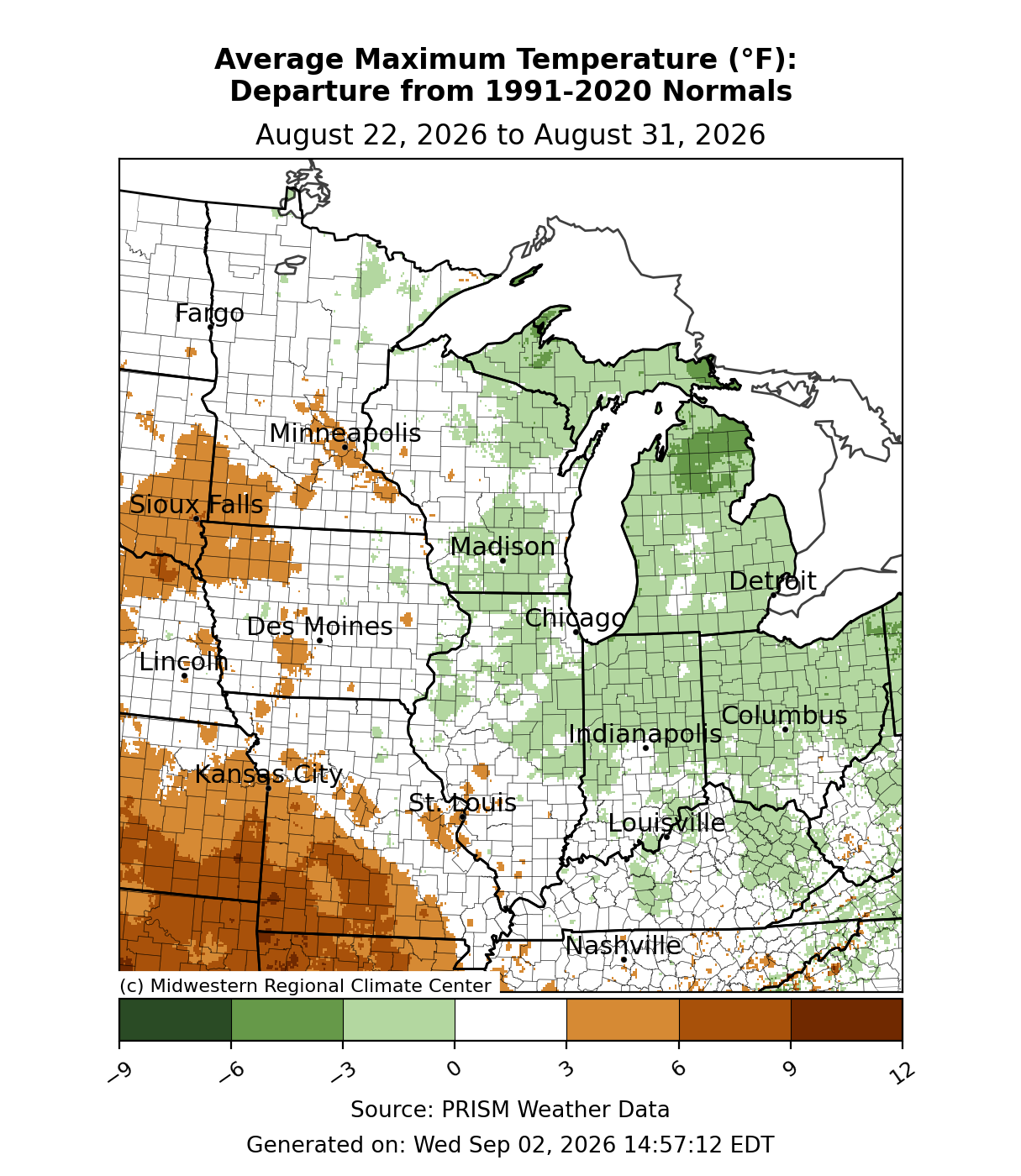
Across the east—particularly Michigan, northern Indiana, and Ohio—maximum temperatures were up to 3°F below normal for the week (Figure 3). Elsewhere, maximum temperatures were mainly near normal, while maximum temperatures were above normal across northwestern Iowa, southwestern Minnesota, and southwestern Missouri.
Precipitation/Drought
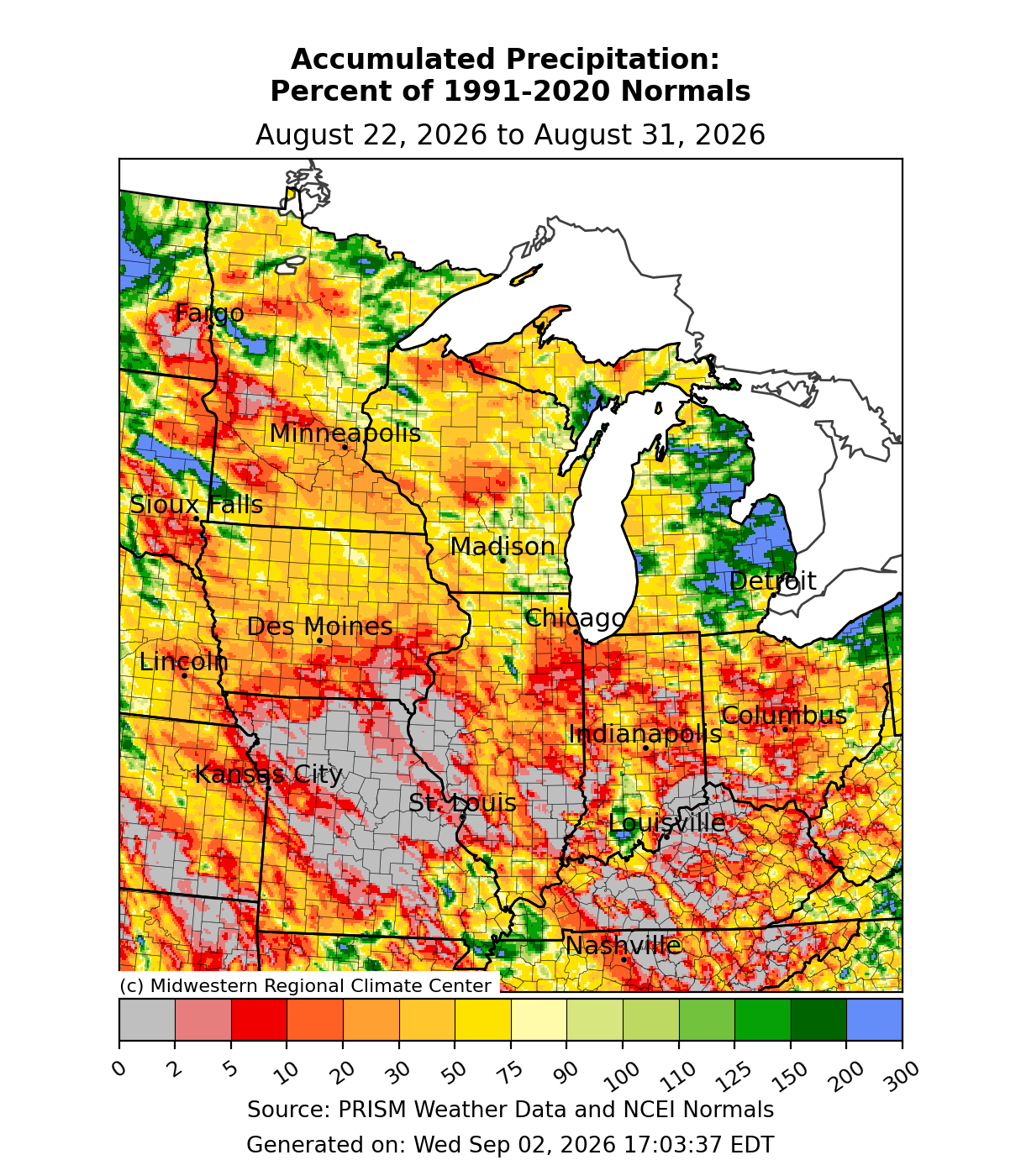
Precipitation was lackluster during the period. Most of Missouri, Illinois, Indiana, Ohio, and Kentucky received below-normal precipitation, if any at all (Figure 4). Even across Iowa, Minnesota, and Wisconsin, precipitation was largely under 50 percent of normal. Only Michigan saw significant precipitation, and it was limited to the eastern half of Lower Michigan.
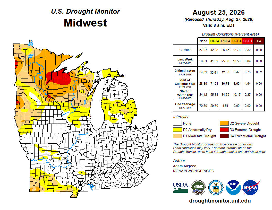
From August 18 to August 25, drought increased slightly across the region as precipitation remained scattered. D1 (moderate drought) expanded across southern Missouri and the Upper Midwest. D2 (severe drought) was introduced across southern Missouri and expanded significantly across northern Wisconsin (Figure 5). D3 (extreme drought) expanded across northern Wisconsin and isolated spots in Minnesota.
Severe Weather
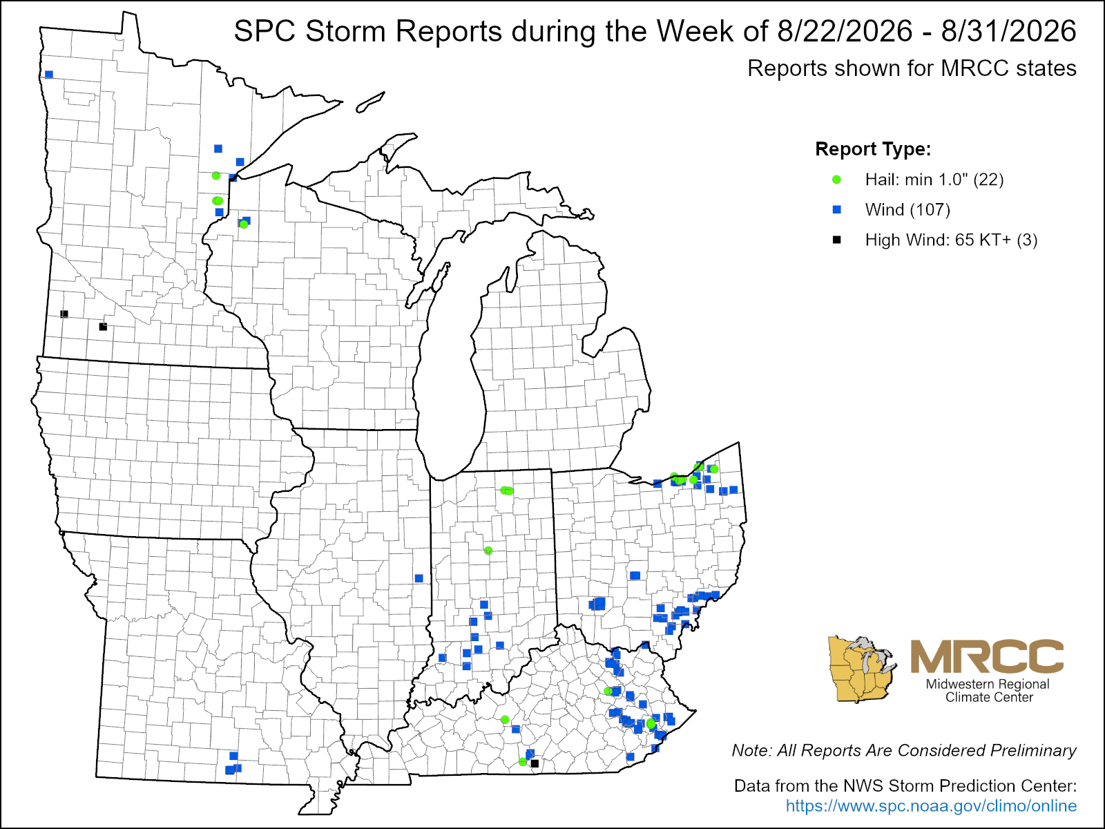
There were just over 100 reports of severe weather this past week, with 107 wind reports and 22 hail reports (Figure 6) The vast majority of wind reports occurred with an outbreak of severe weather on August 22 that brought high winds to Kentucky and eastern Ohio, which resulted in widespread tree damage across both states.