August 1-7, 2026
Temperature
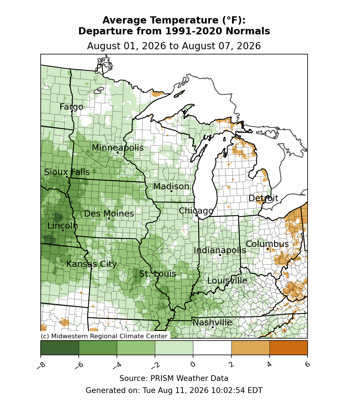
Temperatures were near normal to slightly below normal across the region (Figure 1). Along the Mississippi River, temperatures were 2-4°F below normal for the week. Temperatures averaged just below normal in northern and central Illinois, Indiana, southern Wisconsin, and much of Minnesota, the easternmost areas were near to slightly above normal.
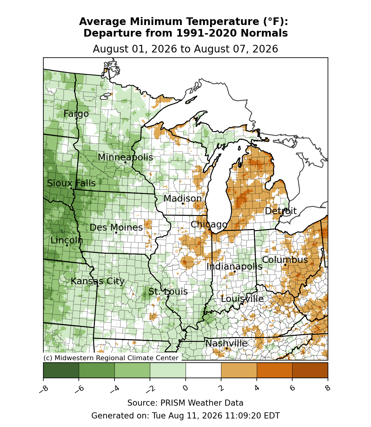
Minimum temperatures were below normal to the west of the Mississippi River (Figure 2). Across portions of Iowa and Minnesota, minimum temperatures were 2-4°F below normal. To the east, temperatures were near normal, and across Michigan and eastern Ohio, temperatures were slightly above normal.
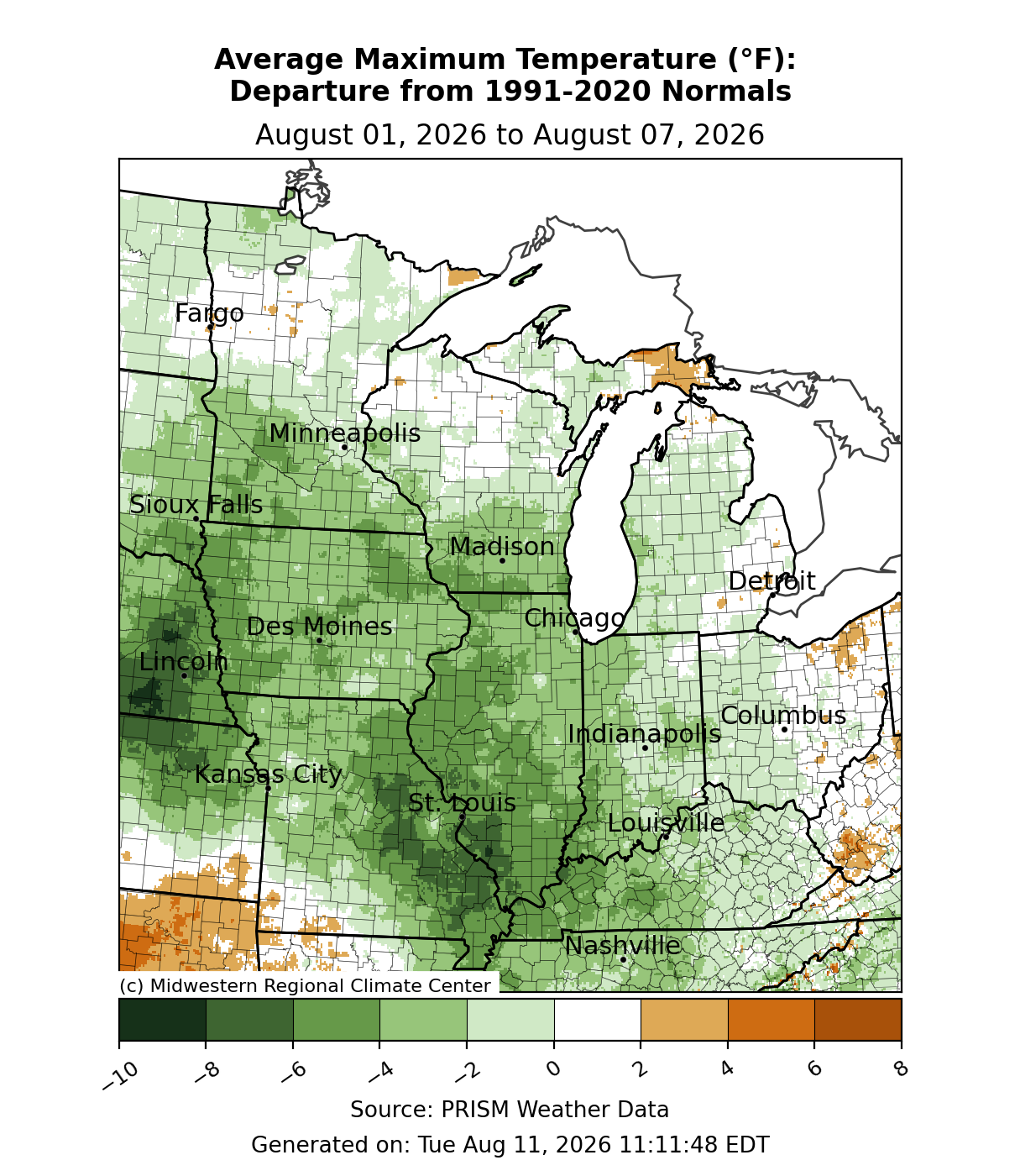
Maximum temperatures were below normal for much of the region (Figure 3). Along the Mississippi River in Illinois and Missouri, maximum temperatures were up to 8°F below normal. Across Iowa, Missouri, southern Minnesota, southern Wisconsin, western Indiana, and western Kentucky, maximum temperatures were generally 2-5°F below normal with isolated areas up to 6°F below normal. The rest of the region was near to slightly below normal. A station in Boone, Iowa, with records dating back to 1904, observed a maximum temperature of 68°F on August 6, the coldest August maximum temperature since 2014.
Precipitation/Drought
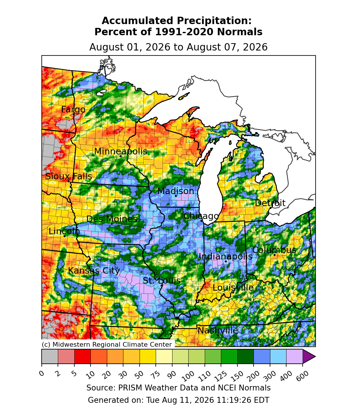
Precipitation was abundant for many areas, particularly between I-80 and I-70. In Missouri, Illinois, Indiana, Iowa, southern Minnesota, and southern Wisconsin, there were areas that received over 400 percent of normal precipitation due to heavy rains from scattered summertime convection (Figure 4). In Park Forest, Illinois, a station with records dating back to 1952 observed 3.04 inches of precipitation on August 2, making it the wettest August day in 20 years and the 4th wettest August day on record. While much of the region observed near-to-above-normal precipitation, some areas were significantly below normal, particularly across the Upper Midwest.
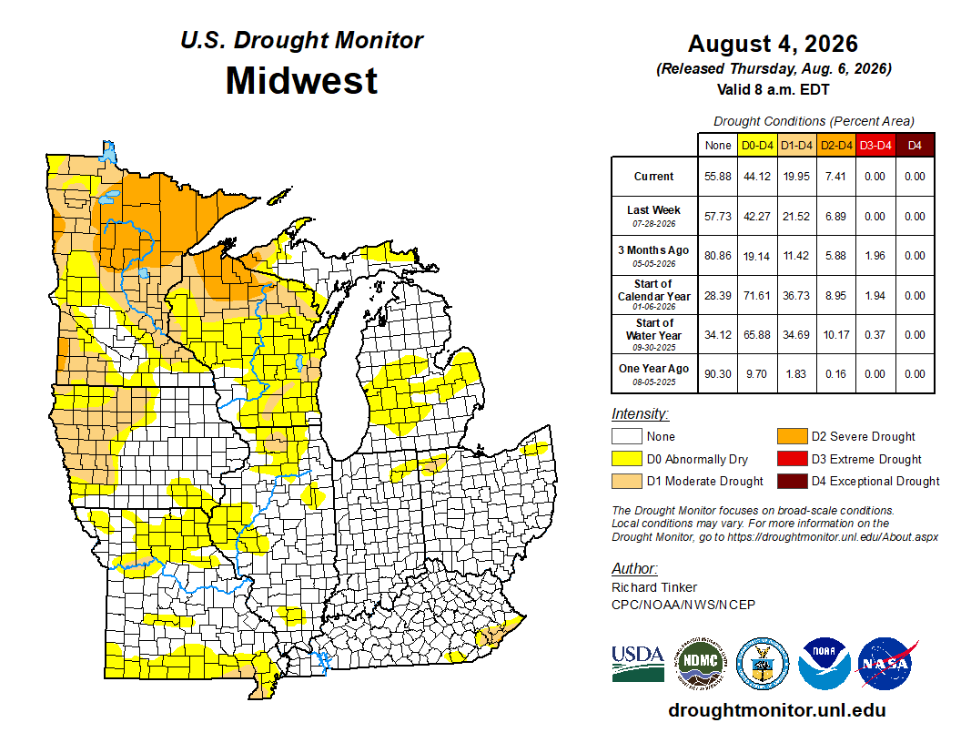
There were minor degradations and improvements in drought conditions across the region from July 28 to August 4 (Figure 5). D0 conditions (abnormally dry) expanded across Missouri while decreasing in coverage across eastern Kentucky. The largest expansions were in the Upper Midwest, where D0, D1 (moderate drought), and D2 (severe drought) expanded.
Severe Weather
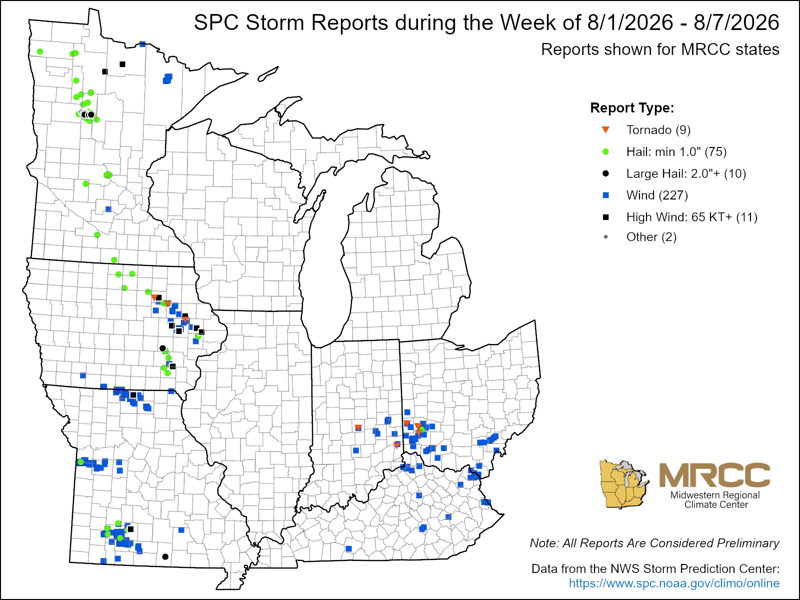
There were just over 300 reports of severe weather this week (Figure 6). 227 were wind reports, 75 were hail reports, and 9 were tornado reports. A small outbreak along the Indiana/Ohio border on August 1 produced several brief EF0 tornadoes. On August 6, severe weather produced 3-inch hail in Howell County, Missouri, and golf ball-sized hail in Hubbard County, Minnesota. On August 7, a severe weather outbreak produced an EF2 tornado with estimated peak winds of 120 mph in Buchanan County, Iowa. A short-lived EF1 tornado with estimated peak winds of 100 mph caused minor damage in Linn County, Iowa. This outbreak also produced 4.5-inch hail in Delaware County, Iowa.