July 22-31, 2026
Temperature
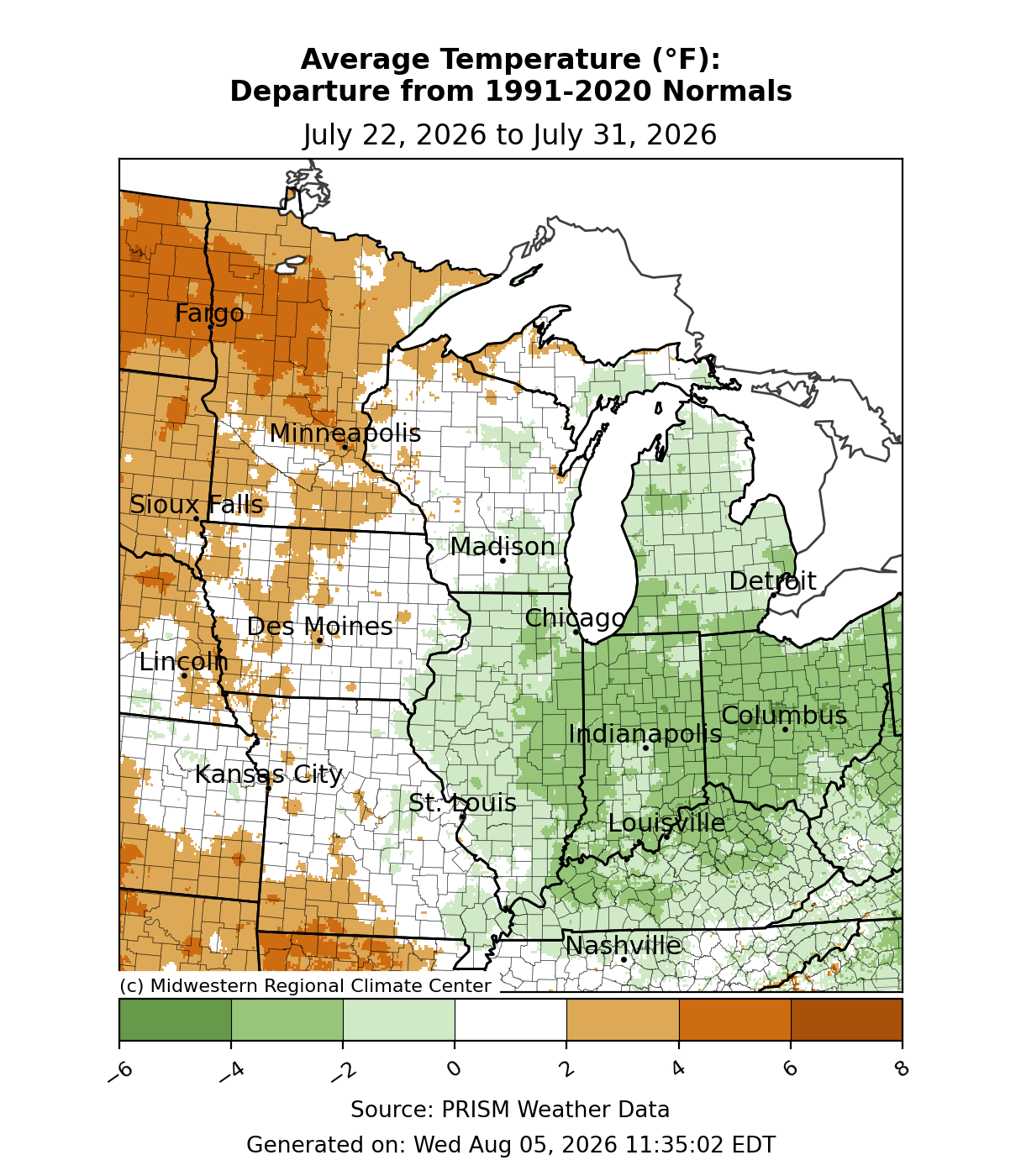
Temperatures were above normal across Minnesota (Figure 1). Across Illinois, Indiana, Kentucky, Michigan, and Ohio, temperatures were below normal by 2-4°F. Temperatures were generally near normal along either side of the Mississippi River.
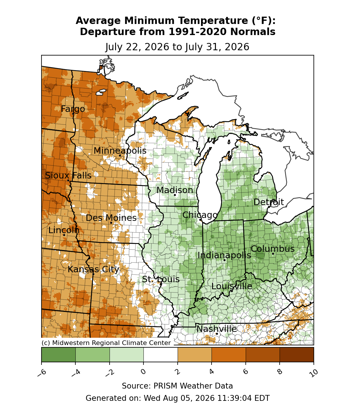
Minimum temperatures were below normal to the east of the Mississippi River, often by 2-4°F (Figure 2). Immediately along either side of the Mississippi River, minimum temperatures were right around normal for the week. Heading toward the western sections of Iowa, Minnesota, and Missouri, minimum temperatures were 2-6°F above normal.
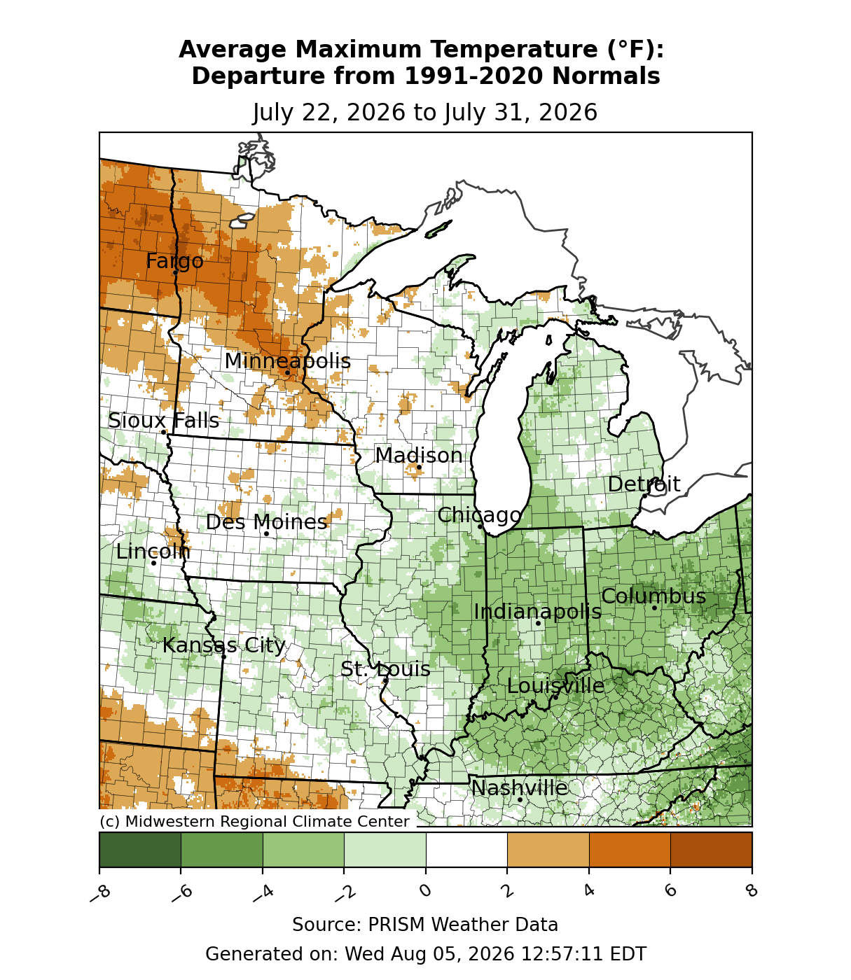
Maximum temperatures were 2-4°F below normal for much of Indiana, Ohio, and Kentucky (Figure 3). Elsewhere, maximum temperatures straddled either side of normal, save parts of Minnesota where temperatures were up to 6°F above normal.
Precipitation/Drought
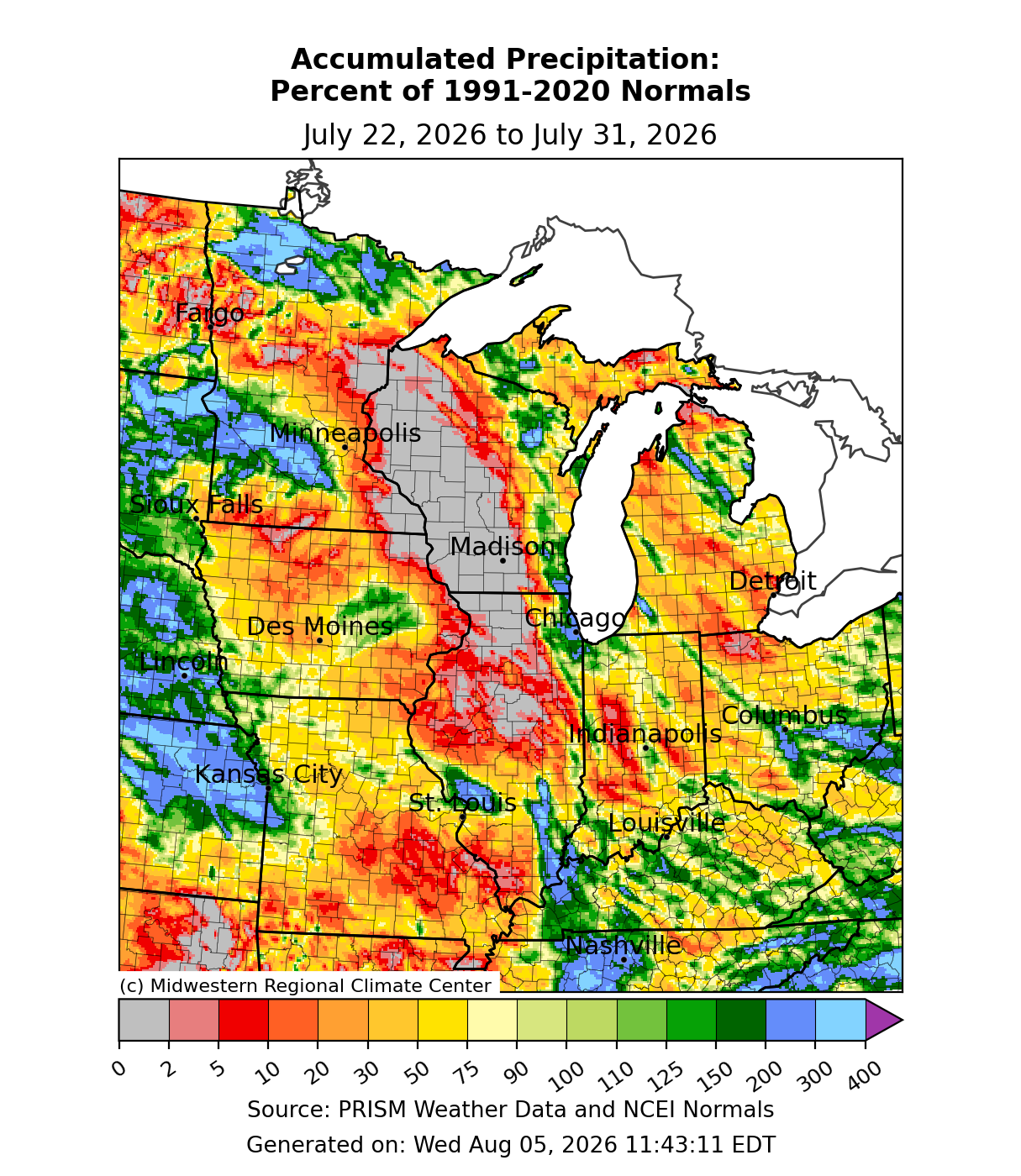
Precipitation was mostly below normal, except where there were scattered showers and storms. A swath of the Upper Mississippi River Basin from eastern Minnesota and Wisconsin down through northern Illinois observed little to no precipitation (Figure 4). Much of the region observed precipitation in the range of 30-75 percent of normal. Some parts of Minnesota observed precipitation up to 300 percent of normal.
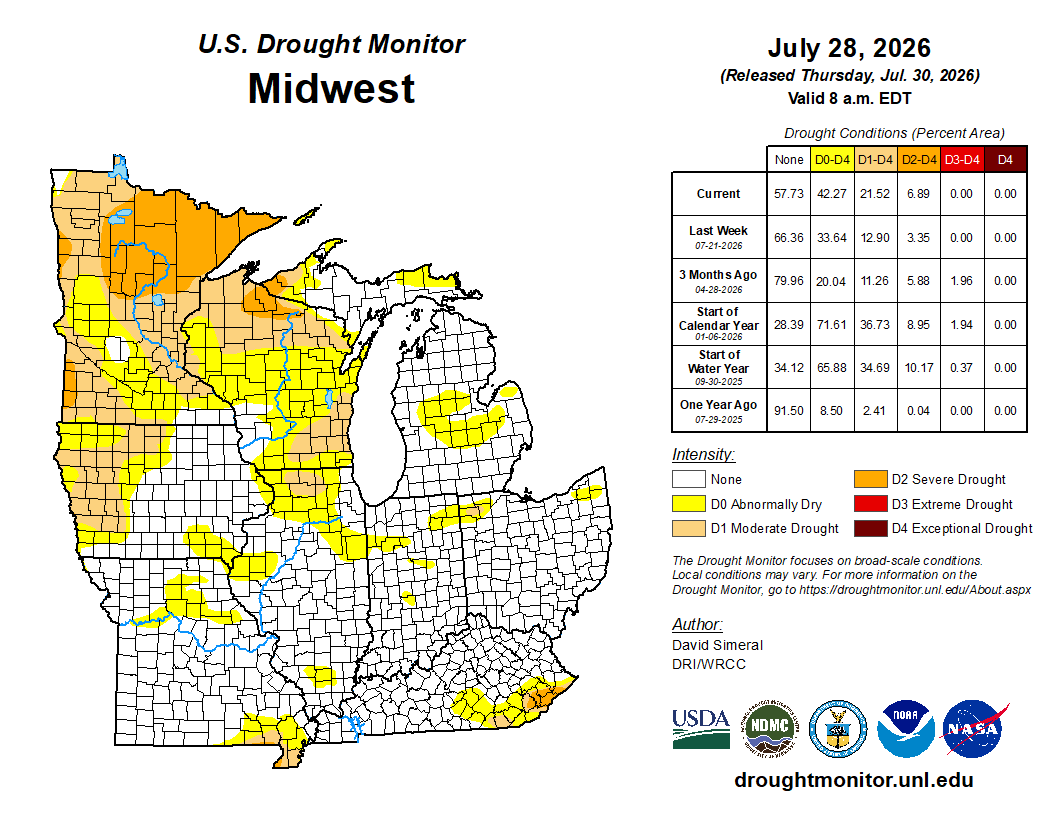
With little widespread soaking rainfall, drought expanded in areas that were already dry from July 21 to July 28. This was especially the case for Minnesota and Wisconsin. At least 42 percent of the region was considered D0 (abnormally dry) as of July 28. D1 (moderate drought) expanded across western Iowa, northern Illinois, much of Wisconsin and Minnesota (Figure 5). D2 (severe drought) expanded to cover one-third of Minnesota, as well as a small section of northern Wisconsin and Michigan’s Upper Peninsula (UP). Southern parts of the region remained largely unchanged.
Severe Weather
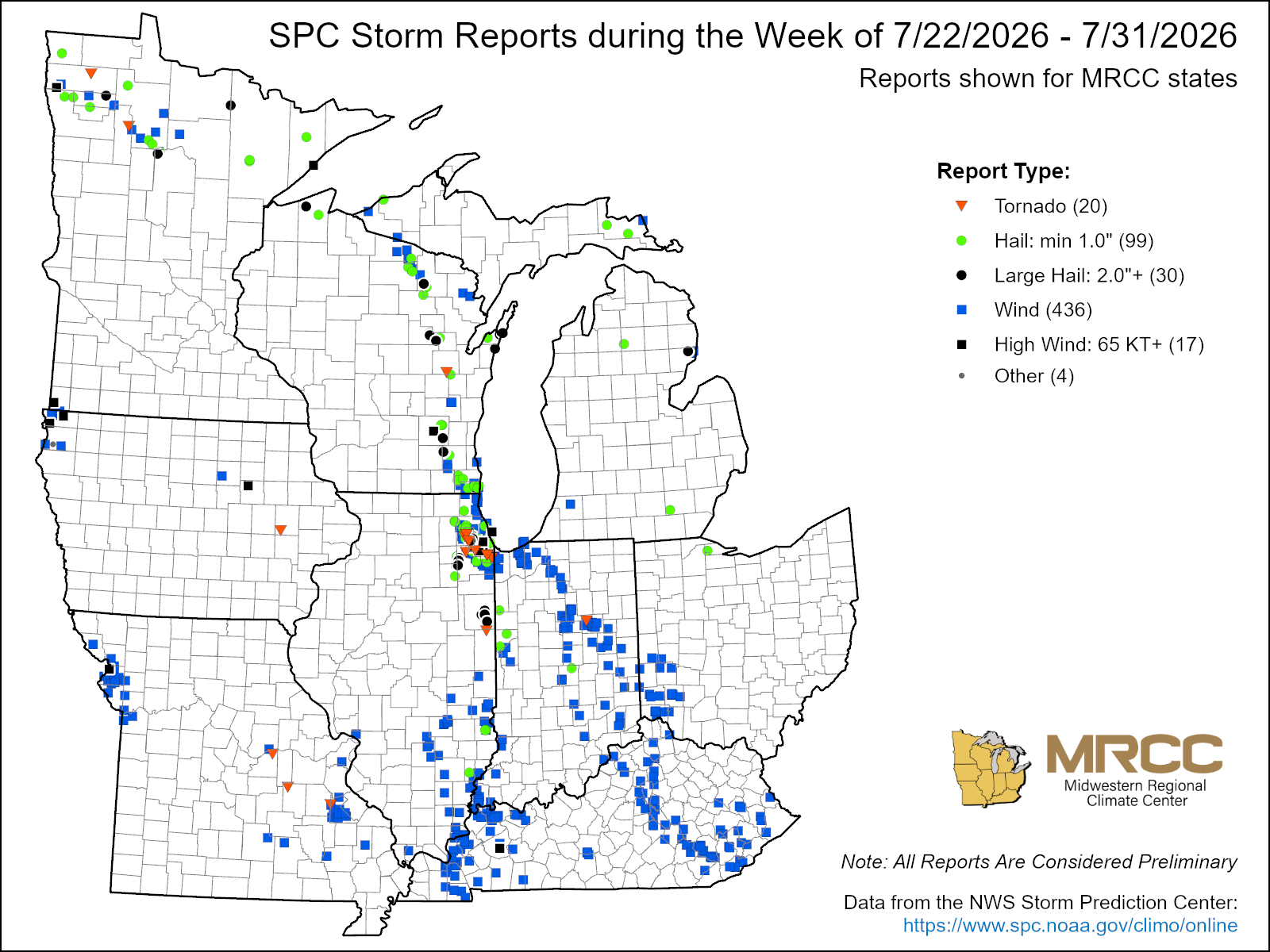
There were over 500 reports of severe weather this week (Figure 6). 436 were wind reports, 99 were hail reports, and 20 were tornado reports. A large outbreak on July 27 brought several confirmed tornadoes to the region. This included a strong EF3 tornado that developed near Appleton, Wisconsin, and moved south with estimated peak winds of 140 mph before crossing Lake Winnebago. Significant structural damage was reported across Appleton and Menasha, Wisconsin. A hailstone over 4 inches in diameter was reported near Gresham, Wisconsin. Several EF0 and EF1 tornadoes with estimated peak winds ranging between 75-110 mph were reported across the Chicago area. Straight-line damaging winds reached 70-80 mph, which included a 78-mph wind gust in DuPage County, Illinois that downed a willow tree with a 2-foot diameter. Several more tornadoes were confirmed in Missouri on July 31, including an EF1 that produced structural damage in St. Francois County.