July 8-14, 2026
Temperature
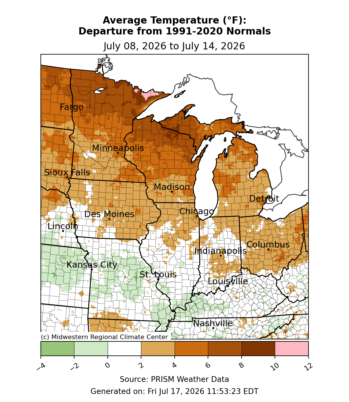
Average temperatures were above normal across the Upper Midwest (Figure 1). Parts of northern Minnesota, northern Wisconsin, and Michigan’s Upper Peninsula (UP) were 6-8°F above normal for the week. Many places from I-80 southward were near normal. Some areas of Missouri and western Kentucky were up to 2°F below normal for the week.
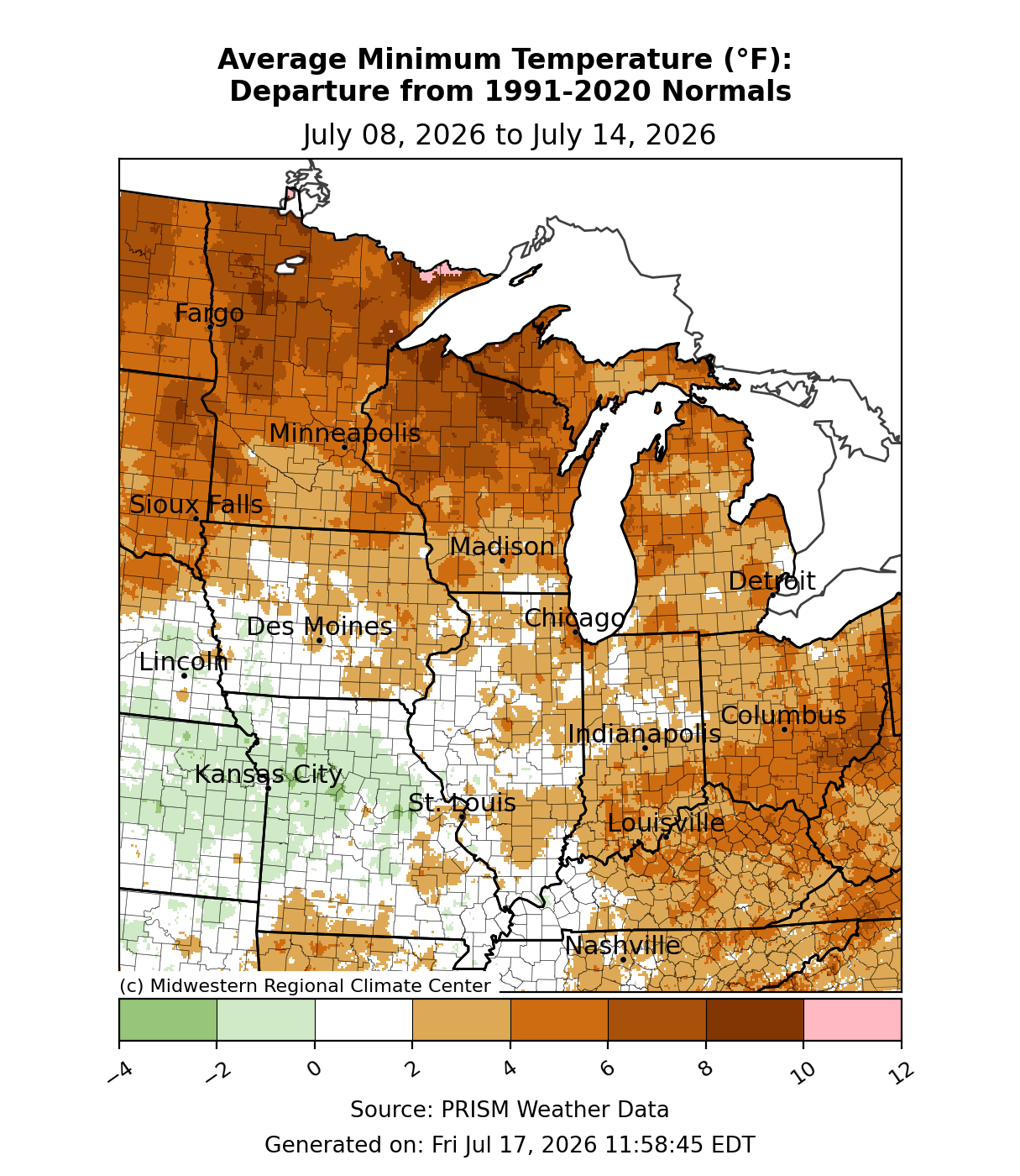
Minimum temperatures averaged above normal for a large swath of the region (Figure 2). The Upper Midwest was at least 5°F above normal for the week. In Marquette, Michigan, a minimum temperature of 76°F was observed on July 14, which was the warmest low temperature ever recorded for Marquette since records began in 1961. Some parts of the Ohio River Valley were also 4-6°F above normal. Minimum temperatures were near normal to the west, with parts of Missouri slightly below normal for the week.
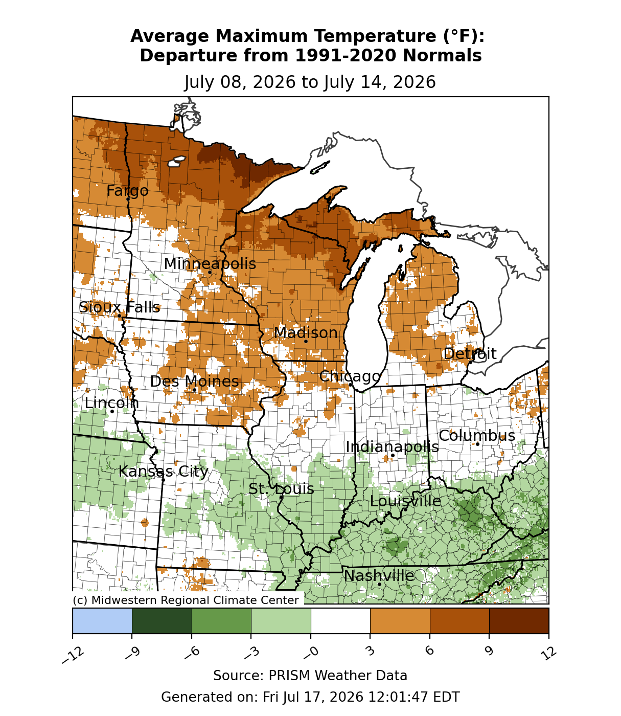
Maximum temperatures were generally 3-6°F above normal across the Upper Midwest (Figure 3). The northernmost sections of Minnesota, Michigan, and Wisconsin were 5-10°F above normal. Maximum temperatures were quite anomalous for some locations. In Marquette, the temperature rose to 96°F on July 13, making it the warmest temperature in Marquette since 2006. In International Falls, Minnesota, temperatures were at or above 95°F for two consecutive days, July 12-13, for the first time since 1995. Areas between I-80 and I-70 were near normal, while the southernmost areas—southern Illinois, eastern Missouri, southern Indiana, and Kentucky—were 0-3°F below normal for the week.
Precipitation/Missouri Flooding/Drought
Precipitation was lackluster, with little to no measurable rainfall across the Upper Midwest (Figure 4). Precipitation was mostly below normal, if present at all, for much of the region outside the southernmost locations. Significant precipitation totaling over 300 percent of normal was observed across southeastern Missouri, southern Illinois, and much of Kentucky.
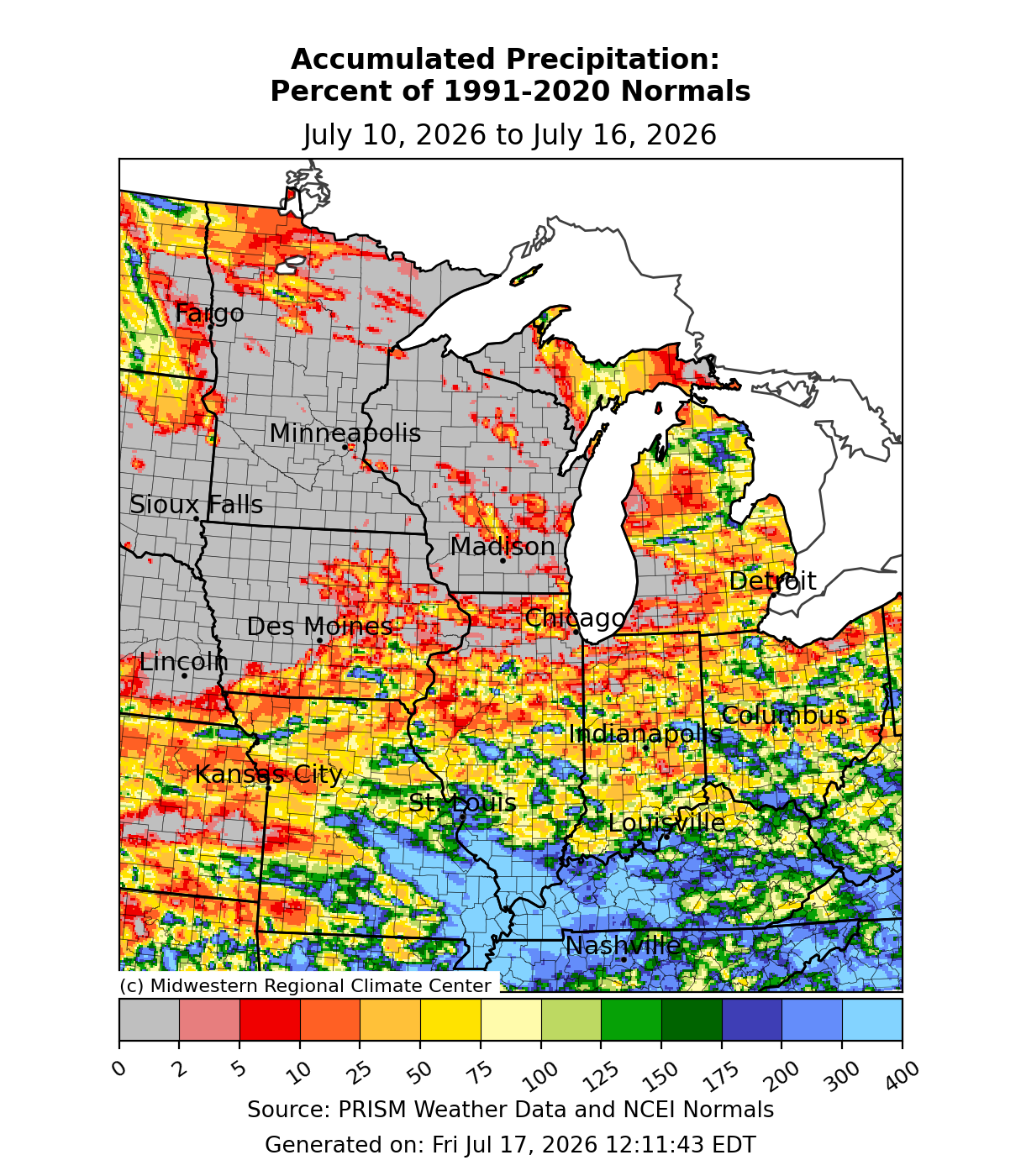
Rainfall across the southern locations was significant and resulted in flash flooding and water rescues on July 10. A summer camp in Missouri with more than 200 staff and children was airlifted to safety when floodwaters washed away nearby roads, and One person died in the flooding when their home was swept off its foundation by rushing water in Crawford County. The Black River near Annapolis, Missouri rose rapidly and crested at 28.73 feet, which surpassed the old record crest of 27.4 feet set in 1993.
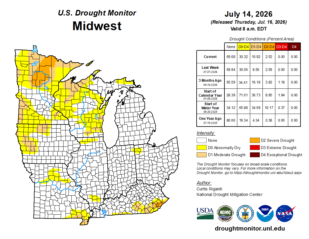
There were minimal changes in drought conditions from July 7 to July 14. Nearly 70 percent of the region has no drought conditions at all (Figure 5). Meanwhile, D0 conditions (abnormally dry) still cover 30 percent of the region, roughly unchanged from the prior week. D1 conditions (moderate drought) expanded slightly from 8.5 percent to over 10 percent, with degradations noted mostly over Michigan’s UP, Minnesota’s Arrowhead region, and northern Wisconsin. D2 conditions (severe drought) were mostly unchanged, save for the removal of severe drought from parts of southern Kentucky.
Severe Weather
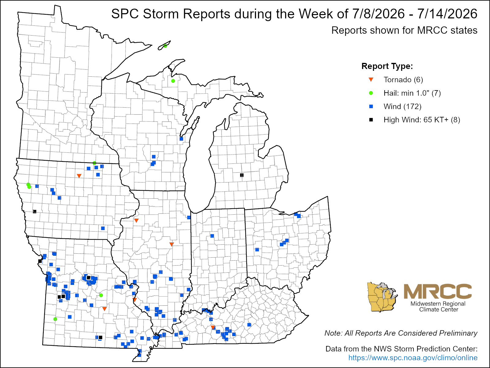
There were just under 200 reports of severe weather this week (Figure 6). Most of these were wind reports. A few brief and weak tornadoes and funnel clouds were reported across Illinois and Missouri July 9-11. Some straight-line winds across Missouri on July 10 reached 70-80 mph. There was a report of a large tree down on a mobile home in Benton County, Missouri.