June 15-21, 2026
Temperature
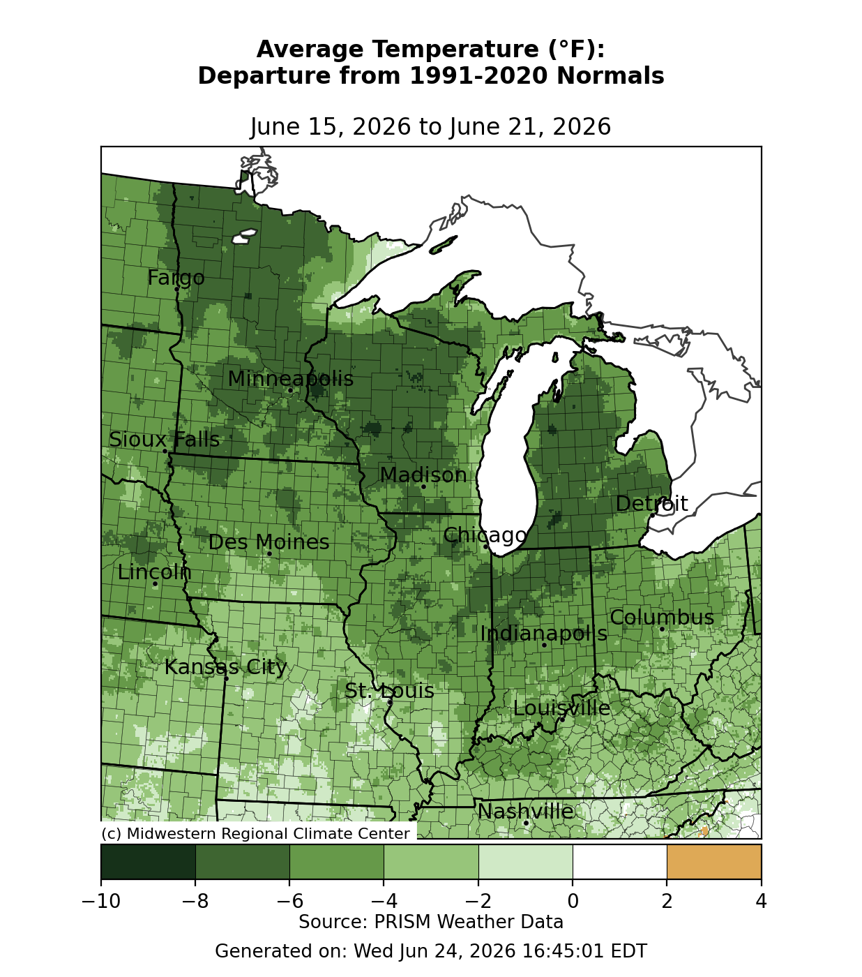
Average temperatures were 2-4°F below normal across southern areas (Figure 1). Heading north, average temperatures were 4-6°F below normal across much of Iowa, Illinois, Indiana, and parts of Ohio. Across the Upper Midwest, average temperatures were up to 8°F below normal.
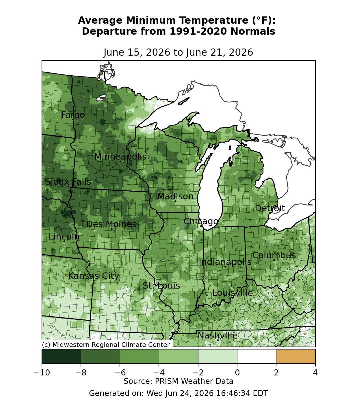
Minimum temperatures averaged 0-2°F below normal across southwestern Missouri (Figure 2). For much of the rest of the region, minimum temperatures were generally 2-6°F below normal. Across northern Iowa and Minnesota, minimum temperatures were 6-8°F below normal.
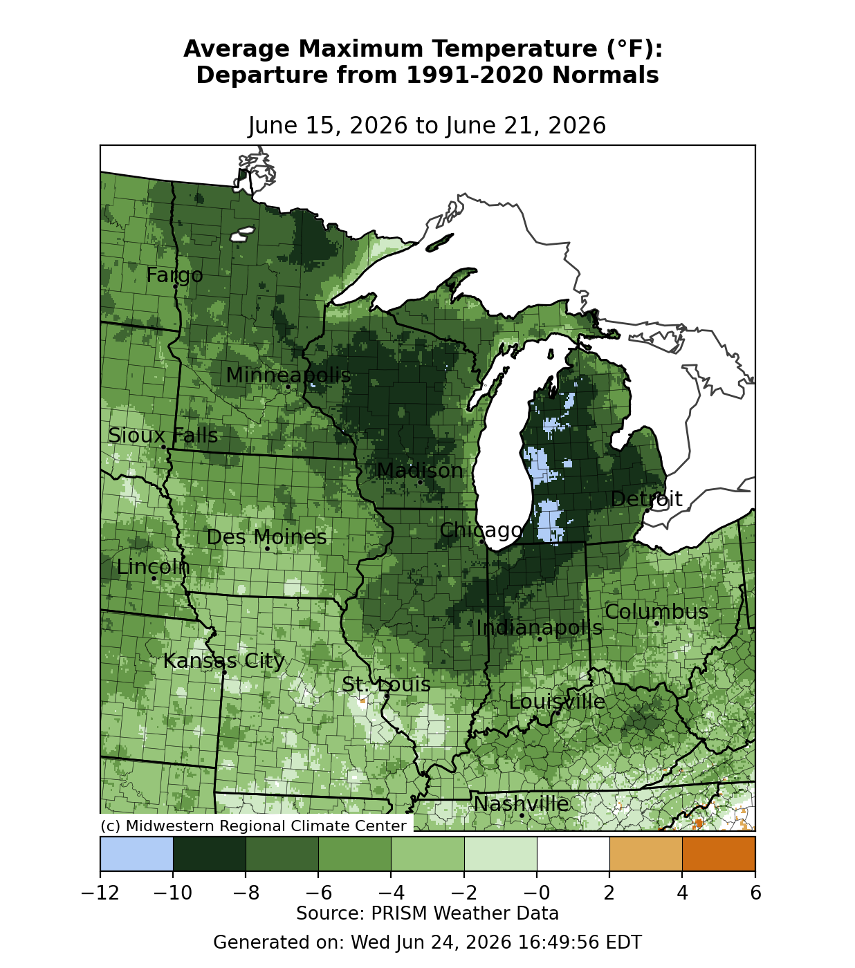
Maximum temperatures averaged up to 10°F below normal across Wisconsin and Michigan (Figure 3). Some areas of Michigan along Lake Michigan averaged up to 12°F below normal. Across Indiana, Illinois, Iowa, Kentucky, Minnesota, and Ohio, temperatures were generally 4-8&;F degrees below normal. In Missouri, maximum temperatures were 2-4°F below normal. At several locations, temperatures remained in the 60s, making it the coldest summer solstice on record. In Peoria, the maximum temperature was only 68°F on June 21, the coldest maximum temperature on the summer solstice since records began there in 1883.
Precipitation/Drought
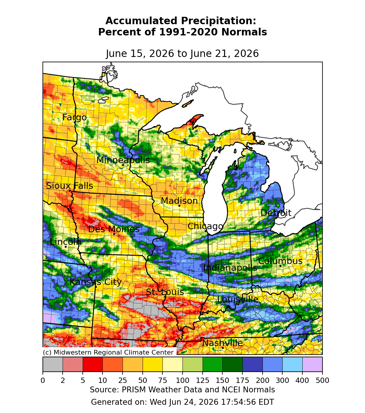
Precipitation was above normal in areas that received significant rainfall from severe weather. Precipitation was over 200 percent of normal from Iowa into Illinois, Indiana, and southern Ohio (Figure 4). There was also above normal precipitation across northern Lower Michigan. Much of the region, however, experienced below normal precipitation. This was the case across much of Missouri, where parts of the state observed little to no precipitation. Similarly, dry conditions were observed across western and central Iowa, southern Minnesota, southern Wisconsin, southern Illinois, and western Kentucky.
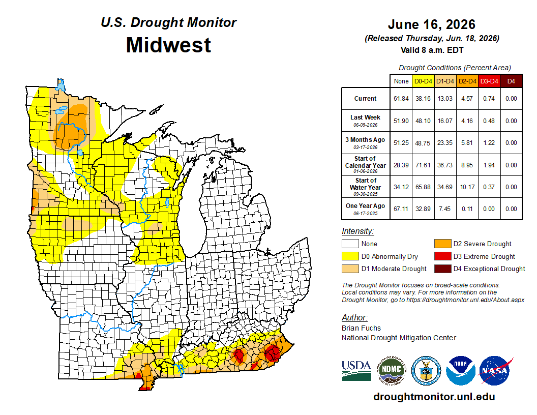
From June 9 to June 16, overall drought conditions receded across the region (Figure 5). There was a nearly 10 percent decrease in D0 conditions (abnormally dry) and a 3 percent decline in D1 conditions (moderate drought). There was a less than 1 percent increase in D2 conditions (severe drought) over northern Minnesota and D3 (extreme drought) over parts of the Kentucky Coalfields.
Severe Weather
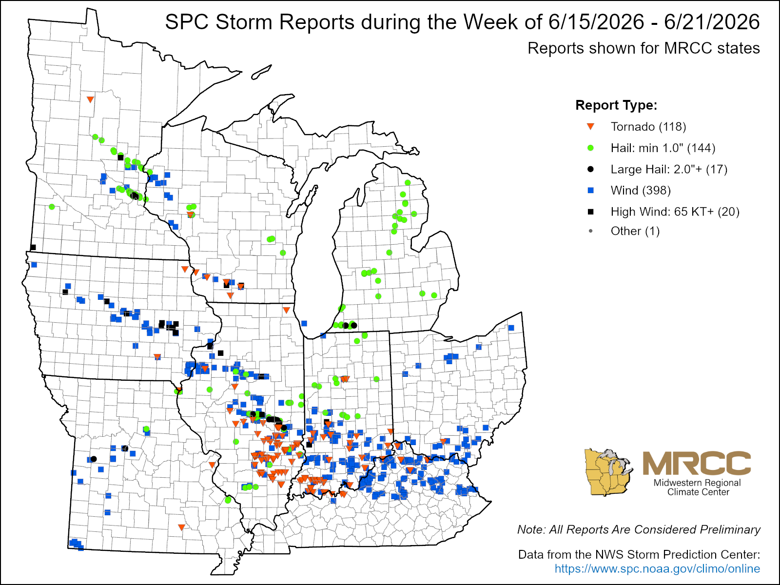
There were over 500 reports of severe weather this week. 118 were tornado reports, 144 were hail reports, and 398 were wind reports (Figure 6). On June 16, severe weather produced hail the size of ping-pong balls and golf balls over Michigan and 70-80 mph straight-line wind gusts in Iowa.
A larger, more severe outbreak occurred late on June 17 and into the early hours of June 18, as storms moved across several states. There were many confirmed tornadoes because of this outbreak. In central Illinois, an EF3 tornado with estimated peak winds of 150 mph spent 31.8 miles on the ground near Effingham. The Effingham tornado caused significant damage to several structures, including a single-family home, with multiple injuries reported near the town of Teutopolis. A tornado in southern Indiana had estimated peak winds of 130 mph and spent 23.6 miles on the ground. The southern Indiana tornado toppled steel electrical transmission lines while also causing 1 injury and the deaths of 6 cattle.